 |
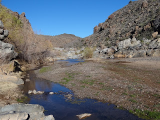
| Agua Fria River at intersection with Badger Springs Wash |
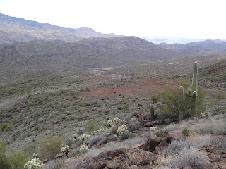
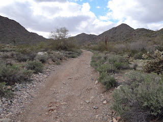
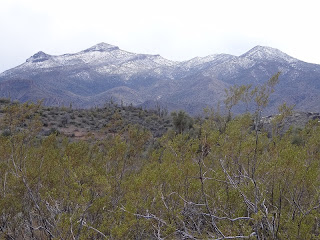
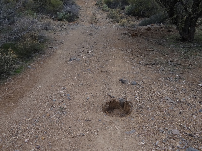
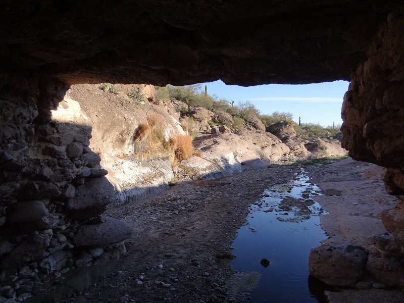
The area that we visit today is not really unexplored territory. We have passed the Badger Springs exit from I17 a lot of times, we have stopped and explored the area close to the first sign near the exit a few times, tried a foray past it only to be stopped by the condition of the road and the number of RVs and even visited the Agua Fria canyon from the other side. Somehow however we never made it to the trailhead and the Badger Springs trail and this is what we intend to correct today. The road condition is much improved to our delight any car can make it in normal conditions to the trailhead. The only thing to keep in mind is that there are 2 places to park; first near the restroom and a bit further from the trailhead and second a bit further down the road near the trailhead. Even if you do not plan to leave the car there it makes sense to stop near the restroom at the informative sign to pick up a map. At the second parking spot don't forget to pick the historical information about the area when signing in. The trail is in Agua Fria NM and is free to use. The trailhead appears to be newly improved with multiple signs pointing to the obvious trail down the wash.
 |  |
| Improved trailhead | The area is an important riparian corridor |
 |  |
| Trail is well marked | Sandy trail |
The trail is well defined and it would be difficult anyway to get lost in the wash that we follow down to the Agua Fria river. There is no one else around this weekend and the weather is great which makes for good hiking. The small canyon walls are full of prickly pear and saguaro which could potentially make this a great hike in spring when the cacti are blooming. After about 1 mile the trail ends at the shore of the Agua Fria river where we stop and enjoy the flowing river and the canyon while having lunch.
 |  |
| Agua Fria River upstream | Agua Fria River downstream |
 |  |
| Agua Fria view | The water was not flowing everywhere |
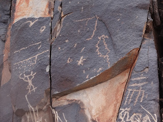
The other highlight of the trail are the petroglyph panels at the end of the trail close to the river. They are quite well preserved with a multitude of shapes including a few anthropomorphic ones.
 |  |
| Petroglyph panels | Zooming closer... |
 |  |
| ....and closer.... | ....got it...reindeers in Arizona |
From the end of the official trail there are informal trails both up- and downstream but in winter and spring using them may involve crossing the river. We hiked a bit upstream to some interesting white rock formations and crossed the river a few times, it is really shallow which made for easy crossings. It is quite fun to look at the tracks in the sand and guess which animals made them. After some hiking we arrived at a difficult spot to climb over and it was getting late so we tracked back to the Badger Springs Trail and then to the car. Overall a fun half day hike to petroglyphs and a river with quite a few waterholes.
 |  |
| Interesting white rocks near the river | Stone bridge to cross the river |
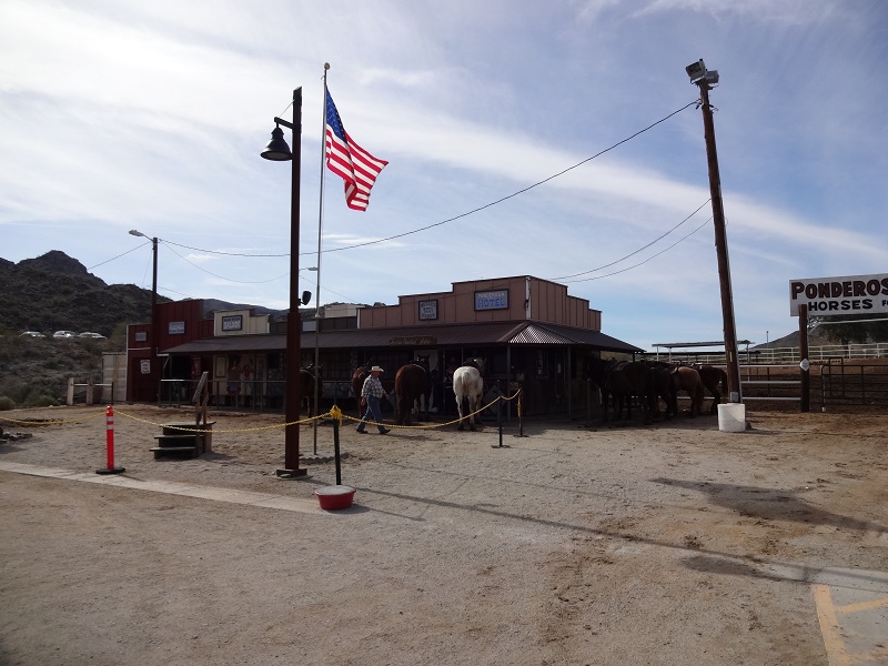
We always wanted to try riding horses but somehow never got around doing it. Today we plan to remedy this and we choose Ponderosa Stables on South Mountain to do our first ride. One advantage is that it is easy to book online and we are wondering if we are going to be the only people on the ride. We shouldn't have wondered - when we arrive there are already quite a few people gathered for the ride and there is a steady stream of arrivals after us. After signing the usual "we are not responsible for your death even if we kill you" disclaimer we check out the horses that are already lined up. It is encouraging to us that most of them appear oblivious to all the hustle and bustle so hopefully they are also placid when we start the ride. The wait is quite long so we walk around the stables and examine the different horses they have available.
 |  |
| Cowboy and horses at Ponderosa Ranch | Horses waiting for riders |
 |  |
| Some have given up (not really he was just rolling in the mud) | Didn't really intend to :) |
Almost 20 minutes after the time the ride was supposed to start the cowboys are finally starting to help the people get in the saddle. We expect to use a ladder that is set up nearby but they help us climb into the saddle from the ground. They let us standing on our horses while they help other people and the horse decides to move on which is a bit scary as we have no idea how to control it. Luckily someone comes to hold the reigns and then finally everyone gets in a single file and on it goes through South Mountain. The first thing that we learn is that the horses prefer to stop at almost every bush to nibble and we have to pull the reigns to stop them so they do not impede the whole group. Relatively soon the initial stress of being high in the air on an unknown animal disappears and we start enjoying the ride and learning how to control the horse. It goes mostly well except for a short episode of one horse biting the one in front who braked suddenly.
 |  |
| People are starting to get in the saddle | Riding was single file (when you could control the horse) |
 |  |
| Close up of my horse | Horses after the ride |
The trail goes in a loop trail in the foothills of South Mountain and the scenery is nice even though it is not overwhelming. However riding up and down inclines is interesting and sometimes a bit terrifying especially if there is (small) precipice on one side of the trail. There are a few saguaros but at no point are we far from civilization and traffic. After returning our legs hurt from riding but we enjoyed it quite a bit and now have to research other opportunities for riding preferably somewhere in the wilderness.
 |  |
| Horse riding was done mostly on official South Mountain trails | Interesting saguaro |
 |  |
| Typical vegetation | Other horses were eating while ours were working |
 |
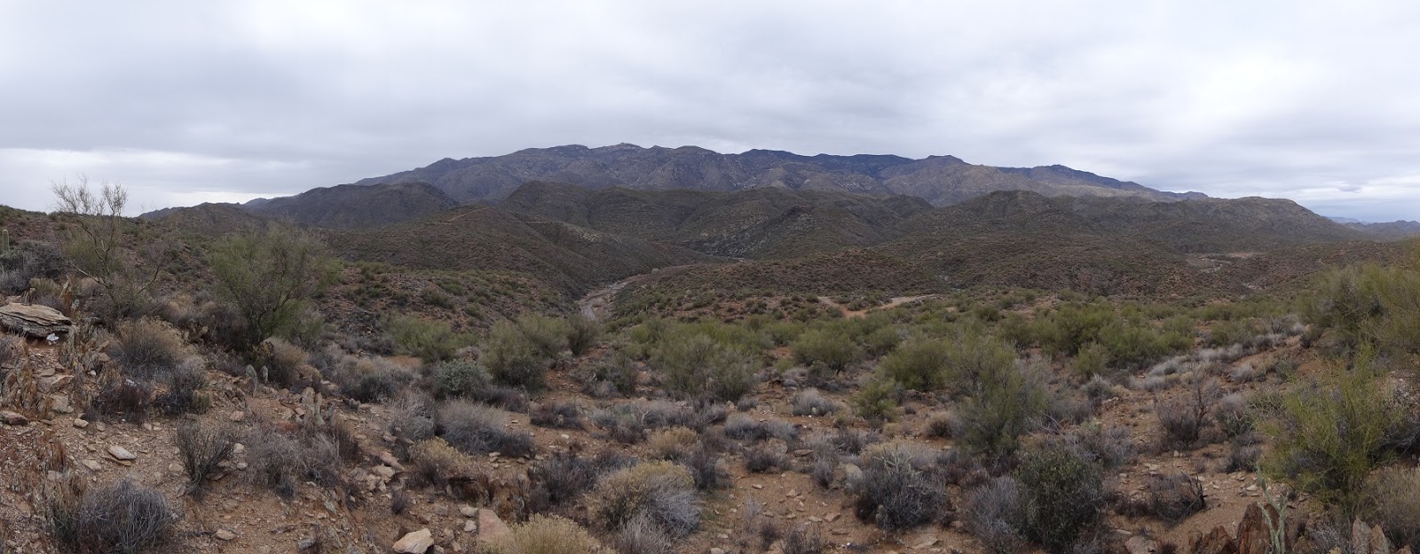
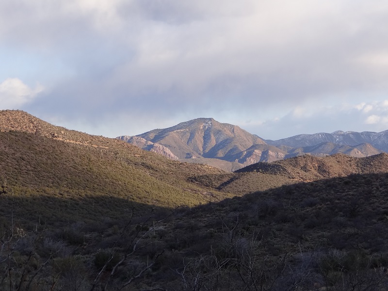
| Mountains from Black Canyon Trail |
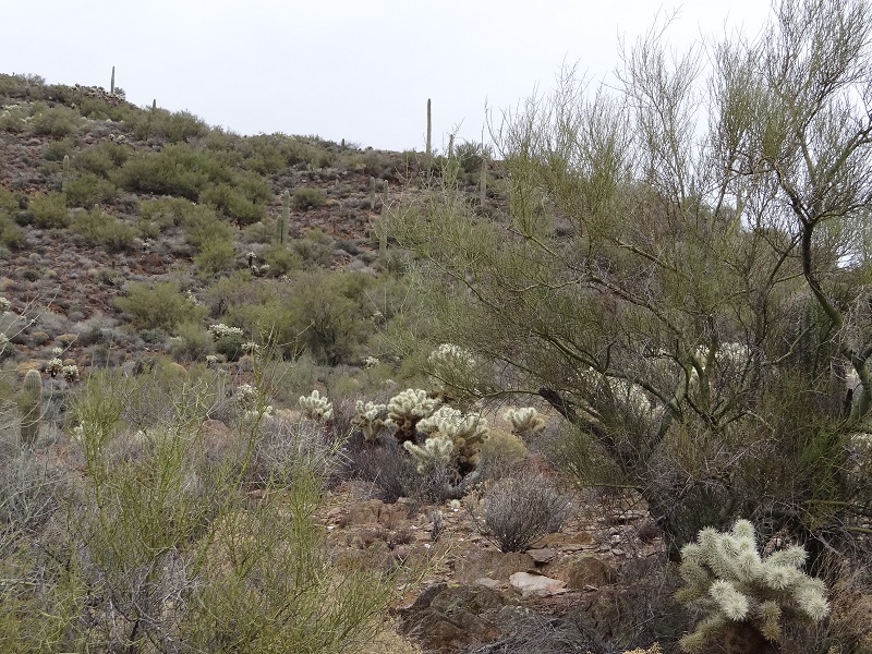
Black Canyon Trail is a long linear trail of almost 80 mile starting near Phoenix and continuing north past New River, and Black Canyon City and almost reaching Mayer. Today we plan to do a short portion of the trail and also to visit a fortress like indian ruin near the trail. Right after exiting the highway at Bumblebee exit we stop for a short walk in the mountains near the highway and to take a look at the nice views of the area. Quite unusually it is overcast so while the pictures come out muted the hiking temperature is much more comfortable. As we stop also along Maggie Road on the way to the trailhead we notice that Black Canyon River where we hiked just a few weeks ago is now full of water and flowing due to the heavy rains in the last week.
 |  |
| View near Crown King Road | Highway view |
 |  |
| Side road towards the mountains and Black Canyon River | Black Canyon River is flowing after the rains |
We stop on the side of the dirt road which is not in as good shape as we would have liked and start hiking up a side road towards the Black Canyon Trail (BCT) and then towards the ruins. There are quite a few impressive cholla areas near the road that we stop and admire. Then we notice the hole in the middle of the road and check it out - it is a former telephone pole that has been ripped out of the ground. Later on our hike we find other remains of this old phone line through the area including cut logs from the former poles.
 |  |
| Maggie Mine Road | Dirt road snaking through the mountains |
 |  |
| Impressive cholla | Former phone pole hole in middle of dirt road |
As we start the climb we are impeded not as much by the rate of ascent which is acceptable but by the cholla which are everywhere and difficult to avoid. However what brings us to a stop is a deer that passes in front of us wary but not necessarily scared of us; of course we have to stop to take lots of pictures.
 |  |
| Starting the climb | Chollas are everywhere |
 |  |
| And sometimes deer in the middle of the cholla | Mule deer |
Continuing the climb from our deer encounter we notice some movement near a rock. Investigating more closely we discover that it is a ground squirrel who is eating undisturbed by our approach. After finishing eating he then proceeds moving towards us but then disappears, unusual behavior for a wild ground squirrel.
 |  |
| Somewhere here there is a squirrel | Close up of squirrel |
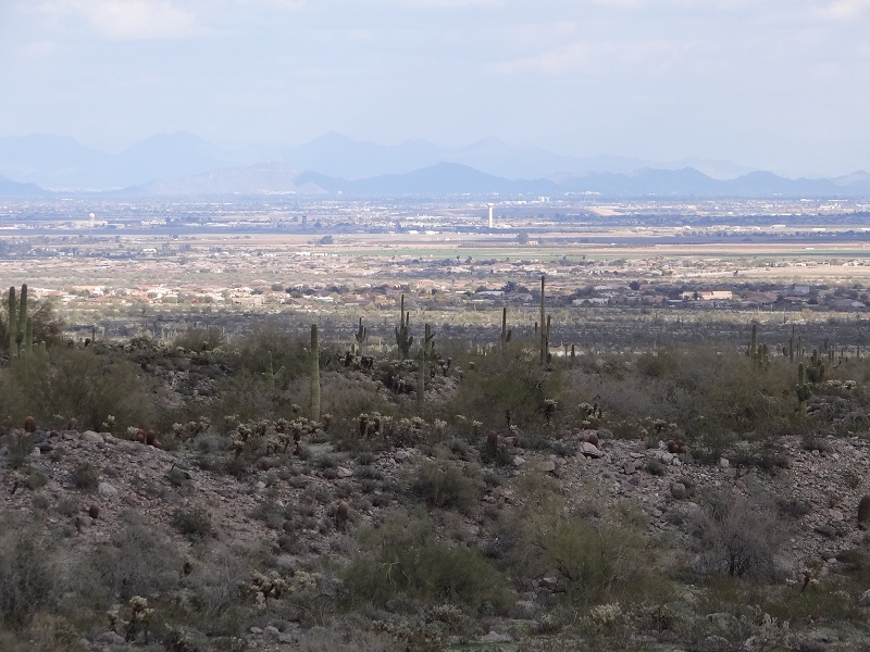
After a few more minutes of climbing and avoiding to the best of our abilities the cholla cacti that are everywhere we arrive at the top mesa. The views are quite good in all directions but it is marred a bit by the pipeline destruction when we look westward. Soon we notice some specks on the fields and zooming in we identify them as cows - haven't seen cows in this area yet. They are also watching us for a while before continuing with their daily routine.
 |  |
| View of the mountains and pipeline destruction | I17 highway view |
 |  |
| There are cows down there | Close up of cows |
Even on the top of the mesa the going is slow due to the high number of cholla but the views are great on both sides of the ridge. Looking at the Bumblebee exit we see a police car parked right at the exit waiting for a speeding car but unfortunately none passes as we look.
 |  |
| Do we really have to pass through here??? | Lonely saguaro on the mesa |
 |  |
| Highway exit to Bumblebee | Waiting for speeding cars at the exit |
After a few hundred feet we notice our goal, the Indian Ruins. Surprisingly the ruins are quite extensive with multiple rooms and the walls are well defined and relatively high. It is quite special to walk into a ruin that is rarely visited and we enjoy it a lot. It is surrounded by steep cliffs on three sides with only one side with easy access - likely for protection against attacks.
 |  |
| Finally the indian ruins | Close up of ruin |
 |  |
| Interesting quartz stone | Ruins of the indian rooms |
As we get to a side of the ruins we notice that the cows are actually eating from the prickly pears something which we haven't seen before. ANother cow is doing a mud bath which is really funny observed from a distance.
 |  |
| Cows eating pricky pear - is that healthy? | Taking a mud bath |
After this short intermezzo we return to our exploration of the ruins. We walk through all of them and even identify a likely kiva. There are no visible pottery shards though.
 |  |
| View of the walls and down the cliff | There were probably around 15 rooms at the pueblo |
 |  |
| Remains of the wall are about 3-4 feet high | The vegetation has started to take back the ruins |
After visiting the interesting ruins we return to the main BCT trail and hike it for about 1 mile until it reaches again the Maggie Main Road and then return back to the car on the road. Due to the rains many washes are full of water and are interesting and fun to explore. Unfortunately it is getting dark and it even starts sprinkling so we return as fast as we can to the dry and warm car. Overall it was a great area to explore especially with no one else around and the ruin was the highlight of the day.
 |  |
| Back on the BCT trail | Water is everywhere after the rains |
 |
| View from the top |
Due to other commitments we do not have time to go outside of the Phoenix area today so we settle on a trail on the west side that we wanted to visit for some time. It takes a bit to find the parking area but when we find it it is large and we find a place to park even though there are quite a few cars parked already. The trailhead and trails are mostly well marked and maintained however there is no trail map at the trailhead to know where you are going.
 |  |
| Parking area | Trailhead |
We start on the way to the petroglpyhs first and the views are nice especially as we get a bit higher and get glimpses of the valley in the distance. There are quite a few groups of people on the trail and most of them seem to be going ar returning from the petroglyphs.
 |  |
| Trail through the desert | Large trail |
 |  |
| Not a lot of vegetation in some areas | View of the Valley of the Sun |
The vegetation is typical for the desert with quite a few saguaros twisted in various shapes as well as chollas luckily always outside of our range.
 |  |
| Unusual saguaro growth | Danger: cholla |
 |  |
| View of area | Interesting saguaro arms |
After a bit over a mile we arrive at the petroglyphs, they seem to be well preserved, even retouched a bit. There are quite a few hands/feets and even an alien form or two.
 |  |
| Well drawn petroglyphs | Old and new petroglyphs |
 |  |
| Alien(?) figure on the left | Unusually there are petroglyphs at the top |
From the petroglyphs we take a side trail that takes us over a small ridge to a second main trail/road leaving from the parking lot. As it is still early we go in the opposite direction towards the ridge top so we can examine what lies beyond the ridge. The road is doable for a Jeep up to a point where a huge rift blocks the main road (there is a bypass though).
 |  |
| Foot trail between the two larger trails | Trail to the top of the ridge |
 |  |
| Trail uphill | Don't think that even a Jeep can pass that |
The views in all directions are impressive. In one direction we can see the Valley and in the other one Buckeye with quite a few interesting mountains to climb in the other directions.
 |  |
| View towards Phoenix | Looking in the opposite direction from the ridge |
 |  |
| Ridge view | Buckeye in the distance |
As we return towards the parking lot the sun begins to set and the desert starts taking beautiful red colors. Phoenix is right in front of us as we descent and we stop multiple times just to take pictures of the illuminated city. After about 1.5 miles we return to the car without meeting anyone else being out this late and leave this interesting area.
 |  |
| Sunset View | Zoomed in view of Phoenix |
 |  |
| Sunset | Typical wash |
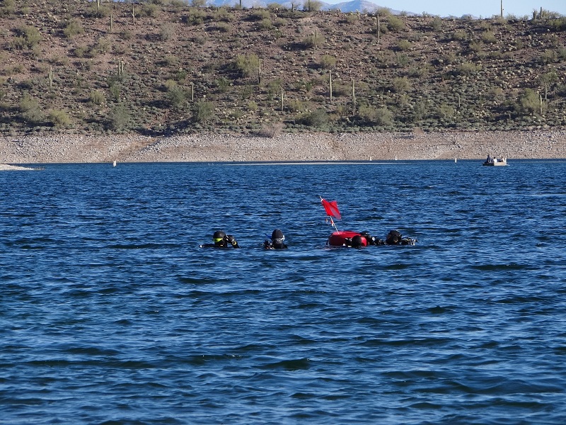
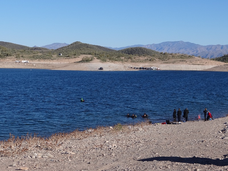
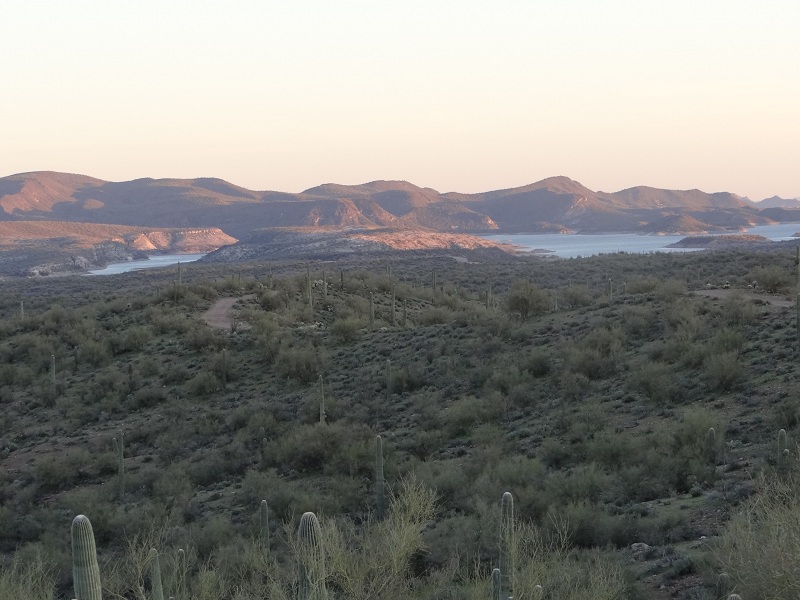
This weekend we are exploring the Lake Pleasant area both by choice and a bit forced by the fact that our open water scuba training classes are at the lake. We have to wake up early to arrive at the prearranged time but at least the drive is on mostly empty highways even though as we approach the lake the traffic picks up. One thing that we observe right away is that there are quite a few picnic areas that appear to be rarely used and a lot of temporary restrooms that were used quite often in contrast.
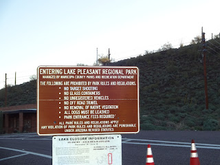 |  |
| Entrance information - can you see the misspelling? | Picnic area |
 |  |
| View from picnic area | Restrooms near the lake |
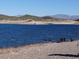
The launching spot for the scuba dives is to our surprise quite popular and later in the day it can become quite difficult to find a spot to park close to the lake so you don't have to carry the 30 lbs gear a long distance. After a briefing and safety discussion we enter the cold water and do the dives - quite interesting even though we have to show different skills for the certification which certainly interrupts the dive multiple times.
 |  |
| What's up with all the cars near the lake? | Scuba diving? |
 |  |
| Scuba equipment | Scuba group going out |
There are two dives per day during the weekend. The dives mostly follow the submerged road in the area and we also see the reef of submerged Christmas trees even though we avoid it for now as at least the students are not yet good enough at maintaining buoyancy in the water to avoid colliding with the trees.
 |  |
| Starting the dive | Everyone disappeared |
 |  |
| Lots of divers | Divers resurfacing |
On one of the days there is a different rescue diver class where they teach the students to save divers in distress and is interesting to watch from a distance.
 |  |
| Rescue Diver Class | Waiting for another rescue |
 |  |
| Diving area | Diver resurfacing |
One of the unexpected things about the dive was that we were full of sticky plants at the exit and even during the dive they were sticking on the gloves and wet suit. We identified them quickly afterwards on the shore but there wasn't much to do except to grin and bear it.
 |  |
| Sticky plants | The lake is growing after the rains |
Of course diving isn't the only water sport practiced on the lake and not even the most popular. There are lots and lots of yachts and boats zooming around, some engaging in stunt like behaviors.
 |  |
| Boating is also popular | Looks dangerous |
 |  |
| Lots of yachts on the lake | Close up of yacht |
The lake is artificial, natural lakes being a rarity in Arizona, but rather the result of damming the Agua Fria River. The dam is quite impressive and it was actually enlarged once as Phoenix was growing in order to ensure it receives enough water. We do a short hike near the visitor center on the Roadrunner Trail up to a small Anasazi ruin with great views of the lake.
 |  |
| Waddell Dam | Lake with island |
 |  |
| View of the lake | Anasazi ruin |
The visitor center has a few exhibits the most interesting one being a Gila monster. There are ducks on the lake and fish in the water and the wildflowers are starting to grow even though it is relatively early during the year.
 |  |
| Captive Gila Monster | Duck on the lake |
 |  |
| First wildflower of the season | And quite a few more |
As we explore different ways to access the lake we find that there are other submerged roads, some that might even resurface during low lake levels. But at the moment only seagulls are using them. The views of the lake continue to be breathtaking especially in a dry area like Arizona.
 |  |
| Submerged road | Flock of seagulls |
 |  |
| View from the shore | Far view of the lake and mountains |
We also stop at the Scorpion Bay marina which is larger than we expected with even has a cable car to get between the parking area and the marina level. There are boats everywhere including a model of a wooden one which looks interesting.
 |  |
| Scorpion Bay Marina | Model ship |
As we start getting farther from the lake the scenery becomes typical of the Arizona desert but it is greener than usual due to the frequent rains the previous weeks.
 |  |
| Mountain view | Starting to get green |
We were hearing reports of burros in the area but didn't see any until suddenly we see some movement and there they were. They seem unafraid of us and observe us closely and when they start gathering it is us who is getting scared. But in the end they decide to move on after a few snorts in our direction.
 |  |
| Burros getting interested in us | Burros gathering to look at us |
 |  |
| Getting bored of us | Close up of attentive burros |
Our longer hike for the day is a hike through Humbug Canyon. We find a good road that descends towards it and from the road we even view a few cows in a side canyon that seem to be enjoying the pools of water from the rain.
 |  |
| Cows in the canyon | Closeup of cow at a waterhole |
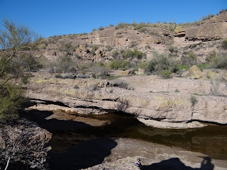
Right after descending into the wash there is a beautiful area with water in a slot canyon that is quite enjoyable and we sit nearby and have a late lunch before continuing further up the wash.
 |  |
| Narrow canyon with water | Short slot water canyon |
The canyon seems deserted even though we find signs of human activity everywhere starting from the likely Anasazi walls up on the canyon rim to the more modern ruins in the wash. There are side roads everywhere but most of them seem to be for hardcore 4WD and ATVs only.
 |  |
| Humbug Canyon | Ruined walls on the canyon rim |
 |  |
| Dead end | Signs of civilization |
Our goal for the day is the Chinese Dam - we know it is there but don't know exactly how it looks and how well preserved it is. When we finally catch a glimpse of it we are surprised of how well preserved it looks and as we get closer it looks even more impressive. With new gates it might even work now....
 |  |
| First view of the Chinese Dam | Close up of dam |
 |  |
| Dam from the other side | River flowing through the dam |
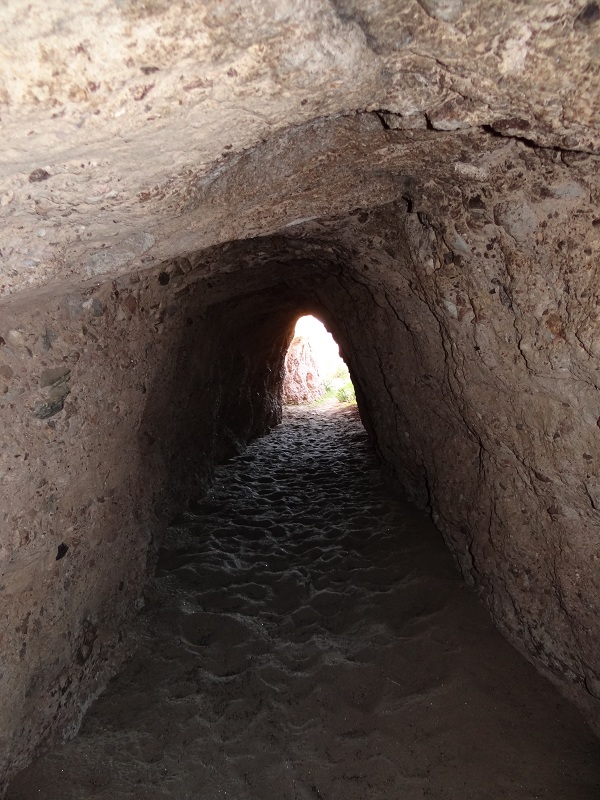
There is even a crude diversion channel that we explore. It seems that the water is actually coming up to that level regularly as there is brush blocking the other exit - still even without being able to exit on the other side it is an interesting walk through a man made tunnel.
 |  |
| Entrance to the diversion channel | Inside the channel |
 |  |
| Channel blocked at the end | Looking back to the entrance |
We try to pass through the dam and are turned back by the river but still there are some beautiful views in both directions so it was worth to do the descent to the bottom level.
 |  |
| Walking under the dam | Looking back |
After finally finding a way to pass the river and the canyon we discover a newer dam on a side channel of the wash which we also bypass as we start to return to our car. We are happy that the washes are not full of water as they can be pretty scary - we passed a long bridge on the way in and the wash was as large as some of the largest rivers we have seen.
 |  |
| Bridge over dry river | Another dam near the Chinese Dam |
As we return the views change as again the mountains seem to catch fire under the last rays of light. We take quite a few pictures but then hurry back to the road and our car. There are a few cars that pass us in the opposite way and a few even stop to ask if we are okay as it seems to be unusual to walk in the twilight. To our surprise and delight we also see another group of burros crossing the street and then are herded unintentionally by us as they run away from us following the road (and they thing we are following them as we continue down the road to our car). Finally the burros go perpendicular to the road and we arrive to the car and then have an uneventful drive back to Phoenix after an exhausting day near the lake.
 |  |
| Saguaro pointing | Dirt road to Chinese Dam |
 |  |
| View of Lake Pleasant in the distance | Sunset view |
Japan is one of the countries that we would like to visit but never got around to do it (yet). So when we found out about the Arizona Matsuri Festival we decided to check it out and take in the culture and traditions of Japan. To our surprise quite a few people had the same idea and therefore it took quite a bit to get to the parking garage which was priced much higher than usual at $12 instead of the usual $2 per hour. Funnily when looking out of the garage the area looked deserted so we were wondering where the people are.
 |  |
| Streets look empty | View of downtown Phoenix with Science Museum in forefront |
We found out soon enough when we arrived at the entrance to the festival - there were huge crowds of people milling about through the festival grounds. We started to examine the stands haphazardly initially and even visited a small origami exhibition.
 |  |
| Entrance to the festival | Crowds near the food kiosks |
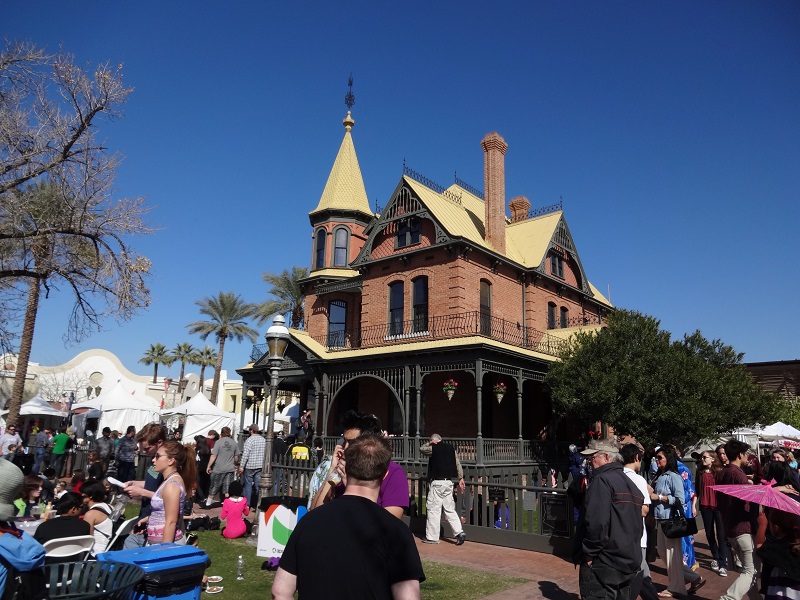
The festival is taking place in the Heritage and Science Park and there are a few buildings that are impressive especially the Rosson House Museum an early 20th century house and the Children's Museum of Phoenix across the street housed in an old school building.
 |  |
| Rosson House Museum | Children's Museum of Phoenix |
One feature of the crowds is that quite a few of them are dressed up either traditionally Japanese (mostly kimono) or modern Japanese (anime). Some anime costumes are really head turning and funny. There are also masked dancers that we observe for a while.
 |  |
| Dancing in the middle of the crowd | Costumes were everywhere |
As it is past lunch time we stop at a kiosk to get some "Japanese" fast food which is average and some sweets which are green, sweet and gooey.
 |  |
| "Japanese" fast food | Dessert |
Another well attended performance is the drum recital that goes on with different sizes of drums for quite some time. During the break they let people to try their hand at playing the drums which is quite hilarious.
 |  |
| Little drums... | Big drums |
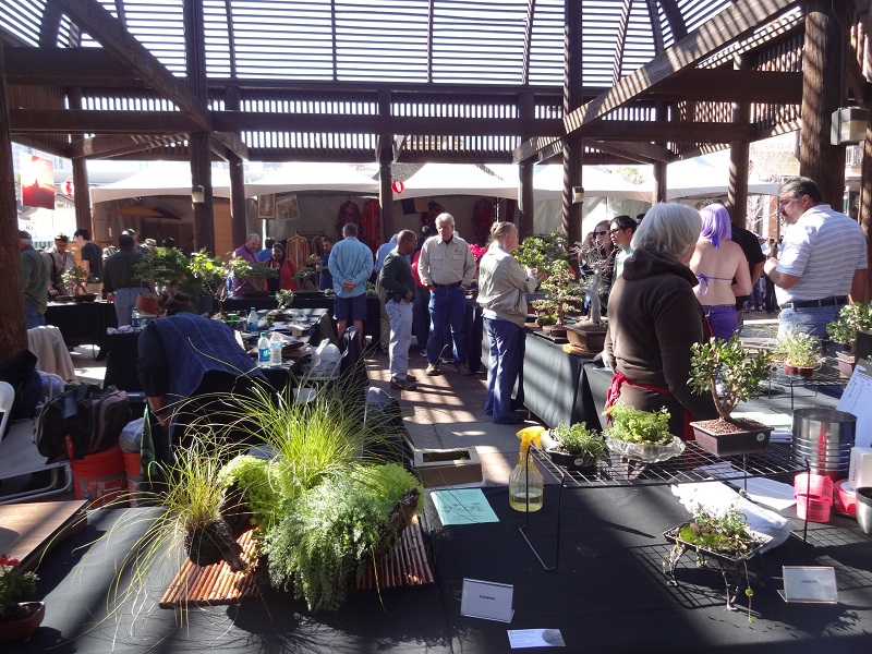
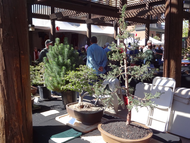
After a bit of searching we finally find one exhibit that we really wanted to see - the bonsai exhibit. There are lots of interesting miniaturized trees including a few pines which was impressive.
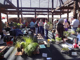 |  |
| Bonsai exhibition | Evergreen bonsai trees |
The artwork at the stands varies between common and interesting. The most interesting ones are those that are inspired from Japan but even with the more common ones it is fun to stroll around the various objects and examine them in detail.
 |  |
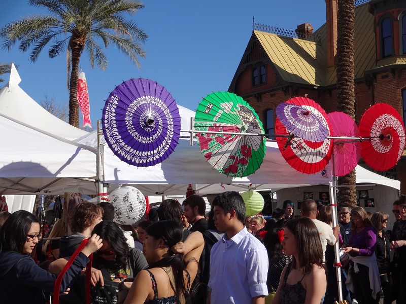
| Interesting artwork | Umbrellas for sale |
And did I mention the costumes? Our last tour through the area we focus on the more interesting costumes and try to take a few pictures of them but it is difficult with the crowds interefering multiple times with the pictures. In the end exhausted we walk back to the car. Overall it was quite an interesting experience but the crowds were really overwhelming in such a limited area.
 |  |
| Interesting costumes | Scenes like this were common |
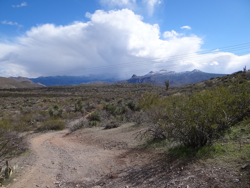
After a cold week with snow falling even in the Phoenix suburbs we are doubtful whether we should even try to get to the Coon Creek ruins which we are intending to visit for quite some time. In the end we decide that we won't let a little snow stop us. As we pass Top of the World on the way to Globe and then Coon Creek it starts snowing again and the outside temperature is 30 degrees F and again it doesn't look like a good idea to continue but we forge on. Our first stop is the Salt River Recreation Area - the bad weather subsided a bit by this point and the river is beautiful so we start to warm up again to the idea of Coon Creek so we drive the additional 2 miles on the paved road before turning onto the unpaved Cherry Creek Road.
 |  |
| Map of the Salt River Recreation Area | View of River |
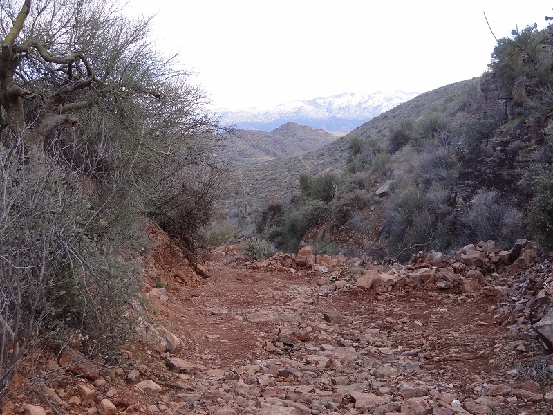
Cherry Creek Road looks well maintained at first but gets muddy as it crosses a mountain pass but it is nothing that our SUV can't handle. We arrive at the starting point of our hike, a side dirt road that has a reputation of being in bad condition so we leave our car intending to start the hike. And promptly it starts snowing. We decide to eat lunch first and the weather improves a bit so we start again on the road to the ruins. From the beginning the views are breathtaking with surrounding mountains covered in snow and views that extend far in the distance. And even though there is a snow shower from time to time we also see the sun and it becomes warmer which lifts our spirits.
 |  |
| Cloudy snowy day | Snow in the mountains |
 |  |
| Road to ruins | Sun is coming out |
After about 1 mi we notice something yellow in the distance and wonder whether someone else is exploring the area which seemed really unlikely given the remoteness of the area and the weather. It takes another mile until we finally reach the ridge and then we find out that it actually is a crawler, a road repair machine, that seems to be abandoned for now. From the tracks it looks like it has been used to build a fence nearby. After examining the unexpected find for some time we have to move on towards our goal.
 |  |
| Road repair equipment | Unexpected find far away from civilization |
As we pass the ridge the views of the mountains continue to be breathtaking but we are more focused on our target the canyon where the ruins are located that we see for the first time. We still have more than one mile to go so we hurry so we can arrive with enough time to spare for our return. The road deteriorates more and more until we reach a pass shortly after which we veer off the road and follow a foot trail down to the creek. The creek is rocky but luckily it is not flowing and the trail follows it until the foot of the cliffs near the ruins.
 |  |
| Great view of the snow covered mountains | Canyon that we are aiming for |
 |  |
| Road deteriorates towards the end | This is foot traffic only trail |
The climb to the ruins is short but difficult due to the steep trail. As we catch our breath we take in the views and we notice some interesting stone hoodoos at the mouth of the canyon that we didn't notice until now.
 |  |
| Interesting stone hoodoos | Lots of saguaro on the mountain side |
The ruins consist of 5-10 visible rooms some of which are well preserved. There are still original wood beams in the walls and one of the rooms still has half of the roof. We explore them as carefully as possible - even after seeing this many ruins there is a sense of exploration whenever we visit a new one.
 |  |
| First view of the ruins | Details of embedded support log |
 |  |
| Is that a window or a door? | View from the best preserved room |
It takes about 1/2h to explore all the nooks and crannies of the ruins. The rooms are really small and as usual it is difficult to imagine a whole family leaving in one of these rooms which shows how much expectations about living conditions have changed in the last hundreds of years.
 |  |
| Not a lot remains from this room | Wonder where they got the big trees? |
 |  |
| Best preserved room | Another view of ruins |
As we descend we notice the beautiful mix of colors in the canyon walls, they are impressive in certain places. In one crevice a hiker even placed a bone which while interesting is a bit creepy.
 |  |
| Colors in canyon wall | Mix of rock colors and a bone |
We decide to also try to catch a glimpse of the ruins from the other side of the canyon so we climb a short distance on an outcrop for a good view of the ruins. Of course this also affords a good view of the canyon mouth and the mountains in the distance.
 |  |
| View of ruins from afar | Canyon View |
The hike back is mostly uneventful but we still stop multiple times to take pictures of the magnificent views of the now reddish mountains. We also see some deers running away from us, they seem quite scared which convinces us that this is a remote area with few visitors.
 |  |
| Mountain at sunset | Snow covered mountain |
As we approach the car the sun goes below the horizon and the moon comes up. It is almost full moon and it is big and impressive as it appears from behind the mountains. The clouds illuminated by the sun look otherworldly also so we stop to take it all in before finally getting in the car for the drive back to Phoenix. To our suprise the muddy areas are either frozen or dried up so we can pass much faster through the area and return to the paved roads and civilization.
 |  |
| View of the moon | Beautiful clouds |
It is rare that we are able to take part in an "Art Detour", the street art expo of Phoenix, but this Saturday we put some time aside to do a visit of some participating locations as we were in the downtown area due to some unrelated obligations. We park at the starting point of the detour and immediately find some street art that we didn't notice before, a panda sculpture from the sister city of Phoenix. The most art shops that take part in the "Art Detour" are located on Roosewelt Street so we walk down to it and immediately we find some interesting new art in an area that in Google Maps still appears to be empty.
 |  |
| A gift from Phoenix sister city of Chengdu, China | Interesting street art |
We enter in different shops along the way and even buy a few knick knacks. As we continue walking down the street there are interesting sculptures and paintings adorning the street at almost every step.
 |  |
| Interior of an art cooperative | Art for sale |
 |  |
| Wall painting | Brightly colored bicycles |
One of the most beautiful street paintings that we notice is one of three birds on the side wall of an art store. There are other interesting bird paintings and sculptures along the way. The area is quite different than expected and seems to be revitalized quite a bit.
 |  |
| Beautiful wall art | Lots of painted birds |
We are getting tired and hungry so we stop at a Quizno's at the edge of the artsy area and eat a couple sandwiches before returning to visit the last part of the area that we wanted to visit.
 |  |
| Reindeers in Arizona? | Lunch in Phoenix |
The last side street has a lot of homes that have been taken over by the art community to live in and exhibit their artwork. Some of them sell even some older stuff that we rummage too. But in the end it is getting close to the closing time of the Art Detour so we return back to the car and go home. Overall the area has changed quite a bit since we were last here, it is interesting to see the difference a couple years make.
 |  |
| Art District | Painting for sale |
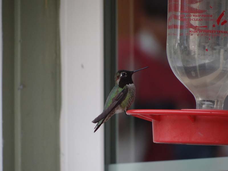
We wake up early in the morning because we want to attend a bird nest identification course at Hassayampa Nature Preserve which is an 1 1/2h drive from our home. After paying the $5 entrance fee we walk to the nearby building where the first part of the class is starting. The class is interesting and we learn a lot of new things about birds and the nests they build and luckily there is also a hands on experience with a few nests brought by the instructor. After this there is a short break before the class continues with a walk across the Preserve. As we wait for everyone to return from the break we notice a huge number of hummingbirds visiting the feeders near the visitor center - it is quite impressive and it almost looks like all hummingbirds in Arizona have been invited to the party.
 |  |
| Broad tailed hummingbird with red patch | Pensive hummingbird |
 |  |
| A rare gathering of hummingbirds | Do I really have to eat all of it? |
As we start the walk with the group on a trail near the visitor center we are impressed with the huge palm trees in the area - likely planted by previous settlers. Now they are used quite extensively for nesting by the multitude of birds in the area. There are quite a few birds in the area that we can observe through the binoculars loaned to us by fellow birders or borrowed from the nature center. Unfortunately we also found a place where likely a bird was killed - the consensus is that it was an Eurasian collared dove.
 |  |
| Palm trees near visitor center | Old nest in palm tree |
 |  |
| Crime scene | Detail of crime scene |
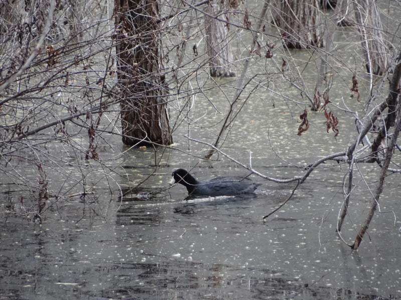
But of course we also observe quite a few birds that are alive as well - the most impressive ones being the water ones that inhabit a small lake in the preserve. The ones that I liked most were the buffleheads - unfortunately they were very skittish and were flying away at the slightest sign of human presence.
 |  |
| Phainopepla far away | American Coot |
 |  |
| View of the lake | Flock of buffleheads |
The trail is level and quite large and it is an enjoyable hike. As we finish the loop we find one of the better preserved nests that we found on the hike on a low hanging branch above the trail.
 |  |
| Trail through the preserve | Looks almost like a road |
 |  |
| A small oasis of palm trees | Found a nest |
At the visitor center at the end of the class we are encouraged to go on a different trail and to view the river that is protected by the preserve. But before leaving we waste a few more minutes studying the hummingbirds at the feeder and visiting the exhibits in the visitor center.
 |  |
| Pair of hummingbirds | Close up of hummingbird |
 |  |
| Hassayampa Nature Preserve Visitor Center | Interior of visitor center |
As we start on the recommended trail we discover that the river is actually split in two branches one which is dry and sandy and a second one that is flowing nicely. Luckily there is a wooden bridge over the river that we pass as we continue the loop through the bosque surrounding the river and then return back to the visitor center and take our leave from the Nature Preserve. Our next goal is the nearby small town of Wickenburg where we intend to find a lunch place as we are quite hungry.
 |  |
| Dry branch of the river | Flowing branch of the river |
 |  |
| Hassayampa River | Trail through the trees |
After getting into downtown we are spoiled of choices and finally settle on a BBQ place, Hog Through Smokehouse. We eat the 3 meat combo plate which is quite good and we are filled when we leave the restaurants.
 |  |
| BBQ lunch in Wickenburg | Interesting fries |
After lunch we decide to take a short walk through downtown Wickenburg. Almost immediately we notice a "Goats Roping at 6 PM" sign and nearby there is a pen which holds all the goats. Some of them are resigned to their fate while others are actively working on trying to escape through a hole in their enclosure.
 |  |
| Downtown Wickenburg | Unique planter |
 |  |
| Goats ready for roping | Trying an escape? |
There seems to be a trend to have street art almost everywhere and that is true also in Wickenburg with some funny and some scary ones. After visiting also a souvenir shop we return to the car and move on to our final goal - the Monarch Mine in the nearby mountains.
 |  |
| Not real | Realistic but not alive |
 |  |
| Is that a good place for a cow? | BBQ restaurant |
The road to the mine is quite confusing and at a point it becomes a single track for quite a distance so we decide to stop at a turnaround point about one mile from the mine and walk the rest of the way for safety.
 |  |
| Dirt road near Wickenburg | Narrow but well maintained dirt road |
We don't have to go far to see mining remains - in fact it seems they are everywhere. The Monarch Mine is at the end of a side road that climbs steeply up a mountain so we have to stop quite a bit to catch our breath and of course examine the different mining pits nearby.
 |  |
| Mining remains near the road | Mining tunnel |
 |  |
| Monarch Mine remains | One of the many pits near the road |
We pass the Monarch Mine and as we are almost at the top anyway we make a final push to get a glimpse of the other side. The views are expansive and impressive, you can see Phoenix in the distance and lots of mountains smaller and larger. And then we walk back to the car but before reaching it we see a few cows eating near the mining remains, almost like they own the area. The rest of the return trip is uneventful and we arrive home really tired after a very long day in the Wickenburg area.
 |  |
| Great views from the top | As far as the eye can see... |
 |  |
| Another view of the extensive mining remains | Mining cows? Not likely |
The initial plan was to visit the Coyote Buttes area near Page but even though we had everything including the permits nature conspired against us with lots of rain and snow in the area making it unfeasable for us to visit. Therefore we decided to take advantage of the colder weather and try to visit Skull Mesa which we read is a difficult and exhausting hike. We started earlier than usual and at 10 AM were leaving the trailhead at Spur Cross Ranch. The one unknown was the level of water in Cave Creek which we had to cross a few times. The signs in the parking lot however were pretty bleak pointing out that the river is flooded and has washed all bridges away.
 |  |
| Not an auspicious start | Huge parking lot |
The trail through Spur Cross till the first water crossing in on a old road and level so we tried to go as fast as possible on the easy part of the hike. Even so we had to stop a few times to take in the nice views and the early spring flowers near the road.
 |  |
| Start of trail/road | Trail through Spur Cross |
 |  |
| View of surrounding area | Wildflowers are starting to bloom (Bird's Foot Trefoil) |
After about 1 mile we get at the first river crossing and after changing to our water shoes we manage to pass relatively easy and enter Tonto National Forest. The next difficult spot is an area where we are wedged between the cliffs and the raging water but we pass it with care while holding on to the cliff. Then we arrive at another crossing that we decide to avoid as we have to cross the cold river back again in 0.1 mi and we find a path that goes around the cliffs. And then we arrive at the last crossing before going into the mountains which is shallow and even has an island between two arms of the river for us to warm up again so it is an easy one. Between all the difficult spots the trail however is wide with a few muddy spots so we keep a good pace while assuming we left everyone else behind at the first crossing. This is not entirely correct - as we dry up and eat lunch we see two horses with riders and three dogs coming up the trail and passing through the water without difficulty.
 |  |
| River crossing | It looks shallow but it is quite wide |
 |  |
| The trailhead - have to hike 2 miles to get to it though | Mexican Gold Poppy |
Even though we had quite a few adventures up to this point the trail is just getting more difficult. While it remains well defined it becomes narrower and starts climbing and descending over several hills. Everywhere around us we see water there are even a few waterfalls and the trail looks like a creek a few times. The views are beautiful and the whole desert is green from the rains.
 |  |
| Well marked trail | Hiking trail |
 |  |
| Unlikely waterfall | View to our back |
As we approach the Skull Mesa trail junction the views change with Skull Mesa becoming more proeminent. There is an area of red rocks that is reminescent of Sedona. Then there are a few rare crested saguaro growing in interesting shapes. And then after a final slog up a hill we arrive at the intersection where the trail for Skull Mesa is leaving and it still looks like a long distance to climb and it is already 2 PM.
 |  |
| Red rocks | Sign in the middle of nowhere |
 |  |
| Crested saguaro | Gate before major intersection |
Before the climb however we leave some of the heavier stuff at the intersection and do a short 0.3 mi side trip to Cottonwood Spring which is a special green area in the desert. Today everything is green but this does not detract from the experience as the spring is surrounded by old trees which are uncommon in the area. And then after a bit of relaxation it is back to the intersection and the short brutal climb up the mesa.
 |  |
| Cottonwood Spring | Everything was green |
The start of the trail is less steep and we even notice a few petroglyphs. As we take pictures we still have to remind ourselves that the trail will raise 1,000 ft in less than 1 mi which is a lot and the flatter it is in the beginning the steeper it will be later.
 |  |
| Petroglyphs near trail | More petroglyphs |
And it really is steep and we are reduced to almost a crawl as we are already tired from the previous 7 miles we hiked to get here. We stop often to catch our breath, at least there is no paucity of great views and there is an eagle who has taken an interest in us and follows us up the trail. With each step we know we are getting closer but it doesn't look like it as the trail weaves around trying to avoid cliffs. And then suddenly we are at the top and we fall exhausted to the ground. We have to change clothes as we are drenched in sweat and leave them to dry while we hike across the mesa to the ruins.
 |  |
| Rocky trail up the mesa | That is where we want to go |
 |  |
| Mine and snow covered mountains in the distance | View from the top while taking a well deserved rest |
How hard can it be to hike across the flat mesa after doing the difficult climb? Quite hard if you are doing it after rains as we found out immediately after going off trail. There was mud all around which was sticking to our shoes and we were almost sinking a few times. It felt like walking in a swamp and with each tired step we were carrying at least a couple pounds of mud with us which really didnt't help. And we had to do this for two miles as we cross the mesa to a knifeback pass to another high point where the ruins are. As we get closer we take a few pictures but we have to retreat as it is already 5 PM and we still have to hike back and cross the river again.
 |  |
| Top was flat but muddy | Anasazi building remains |
 |  |
| Anasazi fortress wall | Close up of wall |
The views are beautiful in the sunset and we get off Skull Mesa just as the sun sets down. After that it a tiring hike back to the river using our headlights where we dress up again for the crossing. Luckily it feels warmer outside even though it is dark so the crossings are okay and uneventful. When we arrive at the car we are the last one in the parking lot so we tiredly climb into it and head home. Overall it was a 20 mile hike over almost 12 hours with at least 3,000 elevation difference - one of the most difficult hikes we have done for some time.
 |  |
| Beautiful view in the distance | Mountains in the sunset |
 |
| Fossil Creek Canyon View |
This weekend we do a two day trip in the vicinity of Phoenix. On Saturday we plan to go to the Archaeology Expo and then to the Archaeology Movie Festival and then on Sunday we plan to do a hike on the Fossil Creek Rim. The Archaeology Expo is help this time at Horseshoe Ranch in Agua Fria NM right of Bloody Basin Road. We passed it a few times before but today we stop and park and then notice that the expo is on the other side of the river. And the only dry way to cross the swollen river is by using a long wire bridge that looks dangerous but is safe given the number of people crossing it without any problem.
 |  |
| Wire bridge to Horseshoe Ranch | Crossing the bridge - a bit scary |
 |  |
| View from the bridge | Agua Fria is flowing |
The ranch looks lived in so it might be used by the Fish and Game Department. It is a working ranch and even has a few horses from which a few appear to be rescued as they have different handicaps.
 |  |
| Horseshoe Ranch | Horse at Horseshoe Ranch |
The Expo has stands by different historic organizations from across Arizona and a few live demos. The most interesting ones are of a few machines from the early 20th century and some mining tools with a live donkey. We take part in a raffle and win a book and a state park cap. There is only one food stand so we eat what is available which is funnel cake. In the afternoon we go to a lecture about the Agua Fria NM and the Anasazi ruins in it which is quite interesting and after it as the expo is coming to a close we move towards Camp Verde where we decided to stay for the night.
 |  |
| Historic Washer | Historic Grinder |
 |  |
| Mining tools and donkey | Only food stand at the expo |
First we go to the motel to leave our stuff. The motel we booked, Territorial Inn, is a small motel with each room following a different theme. Unfortunately we get a room at the corner right next to the reception which we know will make our night noisier than it should be.
 |  |
| Territorial Inn | Room at the inn |
After checking in we do a short walk through downtown Camp Verde. There are a few interesting old buildings, some abandoned, some used as art studios or restaurants and a museum but the streets are mostly deserted and the shops are closed so we return to the motel and car and drive to the place where the Film Festival is taking place. Today is free entry day and the films shown are a local one about the V-Bar-V Petroglyphs and one from Peru about the Moche Trail. Both of them are interesting and the Peru one gives us quite a few ideas for travel in the future.
 |  |
| Camp Verde Downtown | Old motel that went out of business |
 |  |
| Main Street Camp Verde | One of the better restaurants in Camp Verde |
Right next to our motel is a store selling different odds and ends but what attracts us to it is the live rooster outside, it is a beautiful one. We even enter the store and to our surprise in the back they have tens of chickens of different species, very interesting. We end our day at the Horn Salloon which is a relatively upscale restaurant with good food and most importantly it is open late.
 |  |
| Do they sell live roosters? | No...they sell chickens |
 |  |
| Argentinian steak at the Horn Salloon | Creme brulee at the Horn Salloon |
Sunday we try again to hike the Mail Trail; we tried it in fall and it was too hot and we left too late to get to the Fossil Creek Rim. Today we start early and the weather is nicer and we have an idea about the condition of the trail so the going is faster.
 |  |
| Parking lot for the Mail Trail | The road goes past the parking lot |
 |  |
| Start of Mail Trail | This is the Mail Trail |
We go both on trail and off trail as we try to reach the rim in the straightest line possible. There is plenty of solitude on the trail as we do not see another soul during the whole day. The vegetation is mostly juniper and catclaw but sometimes we find a surprise cacti mostly prickly pear but also some huge cholla.
 |  |
| Well built cairns marking the Mail Trail | A cholla as high as the junipers |
As we approach the rim we find a few cows which eye as warily and then decide to run away thunderously. Soon after we reach the rim and the views in the canyon are as breathtaking as we expected. We walk a bit along it and there are some good views of both Fossil Creek and its tributaries.
 |  |
| Wild cows on the range | Fossil Creek View |
 |  |
| Another view of the canyon | Waterhole in the Valley |
On our return trip we decide to stick to a 4WD road that we assume reaches the parking lot. The going is much faster and soon we reach an artificial pond where to our surprise we notice a lonely ring necked duck doing its rounds. Unfortunately not all animals we saw where alive as we saw quite a few skeletons including one of a cow that still had hide on it.
 |  |
| Waterhole at the top | Ring-necked Duck |
 |  |
| Road on the mesa | Not every cow makes it |
As we approach the car it is getting darker and darker and we have to stop to enjoy the beautiful sunset. The moon is also up in the sky with Jupiter closeby; after arriving at the car we take out our binoculars and even notice three of the Jupiter satellites. After that it is back to Phoenix after a full and exhausting weekend.
 |  |
| Nice sunset | Another view of the sunset |
 |  |
| Moon and Jupiter | Night view of moon and Jupiter |
This weekend we decide to stay close to Phoenix and do some small parts of the Maricopa Trail which in its entirety encircles Phoenix through its green areas. The first short area that we hit is in Anthem near Daisy Mountain Road after we do some shopping at the nearby shopping complex. We are suprised at how many flowers we see and there is a variety of wildlife also including quail and rabbit.
 |  |
| Wildflowers near trail | Trail through wash in Anthem |
 |  |
| Mexican Poppy | Marigold near the trail |
Then we move on to an official trailhead for the Maricopa Trail near Pleasant Lake. To our surprise even though there are lots of cars on the nearby highway the trailhead parking is empty and stays that way during our entire hike. The access is a bit unusual as there are a few misleading signs that seem to point that the area is a restricted area even though they refer to the sides of the road. In addition the lanes in the parking lot are market by paw prints....cool!
 |  |
| U-turn for trailhead | Interesting lane markings |
 |  |
| Start of trail towards south | Flowers near trailhead |
The trail is new and well defined and it snakes quite a bit as it tries to avoid any sensitive areas. It climbs and passes the Central Arizona Project (CAP) canal and then descends into a small canyon. The major obstacle on the trail are the cholla which are seemingly everywhere and we do our best to avoid.
 |  |
| Well defined trail | Trail is cholla heavy |
There are birds everywhere on the trail and even though we go only three mile roundtrip we see as many as we usually see on the larger hikes. The highlight certainly is a great horned owl that surveys us for a period and then flies away.
 |  |
| Huge hummingbird | Horned owl watching us |
 |  |
| Eagle flying around us | One of the ducks in the Central Arizona Project (CAP) canal |
The views are quite nice but we have to be careful where we step most of the time as we see quite a lot of lizards and even a lizard that is pursuited by a snake. Both us and the snake have a nasty surprise when we notice each other and start running in the other direction.
 |  |
| Lower dam at Pleasant Lake | CAP appearing from nowhere |
 |  |
| Large and new trail | View from above |
And of course there are flowers everywhere. It seems that quite a bit of flowers are flowering simultaneously and most of them are yellow ones. We also see our first cacti flowers of the week which are quite impressive. We take lots of pictures and enjoy the area which for a short walk certainly delivered lots of interesting sights.
 |  |
| First cactus flower for this year | But there are a lot more nearby |
 |  |
| Grove of saguaros | Mexican Poppy field |


No comments:
Post a Comment