This is our second trip to the Carribean but the first outside of US with Puerto Rico being our first journey into this area of the world. The impetus of the trip is also inauspicious, due to changes in our initial plans for the holiday period we are left scrambling for a location to go and Saint Martin was the cheapest destination in a period were high prices are common across most major destinations. However the more we research the destination the more interesting it seems so we are excited to leave on this early Phoenix morning. We spend the time waiting for our plane by looking at the sunrise and the planes taking off towards destinations unknown.
 |  |
| Sun rising at Phoenix airport | Plane taking of in the Phoenix morning |
The trip is quite long with a stopover in Florida and we arrive in Saint Martin around 11 pm. As the car rental agencies are already closed we hire a taxi to take us the couple kilometers to our hotel, Flamingo Beach Resort and then we plan to rent a car from the hotel the next day. The check in is relatively fast and we are in our room around 12 am. We notice there are a few towels missing so we walk back to the reception to get them but else the room is great with a kitchenette, a balcony and a separate sitting area. We are tired after the long flight so we go to sleep as tomorrow we plan on exploring the island.
 |  |
| Flamingo Beach Resort Room | Kitchenette in resort room |
In the morning we have to buy some groceries so we go outside to explore the resort and surrounding area. One of the reasons we chose this hotel was that it had its own beach..it is relatively small but looks cozy. Unfortunately the red flag is up so no swimming even though the platform out in the sea looks inviting.
 |  |
| Ocean near the resort | You can swim out to the platform |
 |  |
| Beach in front of the hotel | Another view of the beach |
The resort has multiple amenities including a pool, beachside bar and restaurant, laundry room, shop and even a car hire center where we rent the car for the next days. You can walk between the hotel and beach on a path that has good views of the island and of the people frolicking in the water.
 |  |
| Resort Pool | Trail near the Resort |
 |  |
| People enjoying the water | Palm trees are everywhere |
Besides the developed area it also faces a less developed beach which looks more inviting however it has a closed sign on it so we cannot enter it. The only birds that we see in the area are a few sandpipers however the airport is right across the bay and so we have a good view of the planes taking off and landing which is quite interesting.
 |  |
| Less developed side of beach | Scenic beach |
 |  |
| Sandpipers enjoying the amenities | Other type of "birds" |
In the afternoon our plan is to go to Marigot the capital of the French part of Saint Martin. In fact that is one of the pecularities of Saint Martin..it is the smallest island shared by two countries. We stay on the Dutch side however the French capital is closer to us at about 2-3 km distance while the Dutch one is more distant. The driving on the island takes a bit to get used to as the traffic is very heavy and slow going. With a bit of luck we find a parking space in Marigot which is supposedly a difficult feat and then start walking toward the downtown area. The feature that draws our attention is the ferry port right next to where we parked. We are interested in it as we plan on using ferries to reach some of the neighboring islands in the following days. Nearby is an impressive mall building but the offering inside is disappointing with many shops closed for the day already.
 |  |
| Marigot ferry terminal | Close up of ferry terminal |
 |  |
| Mall in Marigot | Close up of mall |
One of the major attractions of the city is Fort Saint Louis which stands guard above the city near the harbor. It was built in 1789 and protected the harbor warehouses against the British from nearby Anguilla until it was abandoned in the 19th century. We decide to hike up from the bottom and take the stairs that seem closest which lead us through a residential neighborhood including some abandoned housing. However the views as we climb are great and soon we intersect the road going towards the parking lot below the fort near some governmental buildings.
 |  |
| Climbing to Fort Saint Louis | Abandoned housing in Marigot |
 |  |
| View from the stairs up | Lush vegetation |
From the parking lot there is no way around it and everyone must climb the last flights of stairs to the fort. It goes through lush vegetation with great views that invite us to stop and enjoy them however we are hurried as we notice that a storm appears to be approaching from the inland mountains.
 |  |
| Fort in the distance | House before starting on the last climb |
 |  |
| Succulent close to the fortress | Almost there |
As we get on top we take a look at a few of the views and then the rain comes in. It is a violent rain shower so we run for some dubious cover - when it ends we are drenched to our bones so it is good that the weather is warm and the fact that we are wet doesn't bother us that much.
 |  |
| Rain is coming in from the mountains | View of Marigot from Fort Saint Louis |
 |  |
| Trail through fort and view of the island | One of the fort guns |
As we are already here we continue the tour of the fort. We are alone now as the few other tourists have run downhill which makes for a relaxing exploration. Besides the walls and the entrance gate remains there are a few building ruins and foundations but mostly it is flat with a few paths crisscrossing the plateau on top.
 |  |
| Interior of fort | After the rain in Fort Saint Louis |
 |  |
| Remains of entrance gate | Looking in the distance |
From the top we also see a wreck, probably an old one, near the coastline away from downtown Marigot and towards Marigot we capture the arrival of the Anguilla shuttle that we will take in a subsequent day.
 |  |
| Wreck near Marigot | Close up of wreck |
 |  |
| Marigot harbor | Ferrry to Anguilla |
We return downtown using the roads and pass the Sur le traces des Arawaks Museum that we intended to visit however unfortunately it is closed already. We pass also the Catholic Church which looks well maintained and today appears to be full of schoolchildren. There are also interesting houses to see and passages to explore but everything seems strangely empty and the vast majority of stores are closed.
 |  |
| Sur les traces des Arawaks Museum | Catholic church in Marigot |
 |  |
| Colorful house | Stairs with restaurants on both sides |
Before we leave we explore also the waterfront and we notice an accident where a driver didn't notice a roundabout and crashed into a Christmas display in the middle of the intersection. There are also a few interesting sculptures celebrating the islands history which we examine. On the way back to the car we find an open patisserie where we buy some sweets for dinner.
 |  |
| Not sure he was supposed to park there | Artwork |
We decide to take the more scenic route when returning back to the hotel and we also want to see a newly opened mall on the west side of the island. On the way we try to reach a few beaches however they are either too difficult to find or to access especially given the limited time we have. In the end we stop at the mall and walk to the beach next to it, Cupecoy beach. We have to descend to it using some rickety looking stairs however at least it is not raining anymore and the sunset from the beach is quite nice.
 |  |
| New mall | Going to the Cupecoy beach |
 |  |
| No one this late | Sunset from Cupecoy beach |
The beach itself is quite spectacular with the small strip of sand caught between the cliffs and the waves. With no one around it is a perfect place to enjoy the sunset however suddenly clouds come in and it starts to sprinkle so we retreat to the mall. The mall is just opened so not all stores are yet opened and the food court is also closed so it doesn't take us long to see everything and then we return to the hotel.
 |  |
| Scenic Cupecoy Beach | Walking in one direction |
 |  |
| Dead end | Waves at Cupecoy Beach |
We are hungry after our tour of the area so we step to the restaurant in front of the resort in order to eat dinner. To our dismay there is a long line of customers and due to the rain the outside patio is closed. In the end we order takeout which is faster but still takes the better part of 1/2 h. However the food is very good and we finish with the sweets we got from Marigot for a great meal. After this we are tired so we go to bed as the next day will also be a busy day.
 |  |
| Food from Bon Appetit restaurant nearby | And this is from Marigot |
 |
| Phillipsburg Bay |
After visiting the capital of the French side of Saint Martin the day before today we plan to visit the capital of the Netherlands side of the island, Phillipsburg. In order to do that we have to pass the mountains which is slow going with bumper to bumper traffic in areas and especially a few roundabouts creating traffic backups. After arriving in Phillipsburg it takes a bit to find the parking area which is right next the Great Salt Pond and from there we start on foot towards the downtown area.
 |  |
| Saint Martin View | Is this our road? |
 |  |
| Typical road congestion on an island | Phillipsburg congestion - even worse |
It is a short walk but because we pass by the post office we decide to enter and buy some stamps for postcards later. The main street of Phillipsburg, Front Street, is narrow and it is quite crowded with three cruise ships in the harbor. There are many shops with jewelry, souvenirs, electronics and clothes. The major building right in front of the pier is the courthouse, a building from 1783 much renovated since.
 |  |
| Narrow main street in Phillipsburg | Lots of tourists on main street |
 |  |
| Old courthouse building | Close up of courthouse |
From the courthouse we walk toward the ocean, there is a large promenade along the waterfront with what seems a very popular beach along the ocean. The pier is also interesting as it is jutting into the sea. It is mostly for cruise ship tourists but we are also allowed to enter the secured area and walk around it.
 |  |
| Large oceanfront promenade | Tourists on the promenade |
 |  |
| Phillipsburg beach | Pier with ferry to cruiseship dock |
The views from the Pier are quite nice in all directions with the mountains in the distance and the city and beach close by. After gawking a bit we return to the main street to continue our tour of Phillipsburg.
 |  |
| Pier with Phillipsburg and mountains in the distance | Very busy city beach |
The streets continue to be full of shops and curiosities including a Star Wars Museum the brainchild of Hollywood creature effects wizard Nick Male. It has quite a few interesting exhibits that we see from the outside.
 |  |
| Narrow sidewalks on main street | Side street |
The more well known stop is the Guavaberry Emporium. As the name implies it is selling products made of guavaberry, specifically rum. It is sold everywhere on the island but this is the official selling point and it is quite popular with the tourists.
 |  |
| Well known Guavaberry Emporium | Entrance to the Guavaberry Emporium |
 |  |
| Where should we go next? | Wildlife near the emporium |
Our next stop is the Sint Maarten Museum, which is free admission. It is a small but interesting museum with lots of artifacts starting from the original inhabitants, the Arawaks, and then going through the European colonization period to the present autonomy movement.
 |  |
| Sint Maarten Museum Interior | Old objects from the island |
 |  |
| Different ships that plied the area | Artefacts in a side room of the museum |
 |  |
| Lots of knickknacks | Objects from the time of the Arawaks |
We decide to walk to the old Spanish battery site a bit outside the main city which is on the way to the cruise ship site. First we pass over a few canals and visit an interesting art gallery before the sidewalk becomes a narrow strip between a busy road and a boat dry dock. As we arrive at the battery site there are only a few ruins some of which are overgrown with the lush vegetation.
 |  |
| Boats near Phillipsburg | Canal near the waterfront |
 |  |
| Hot unshaded way to cruiseships | A Spanish battery was at the bottom of the mountain |
On the return way we pass again the dry dock site where people are busy spraying and repairing their ships. There are lots of boats everywhere as you would expect from a Caribbean Island. There are multiple warehouses near the beach quite impressive looking even though now they are used as housing and shops.
 |  |
| Boats on dry dock | Boats in the water |
 |  |
| Disconcerting sign | Former warehouse near waterfront |
With the majority of the tourists returning to the cruise ships there are stretches of the beach that are more empty when we return. We explore the waterfront now, both the shops but especially the restaurants as we are quite hungry already. Still we have to stop at the interesting display of rum barrels - unfortunately they are for show only.
 |  |
| A more deserted area of the beach | Interesting abandoned house |
 |  |
| Not real rum unfortunately | A more modern church |
The restaurant where we decide to eat is a newly opened one and while it takes a bit for the food to appear it is quite good both the island bbq and the fish. Satiated we return to the car in order to go to our last objective for the day, the ruins of Fort Amsterdam.
 |  |
| Restaurant that we decided upon | Guavaberry juice |
 |  |
| Island barbecue | Fish dish |
Before leaving we take a look also at the Great Salt Pond which together with the ocean limits Phillipsburg to just a narrow habitable strip of land. The views are beautiful and there are lots of birds including quite a few frigate birds which are striking when flying with the red pouch visible.
 |  |
| View across the Great Salt Pond | Another view of the Salt Pond |
 |  |
| Find the sandpiper | Frigate bird |
 |  |
| Moorhen | Egret near water |
Getting to Fort Amsterdam is more complicated than we expected as it is behind a resort and we have to request at the gate for them to let us in. We park in the assigned parking lot and then pass through the resort towards Fort Amsterdam. The last part after the resort is a gentle climb and here we pick up a dog that follows us faithfully up the hill. From the first viewpoint we notice the the first of the three cruise ship is ready to leave - the top deck is full of passengers that are watching the departure.
 |  |
| Starting towards Fort Amsterdam | Our companion for the evening |
 |  |
| Cruiseship ready to leave | "Cruisers" watching the departure |
There are few remains of the old fort mainly a few cannons and walls but you can see how this site was strategically important in protecting the harbor. In fact the fort was built by the Spanish and it was the most important fort east of Puerto Rico until it got abandoned. There are a few building that were used as a signaling and communication center into the 20th century however now they are mostly trashed inside. Still from the outside they look great on the cliffside, it almost feels like we are in Ireland not in the Caribbean.
 |  |
| Cannon at Fort Amsterdam | Hmmm..is it pointing at the ship? |
 |  |
| Old buildings in Fort Amsterdam | Close up of building |
 |  |
| Open window? | Interior of house |
Past the fort the path continues through the native vegetation to the cliffs. We can see small coves and bays that seem to be visited by pelicans quite often as they fly above our head towards the coves. There are also a lot of planes that fly above our head likely taking off or landing at the major airport in Saint Martin.
 |  |
| Path through interesting vegetation | Wild ocean at the end of the peninsula tip |
 |  |
| Small cove | Island Cacti |
 |  |
| Pelican flying | More modern "birds" in flight |
As we watch the beautiful sunset the leaving cruiseship passes the cape and goes off into the sunset..like in the movies. It almost looks like an advertising clip for a cruise ship company.
 |  |
| Cruise ship leaving into the sunset | Even more distant |
 |  |
| Can barely see the ship anymore | Another ship at sunset |
We return on the other side of the small peninsula in order to examine the area where the pelicans seemed to be flying to. First we notice a small floating house that looks lived in and then we find an interesting overgrown trail that passes some old wall with cannon holes in it - likely still a fort wall. It goes a bit downhill through flowers and we even find some egg shells that look suspicious like hen eggs.
 |  |
| Interesting ocean homes | Old wall of Fort Amsterdam |
 |  |
| Trail between wall and flowers | Eggs....of what? |
From the overlook at the end of the trail we can see further downhill a lot of pelicans already roosting with a few laggards still coming in. There are both young and old pelicans and sometimes they conflict but mostly they seem just contend to stay and relax. Soon we notice in another tree a rooster - obviously there are wild chickens also in this area.
 |  |
| Pelicans roosting | Enjoying the evening |
 |  |
| Nice colors | Wild chickens roosting |
It is getting dark however so we decide to return our car. On the way back we enjoy great views of the illuminated city and remaining cruise ships that are preparing to leave. Unfortunately the return back is as slow going as it was coming here even though we try a different route. The roundabouts especially create long traffic backups but after a lot of waiting we arrive spent at the hotel and go directly to sleep to recuperate for the next day.
 |  |
| Remaining ships | Well illuminated cruise ship |
Today our plan is to do a day trip to Anguilla a neighboring island and reachable by a 30 minutes ferry ride. The ferry leaves from Marigot so we have first to drive there to catch the ferry. As we arrive the ferry is just leaving so we have to wait an additional hour that we spend by examining the surprisingly small outdoor market given that today is one of the two weekly market days in Marigot. The ferry ride is fast and uneventful except for the rain that is starting as we arrive in Anguilla. We pass through the immigration check after a bit of waiting and then find the rental car company that we rented from. Next we receive an Anguillan driving permit - they do not recognize International Driving Licenses so you have to get a driving permit to drive even for one day. It is an easy but bureaucratic process with some papers to be filled in. The car we receive has about 100000 miles on it and parts of it are not necessarily working as intended but it is working overall and at least no additional scratches will be noticed so we start our visit of the island country in the falling rain.
 |  |
| Marigot covered market - not that used | Marigot market stalls |
 |  |
| Debarking in Anguilla - yes it is raining | Customs/immigration building |
First we drive to The Valley, the capital city of Anguilla. It is a small town and while we stop at the post office to get a few stamps and also to make sure the car doesn't fall apart as it makes a few interesting sounds we pass through it mostly without stopping. The major avenue is Coronation Avenue a tree lined street with potholes that especially after the rain are hidden so we drive carefully to ensure we don't fall into one.
 |  |
| The Valley - Coronation Avenue | Houses in The Valley |
One of the historical attractions on the island that we know off is the Heritage Trail which links together the historical sights on the island. Unfortunately we couldn't get any printed information on it so we are following signs that are scattered on the island. The first one we discover is the old ruined courthouse and jail that was destroyed in 1955 by Hurricane Alice. It is an interesting sight that can be explored in peace with nice views of the ocean and new houses springing up on the ocean shore.
 |  |
| Heritage Trail - former courthouse | Old courthouse ruins |
 |  |
| Side view of ruins | Another view of courthouse |
 |  |
| Foundations from above and new building | View of the ocean from courthouse ruins |
We continue on from the courthouse trying to see where the road goes and also trying to understand our map of the island better. The road becomes narrower and narrower and then it becomes and then it becomes overgrown. Our curiosity gets the better of us so we get out and continue walking on the overgrown road with great views on both sides of the road which follows a crest up to a cape with great views. The weather has improved with sun at times and it is quiet with birds singing..quite a nice walk.
 |  |
| View from crest road | Major beach in Anguilla |
 |  |
| Crest road | Abundant flora |
 |  |
| "Road" starts to disappear | Becomes a trail towards the end |
Anguilla is known besides the great beaches for its caves - it has a number of them scattered on the island. We planned to visit one that seemed more easy to find in the short time we have on the island and that is our next stop. FInding the trail entrance to the cave is quite difficult as we stop on the street and walk along the edge with our hopes fading as all entrances disappear after a few stops in the impenetrable jungle. Just when we want to give up we find the correct entrance and we are off on our adventure. The trail is well defined after the hidden entrance through the jungle and scrub and after about 15 minutes we arrive at the cave. It looks a bit dark and foreboding but we forge on only to scare a few bats..and then we look up...oh there are a lot of bats here.
 |  |
| Cave trail | Vegetation on trail |
 |  |
| Entrance to the cave | What are those...bats?? |
Still we forge on and arrive to an intersection where the roof has caved in and a tree has started growing exiting the hole in the roof..beautiful and we almost feel like Indiana Jones looking for treasure. THe only thing that we find however as we explore the side passages are bats and bats and hermit crabs. Yes hermit crabs are everywhere on the ground so we have to choose our poison look up to make sure we don't get a gift from above or look down to not step on the hermit crabs running around.
 |  |
| This looks like a movie location | Tree of life - or just normal tree in cave |
 |  |
| Bats in the cave | Solitary bat |
 |  |
| The other inhabitant of the cave | Those are quite a few bats |
Outside we have only the crabs to worry about - this is the first time we have seen this many in one place almost every shell we see is inhabited. We explore also the vegetation a bit and then walk back to the road and our car..next we move on to one of Anguilla many beaches the Sandy Ground Beach.
 |  |
| Hermit crabs are everywhere | Succulent forest |
 |  |
| That is the entrance to the trail | Deserted road |
After arriving at the beach the first order of business is to find something to eat as we are famished. There aren't many restaurants open but we find one on the beach where we can relax until we get our food, BBQ and fish both of them good.
 |  |
| Sandy Ground Beach | Beach side restaurant |
 |  |
| Anguillan barbeque | Fish sandwich |
The beach is actually sandwiched between the Ocean and the Road Salt Pond on the other side with supposedly quite a few birds but we dont see any except a few gulls.
 |  |
| Road Salt Pond View | Not enough birds on the pond |
We walk along the beach to the end of the sand and then continue on the small rocky beach between the cliffs and the ocean for nice views of the coastline.
 |  |
| Sandy Ground beach | Boats in the harbor |
 |  |
| More rugged coastline | Can you really go further? |
The attraction here are the shells and the conches that are everywhere. It is really interesting and one of the most "wild" stretches of coast that we see during our trip.
 |  |
| Conch shells on the beach | Fossilized shells |
 |  |
| Secluded beach | Found on the beach |
Our last goal before returning to the ferry is to visit the East side of the island which is less developed. To do that we pass again through the Valley where we find another stop on the Heritage trail, the Wallblake House. Wallblake House was a plantation home built by Valentine Blake, a sugar planter and it dates back to 1787 making it one of the oldest surviving plantation homes in the Caribbean. Nearby is Gerard's Catholic Church which looks great architecturally. Actually there are two buildings, both of them built in the same style.
 |  |
| Road near Road Salt Pond | Gerard's Catholic Church - Old |
 |  |
| Gerard's Catholic Church - New | Wallblake House |
After exiting The Valley the road standard degrades gradually. Initially it is paved as it curves along the island however as soon as we turn toward the East End it becomes dirt and then it starts having potholes and it becomes more and more sandy. But we forge on and arrive at our goal, the Savannah Bay area.
 |  |
| Towards the East End | Wild Anguilla |
 |  |
| Road is becoming...interesting | Nice collection of coral |
We park a bit back from the beach and walk to it next to a nice pond and arrive at the beachside bar which is already closed for the day (or wasn't open at all). The beach is the best we have seen till now wide and fully ours. There arent even mosquitoes or other insects to spoil our enjoyment.
 |  |
| Pond near the ocean | Deserted beach |
 |  |
| Abandoned (at least for the day) beachside bar | This we like |
We walk for minutes along the beach, enter the water and enjoy what appears to be a rare unspoiled beach - no houses close by, no one else here, like in paradise.
 |  |
| Even better - really deserted | Vegetation near the ocean |
 |  |
| Not really good for swimming now | Waves coming in |
Unfortunately we have to return as we plan to leave with the penultimate ferry of the day. However until all the exit and car rental return formalities are done we miss the ferry so we have to wait 1h for the next one. As it starts drizzling again outside we dont mind that. The return trip is uneventful including the drive back to the hotel. We are a little bit sad that we couldn't stay the night on Anguilla that we enjoyed a lot however the hotel prices are quite higher when compared to St Martin so it was not in the cards this time. Tomorrow is a relaxation day before we leave St Martin for a few days on Saba.
 |  |
| New house in the area | Close up of house |
 |  |
| Inhabitants of the area | Leaving towards Saint Martin |
Today we plan to have a more relaxed day as tomorrow we are leaving for Saba. We start it by enjoying our balcony with the garden in front of it. There is a cat sleeping in the garden, we have seen her a few times even eyeing our breakfast one time.
 |  |
| Our hotel balcony | Common visitor in front of our balcony |
 |  |
| Hotel gardens | Palm tree in front of balcony |
We take one last tour of the area visiting the hotel souvenir's shop to buy some souvenirs and then passing the restaurant where we ate the first night on Saint Martin. We enter then the nearby supermarket store where we got our supplies till now to buy some water before returning back to the hotel room to relax even more.
 |  |
| Hotel's souvenir shop | Restaurant near the hotel |
 |  |
| Closest stores to hotel | Supermarket where we bought our food |
In the afternoon we decide to exit and visit the close by Maho Beach. To get there we have to go around the airport - an about 2 km drive from the hotel. Maho Beach claim to fame is that the planes landing at the airport fly right above the beach which especially for large planes is quite impressive. The traffic to get there is bad and the going is slow but we finally arrive and find a parking place in the nearby resort that is still under construction.
 |  |
| Crazy traffic near airport | Plane landing |
 |  |
| Between Maho Beach and airport | Probably unique sign in the world |
We walk through the resort - quite a nice location and nice apartments when it will be ready. However our goal is Maho Beach so we exit the resort and try to access the beach.
 |  |
| View from the new resort | Only inhabitant for now |
The beach is choke full with people and also really narrow which makes it difficult to find a place to stay and see the planes. We somehow find a safe place as the planes start coming in, mostly small planes initially.
 |  |
| Maho Beach - really narrow | Almost no place to sit down |
 |  |
| Small plane landing | On approach |
 |  |
| Getting closer | Above us |
AFter a few planes there is a short respite that we use to enter the water which is great however it becomes really deep really fast. In the water we notice something coming in..it is a 747. Everyone runs to take pictures and even we manage to get a spot to catch a few pictures. IT is almost like if you blink it already passed you.
 |  |
| Everyone relaxing between planes | Something is coming in |
 |  |
| It is a 747 - everyone to the cameras | Money shot |
The return to the hotel is really bad - the 2 km takes more than 2 hours. Later we find out that there were an unusual high number of cruise ships in Phillipsburg (8 ships) which led to the traffic jam. Arriving we are exhausted so we go to the beach to relax a bit. For the first time since we are here we see the green flag up which convinces us to go out for a swim. We swim around including to the platform which is quite relaxing however the waves right to the shore are unexpectedly high for a green flag sea.
 |  |
| Green flag at hotel beach - uncommon during our stay | View of plane landing from hotel beach |
 |  |
| Waves coming in | Does this look like a green flag wave? |
In the evening we decide to eat at the hotel restaurant in the terrace. The sunset is great as the cruise ships sail by however the food is so and so while the drinks are also not the best that we have seen in the Caribbean. Still it is filling so we go to sleep to relax for the really early flight the next day.
 |  |
| Caribbean sunset | Cruise ship and sunset |
 |  |
| Evening drinks | Food at restaurant bar - only average |
Today we wake up really early in the morning as our plane leaves at 7 AM and we want to be in time at the airport especially with yesterday's road congestion. Today especially this early the road is empty and the taxi arrives with time to spare. In fact we are the first people in the terminal which is something that never happened before. Everything is closed and ghostly. To our surprise our plane does not show up at all on the departure list and with only 1:30h left and no one around it is getting a bit uncomfortable. Finally a person arrives at the Winair counter and confirms that an unannounced plane (ours) will take off at the expected time at that the electronic boards are not accurate (first time we have seen this). Then we have to wait for the border control people to start working and about 1h before our plane departure we are the first people to pass border control and immigration and get to the secured area. Slowly the waiting area fills up with tired looking travellers. The plane is a really small one - as expected. This time of flights don't have secured doors to the cockpit and the passengers are rearranged according to weight in order not to unbalance the plane.
 |  |
| St Martin Airport in the morning | Nothing is open this early in the morning |
 |  |
| Our plane..really small | No secure door on these flights |
The flight is short and relatively low which allows us to view the ships and yachts from close up. Soon we have the first view of our destination, the imposing island of Saba. It is basically a forested volcano jutting out from the sea and so scenic that it was the "home" of King Kong in the original movie. And then we have to land. The landing is considered one of the most difficult commercial air landings due to the short length of the runway limited by the terrain (shortest in the world for commercial flights). As such the pilots are specially trained to be able to land and takeoff using a much shorter runway than usual. The landing goes well with a short break and soon we are at immigration which we pass fast and then we have to find a taxi to go to the hotel. While distance wise it is close it is high on the mountain and the airport is at the bottom so walking with luggage is out of the question.
 |  |
| Ships from the plane | First view of Saba - King Kong island |
 |  |
| Airport waiting area | First view of Saba - breathtaking |
The taxi that we find seems to almost fall apart..in fact it does in the middle of the climb to the hotel. The driver has to put motor oil in the car and then stop at a shop to buy additional oil (and groceries we are not really sure). Finally after the car almost dying again in the middle of the last climb we arrive at the hotel and are happy to be out of the taxi.
 |  |
| Our hotel on Saba | Massive house right across the street |
 |  |
| Rooms at Selera Dunia | Selera Dunia garden |
The hotel seems deserted and a neighbor comes to help and mentions that the owner is out on a trip and likely he left the room open. That is true at least for one room which looks like ours. It is beautifully decorated on par with some of the best hotels we have been in. It has lots of interesting Asian porcelain and furniture...very tastefully and nicely decorated. We are really tired so we decide to rest a bit but then a woman enters and identifies herself as the housekeeper - there was a misunderstanding and she thought we will be arriving with a later flight. So we pay the hotel and get the tour of the facilities and then finally we can rest for a couple hours.
 |  |
| Wow - what a room | Detail of room |
 |  |
| Antique closet | Beautiful porcelain |
After resting we have time to take in the beautiful view from the balcony before starting the walk down to the city of Windwardside. The walk should take about 15 minutes however we stop on the way to take a look at the well maintained houses with beautiful gardens so it goes much slower in the end.
 |  |
| View from the balcony | First wildlife |
 |  |
| Going down - well maintained houses | Mt Scenery and Windwardside |
The vegetation is very lush, both the maintained one in the gardens as well as the unmaintained one in the jungle. We stop almost at every step to smell this one or take a picture of another flower.
 |  |
| Gardens are everywhere | Do we have to come back up? |
 |  |
| Flowers near the road | Lush vegetation |
As we arrive in the Windwardside main area we walk around finding lots of picturesque locations. One of the more interesting ones has a goat outside that looks almost like he owns the building and the area.
 |  |
| House with owner(?) | Vegetation taking over a house |
One of the things that we intend to visit in Windwardside is the Harry Johnson Museum a small museum dedicated to local history. However while we can enter the museum grounds, and we do it multiple times, the museum unfortunately is closed during our whole time on the island.
 |  |
| Museum entrance | Museum building - closed unfortunately |
 |  |
| Statue in museum garden | Only inhabitant |
One of the things that surprises us on the island is the abundance of fruit trees some of which we know and some that we can only guess if they are edible or not.
 |  |
| What are these? | These we know |
The streets are really narrow including a pedestrian only street that links the museum to the main street while passing near a small church.
 |  |
| Narrow passage | Well maintained church |
The main street of Windwardside is the shopping street with a couple supermarkets, a few restaurant and a few souvenir shops to visit. We enter a few including a nice art gallery with interesting paintings by local painters.
 |  |
| Main street of Windwardside | Another view of main street |
 |  |
| Main street fast food joint | Supermarket |
As usual in the old cities/villages in the center of the city stands the major church quite impressive from the outside. Nearby is the old cemetery quite big for such a small island. After that the central area ends so we decide to return back to the hotel and to return in the evening to eat at a restaurant.
 |  |
| Another church - impressive from the outside | Downtown cemetery |
 |  |
| Shopping center | Hotel and restaurant |
As we climb we marvel at the views and then in our hotel room rest a bit and try to connect to the internet (which we succeed after some initial setbacks). When we decide to go down back to the city we notice that a fog is engulfing everything and it is really windy and it is raining so we decide to stay and eat from our provisions. When we finish dinner we look outside again and now everything is calm with great visibility so we take a walk through the neighborhood to view the beautifully lighted houses in the area.
 |  |
| View of ocean in the distance | Mt Scenery from Windwardside |
 |  |
| Fog coming in | Well illuminated house |
After returning from our stroll we test our first purchases for the day - two types of Saba spice - the well known Saban rum. They are great (we tasted samples also in the store) and really help us get a good night sleep with the house moaning under the force of the wind.
 |  |
| Interesting container | Our first souvenirs |
 |
| Balcony View |
Today we have a lofty goal - we intend to climb Mount Scenery which is also the tallest mountain in.....Netherlands. Before leaving we explore the hotel grounds a bit more as we don't know when we are going to catch again good weather to do that.
 |  |
| Back of the hotel | Main entrance |
The garden and the fish pond are beautifully done and decorated with objects brought back from the trips that the hotel owners have done outside Saba.
 |  |
| Garden after the rain | Detail in the garden |
 |  |
| Nice mural near the fish pond | Head in the garden |
Given the location of the hotel on top of a side peak of the volcano the views are beautiful, we even catch a glimpse of the airport far down in the distance.
 |  |
| View from the hotel | Ocean in the distance |
 |  |
| Airport - only flat area | House in Christmas spirit |
The hotel is surrounded by lush vegetation almost jungle like where the giant pigeons, that we see occasionally, reside.
 |  |
| Jungle near hotel | Same or different? |
As we descent towards Windwardside where the trail towards Mt Scenery starts we pass again the small unassuming shop where we bought Saba lace and spice the day before. This time it is closed so we are happy that we did our shopping the day before.
 |  |
| Shop for Saba lace and Saba spice | Downtown art gallery/store |
 |  |
| Inquisitive bird | Zenaida dove/Guanaro |
Soon we are at the end of the village where the trail to Mt Scenery starts. There is also an adjacent trail shop that can help with directions and in our case with hiking sticks which are free to borrow. And then up we go stair by stair.
 |  |
| Start of the trail | 90 minutes....really? |
 |  |
| Trail description | Stairs going up |
The whole trail is actually mostly stairs (over 1,000) as we will soon learn. But we are still at the beginning enjoying the walk through the jungle and noticing signs of human habitation almost everywhere including walls that almost seem to belong to a lost civilization.
 |  |
| Jungle vegetation | Wall in the rainforest |
 |  |
| Still going up | Decision time |
Whenever we exit the jungle and hit a patch of open land we use it to orient ourselves and see how much we climbed - usually it feels like not enough. However the climb is not tiring mostly because we stop to examine almost any fruit, flower or tree that we pass.
 |  |
| Getting closer | Only one arrow in our direction |
 |  |
| Fruits on the way | Another fruit near the trail |
One of the nice things about the trail are the resting places provided by the local telecom company - they are a welcome shaded place to rest and enjoy the great views.
 |  |
| Jungle flowers | Jungle(?) inhabitant |
 |  |
| Resting place | Trail level for a change |
As we get higher the views of the area become more impressive but they are still rare as we mostly are walking through the trees without any visibility downwards. We are quite happy initially when the trail becomes dirt instead of paved but soon we learn that in the rainforest dirt=mud especially after the rain last night and start to hope for a restart of the pavement.
 |  |
| Interesting root bark | Going up again |
 |  |
| Sea in the distance | Not paved for a while |
As we walk we find an interesting sign pointing to danger of electrocution - in the middle of the jungle - really unexpected and unexplained.
 |  |
| Everything is soooo green | That really looks dangerous...not |
Of course in a jungle there is also wildlife, we see a lot of interesting birds, a very tame rat not scared by people and a few snakes that seemed to be scared by people.
 |  |
| Warbler on an alien plant | Antillean Crested Hummingbird resting |
 |  |
| Really tame rat | "Black eyed Susan" - Saba's national flower |
The closer we get to the top the more overgrown the path becomes. Finally we get to the first overlook side trail near the peak and courageously start down it. Wrong move...it is ankle deep mud and at the end the trail the view is not really that good compared to the main trail. We are lucky to escape with our shoes on as the mud twice takes them off our feet so we return to the main trail tired and covered in mud. Even so on we go towards the top.
 |  |
| Path becomes more overgrown | Plant at the trailside |
 |  |
| Don't trust signs | The closest to a scenic view |
The trail however unexpectedly ends at a recently fallen palm tree right across the trail. It might be possible to pass it if we get muddy on the last dry spots on our clothes but we are already on top so we decide to turn around and start our descent. Our initial plan is to descent in a different direction towards "The Bottom" the capital of Saba and then complete the hiking loop by returning from there to Windwardside. However we are not sure now what to do given the muddy condition of the non-paved trails.
 |  |
| End of trail | Radio tower on top |
 |  |
| Looking down the trail | Ocean and coastline |
As we arrive at the trail junction we decide to go with the original plan and start on the new trail towards The Bottom. While it is unpaved the mud isn't so bad as it was towards the overlook and with the hiking sticks we can ensure that we don't slip so we descent relatively fast while still stopping for different plants and animals including a hen passing the trail right in front of us.
 |  |
| Different trail - muddier | Tree bark close up |
 |  |
| Going down | Junglefowl |
After about 1/2h descent (plus 1/4h to eat lunch) we arrive at a meadow with an interesting reservoir that we explore before continuing down on the abandoned road that was leading to the reservoir. Quite close we find the biggest surprise of our hike a banana tree that looks really like an alien plant. We explore it and even notice some baby bananas starting to appear from the alien appendage of the banana tree.
 |  |
| Resting near an abandoned reservoir | Exiting the jungle |
 |  |
| Alien banana tree | Baby bananas |
Soon we pass a goat pasture which brings our hopes up that we are close to civilization. Nope. In fact we enter the jungle and start again a more difficult descent aided by ropes (thanks to however put them out there!). We descent/slide carefully and manage not to fall down during this section of the trail and after a bit it starts again to level out.
 |  |
| Relaxing near the trail | Bored goats |
 |  |
| Entering the jungle again | Ropes to get down - dangerous?! |
We catch glimpses of The Bottom from time to time and it still seems far away when to our surprise we exit on a paved road. Yay...civilization! In fact we exit right next to the Queen's Garden Resort - the place to stay on Saba.
 |  |
| First view of The Bottom | Fallen tree |
 |  |
| Is that the end of the trail? | Yes it is..right in front of Queen's Gardens Resort |
Before continuing our descent, now on the paved road, we walk a bit around the resort taking in the views and the location, quite nice even though in the end we decide we prefer our hotel more :).
 |  |
| Resort Entrance | Resort parking |
 |  |
| View from the Resort | Flowers near the resort |
Going down we meet a lot of domesticated animals including a placid cow and a few hens with chickens. And then we are suddenly in downtows The Bottom right next to Sacred Heart Church which looks postcard perfect. In fact the whole island is beautiful and the buildings look well maintained which seems difficult given the climatic conditions on the island.
 |  |
| Near the street in The Bottom | Hen with chicken walking near a car |
 |  |
| The Bottom - Sacred Heart Church | Street through The Bottom |
We take a tour of The Bottom noticing the different churches one prettier than the other.
 |  |
| This is where we come from | Saba Emergency Room |
 |  |
| Wesleyan Holliness Church - Vividly painted | Another church in Saba |
To our surprise we find also a museum which we weren't aware off however it is closed so we can only look through the windows. Then we find the supermarket which is open where we but some cold drinks and some food for the way back to Windwardside.
 |  |
| The Bottom Museum | View through the window |
 |
 |
| Supermarket in The Bottom |
Flowers in downtown The Bottom |
Quite soon we are almost leaving The Bottom but before exiting the city we pass the School of Medicine, well known and which when the students are in is actually almost doubling the population of the island.
 |
 |
| Well known School of Medicine seal |
Main buildings of the School of Medicine |
 |  |
| Impressive house | Leaving The Bottom |
As we leave The Bottom we start the climb on the road to Windwardside (again the only road on the island linking the airport to The Bottom) and which is quite busy. So we are really happy when we find the trailhead side for the trail to the Windwardside and we decide to take the hiking trail even though it is likely a bit longer and with more elevation changes. And of course we start up again with more stairs that are really getting to our tired feet.
 |  |
| Our trail starts here |
| Going up....again |
 |
 |
| Moss covered steps |
Enjoyable trail |
However the trail levels out soon enough with great views of The Bottom. Soon we get also some native guides - a few goats that walk the trail in front of us for a few hundred meters until we reach a junction and they decide to take the other way.
 |  |
| Great view of The Bottom | House in the mountains |
 |  |
| Following the guides | Leading us to a great view |
It is already late afternoon so it is cooler but we are more tired. The trail still has lots of ups and downs but we are used to them already and as before with a lot of stops to examine flowers and wildlife we arrive right when the darkness is falling in Windwardside.
 |  |
| Flower in the jungle | Banana flowering |
 |  |
| Interesting flower | Trail is overgrown |
We are really hungry so we decide to eat at one of the few open restaurants. Luckily they take us in even without reservations (and looking like we just stepped out of a 2 months trek in the jungle) and the food is great and filling and gives us enough energy for the final climb to our hotel where we crash in our beds.
 |  |
| Lamb dish | Fish dish |
Today is our departure day from Saba but our plane is leaving only around 5 PM so we still have most of the day to spend on Saba. We decide to try something shorter than the day before but still well known the hike to the Sulphur Mine. That is if we can actually get there as our muscles are hurting from the previous day. At least the start is downhill and the pain is slowly subsidizing as we get to Windwardside and now continue on the road towards the airport trying to find the hiking trailhead for the Sulphur Mine.
 |  |
| Should we buy it or not? | Restaurant from previous day |
 |  |
| Hotel is on the hill | Close up of hotel |
On the way down we stop quite a few times to examine this bird or that bird, look at the trees and the fruits or even examine a cow sitting lazily near the road.
 |  |
| Jungle near the road | Bird relaxing |
 |  |
| Lonely cow | Fruit tree on the way |
However the thing that impresses us most is the road. When the idea of a road on Saba was raised both Netherlands and Swiss engineers said that it cannot be done. One local person, Josephus Lambert Hassell, was not deterred and took a correspondence course in civil engineering and then with a crew of locals built the road over a 20 year period. As we walk it we can see how difficult it was to built it and even now to maintain it against the jungle and steep slopes.
 |  |
| The only road on the island | Road support or ancient statue - you decide |
 |  |
| Beautiful view of road | Road walls are getting overgrown |
The views are interesting with the airport visible almost all the time and great views of the ocean and a windswept headland jutting into the ocean. After a bit of walking and avoiding cars we arrive at the small village of Zion's Hill where the major building is the Queen of the Holy Rosary Church. As an interesting tidbit the original name of the town was Hell's Gate but it was changed after complains from the church. No idea why you would complain as it is an interesting name but it is what it is.
 |  |
| Airport and coast | View in the distance from road |
 |  |
| Queen of the Holy Rosary Church - Zion's Hill | Getting closer to the airport |
After descending a bit more we finally find the sign pointing towards the Sulphur Mine trail. Here the road climbs a bit which allows other muscles in our legs to get engaged and hurt. Then we get at the end of the road and the trail starts almost unnoticeably near the wall of a new house. After a short descent we get a first glimpse of a meadow far below us with goats and what appears to be some ruins. Nearby in the ocean is a beautiful island around which the waves are breaking and birds are flying it looks picture perfect (and we take lots of pictures of it).
 |  |
| Going up for a change | Start of trail |
 |  |
| What a view | What is that? |
The trail is level intially however soon we get at an intersection. Down is the Sulphur Mine while another trail is continuing at the same level. We start with the second trail that goes level through the rainforest. It is a nice hike but our time is limited so we have to return.
 |  |
| Major intersection | Trail through Saban rainforest |
 |  |
| Interesting tree | Rainforest view |
Before starting down however we meet an angry crab but after checking him a bit more we see that he has reasons to be angry as quite a few of the legs are missing. But they seem to be regrowing so he only needs some time probably to be as good as new. And then we go down on a steep descent before arriving at the meadow below.
 |  |
| Poor guy | But so aggressive |
 |  |
| Nice offshore island | Close up of island |
We investigate the ruins which appear to be an old kiln and a chimney of some sort but our eyes are drawn more to the island and the frigate birds flying around it.
 |  |
| Old kiln(?) | Kiln and cliffs |
 |  |
| Ruin near the sulphur mine | Frigate birds over the rough ocean |
And then we notice that a passenger plane is coming in. Not ours of course but an earlier scheduled flight. From our position we can watch the difficult landing it is exciting to see how the plane has to hit the cliffs just right so it can land on the short landing strip. Also taking off is interesting with the plane starting from the edge of the cliff and then basically catapulting on the other side over the ocean.
 |  |
| Plane coming in | It is still far over the ocean |
 |  |
| Getting close to the ocean..no land yet | Almost there |
 |  |
| Landing | Taking off |
We finally find the side trail to the mine, it is short and soon we are there. There is an informative plaque about the history of sulphur mining in the area and behind it is the mine. It is quite smelly and hot in it and there are warning signs outside so we decide not to enter it but we still examine it from the outside and take a close look at the crystallized sulphur minerals outside - it looks like an inhospitable terrain but there is vegetation growing on it including some interesting flowers.
 |  |
| Trail to the sulphur mine | Rare plant growing in the sulphurous ground |
 |  |
| Sulphurous rock | Entrance to the sulphur mine |
 |  |
| Corridor into the mine | Corridor split in the mine |
We look at our watches and it is getting late so we start back up - it is tiring but soon we arrive at the main trail and then at the road.
 |  |
| Trail near the coast | Last view of the area |
As we walk back to the main road we see more wildlife in a few minutes than we have seen during the whole trip through the jungle. First there is a giant iguana crossing the street and then there are multiple hawks that are sitting on telephone poles and looking really bored. A feeder near a house provides multiple other birds including a few warblers.
 |  |
| Very popular feeder | Find the iguana (or its tail) |
 |  |
| Hawk resting | Beautiful moss covered stone |
As we get into Windwardside we are in a bit of a bind - we need a cab but don't have a phone to call for it. We find a store where the store owner graciously agrees to help us and calls multiple cabs but some don't answer and some are busy so we are relieved when finally one agrees to take us to the airport. But first we have to climb to the hotel faster than the taxi to do last minute preparations with the luggage. Luckily we arrive in time and we can even shower after our hike before the taxi pulls in. It is in much better shape than the first taxi and there are no surprises on the way down.
 |  |
| Entrance into Windwardside | Saban wildflowers |
We still have a bit of time so we decide to eat lunch from our provisions and to do that decide to walk to the nearby beach - the only one in Saba due to the rugged terrain. It is in a quite pictoresque location and we enjoy the view while eating our sanwiches and then return back to the airport.
 |  |
| Side road to the ocean | Only Saban beach |
 |  |
| Great views | Dangerous to swim |
The formalities go really fast and then we wait in the outdoor waiting area for the plane to come in. It is a bit late but it arrives in the end and we can watch now the landing from the airport. There are few people going to St Maarten that late in the day in fact we are the only ones with luggage on the plane.
 |  |
| Saba airport | Plane landing |
 |  |
| Safely down | Our luggage - only luggage |
The takeoff is interesting and we have great views of Saba and we can see a lot of places that we visited during our too short stop on the island. And then we are over open water watching for boats and ships that seem to be everywhere in this area of the ocean.
 |  |
| Taking off | Last chance to view Saba |
 |  |
| Nice clouds | Cruise ship below the plane |
Quite soon we see St Martin in the distance and now we can identify features on it including Maho Bay over which we fly while landing - it looks positively empty now.
 |  |
| First view of St Martin | Much more built up compared to Saba |
 |  |
| Nice sea caves | Maho Beach from above |
The plane stops quite far from the terminal in order to get refueled so we have to wait for a few minutes for a bus to come and get us. This allows us to view a few more planes coming in and of course those that are already on the ground. This time we have a rental car to pick up from the airport and it takes a bit to get it, as it is really busy. Luckily we know the island now so we arrive at the hotel safely, this time we couldn't find one near the ocean and it is more inland. It is quite a strange hotel with a bakery downstairs and a bit more run down but our room is ok and we are really tired so we go to sleep almost immediately.
 |  |
| Refueling the plane for the return trip | Lots of private planes |
 |  |
| New hotel room | Bit different from the previous one |
Today we plan to circumnavigate the island and visit especially the north side of the island that we haven't been till now. But first we go to Phillipsburg to drop off our postcards for the people back home. Now we know where to park and where everything is almost like a local (not really but at least we know where the post is).
 |  |
| Small parking lot near hotel | St Martin View |
 |  |
| Phillipsburg Post Office | Egret enjoying the morning sun |
The first touristy stop of the day is the St Maarten Zoo. It is not really signposted from the street so we pass it a few times but finally enter the unpaved parking lot. The entrance is small and unassuming but soon after entering we see the parrot habitat which is well maintained and has quite a few parrots and are hooked.
 |  |
| St Maarten Zoo | Playground inside the zoo |
 |  |
| Quite a few of these in the zoo | Water is available |
Funnily enough a dove is actually stealing food from the parrots who don't seem to care about the food as much as for the water. Everywhere we see chicken and peacocks walking freely around the zoo.
 |  |
| Stealing from the parrots | Walking through the zoo |
 |  |
| These were "free" birds | Looking for a mate |
They are just feeding the animals for the morning which leads to many happy animals. The food of choice seems to be sour grapes that are quite enjoyed by the peccaries and monkeys.
 |  |
| Morning food | Brightly red flamingo |
 |  |
| Offering us food | Happy(?) to see us |
While most animals seem happy to see us some are indifferent and some are openly hostile. We are almost the only people in the zoo which makes for a leisurely and peaceful walk and the animals are also not stressed by our presence.
 |  |
| Tired after a long night of partying | He really is not happy |
 |  |
| Not sure if he is part of the zoo or not | But they likely are |
The most interesting animal in the zoo is a bush dog an animal that we haven't seen before which walks quietly in his exhibit an ignores a chicken that passes right next to it.
 |  |
| Very active bird | Bored capybara |
 |  |
| Peccaries eating breakfast | Bush dog |
There is even a petting zoo with a few goats which is surrounded by what seems to be a lot of cages full of parrots and parakeets which seem to have been abandoned by the owners. The birds are very friendly and are responding when we call out to them. After playing a bit with them we have to leave and continue on our tour of the island.
 |  |
| Very friendly bird | Likely abandoned birds |
 |  |
| Petting goat | Spot the animal |
Next we want to explore a few beaches and start with Dawn Beach. In order to access it we have to pass through the Westin Dawn Beach Resort & Spa. The road to the resort from Phillipsburg is unexpectedly bad with lots of potholes but with careful driving we make it through. The parking is free and after orienting ourselves we find the beach. It is a nice one but most of it is taken by chairs from the hotel and the only place that we find outside of that is regularly hit by the waves so we cannot stay for long and move on.
 |  |
| Our road to the resort..really bad for a small car | Resort view from Dawn beach |
 |  |
| Looks deserted from here...it isn't | Beach view |
 |  |
| Rocks in the water | Stormy ocean |
Next we stop at the Coralita whale overlook a pretty stop on the way to the Orient Beach. The view from the top of the observatory is nice even though there are no whales around. The nearby island seems reachable by foot but we decide not to try it.
 |  |
| La Coralita whale overlook | Boats in the nearby harbor |
 |  |
| Island you can walk to | View of the water |
Instead we decide to climb the hill across the street for a better view of the area. It is a nice climb through tall grass which obscures the cacti quite nicely but we somehow manage to avoid them - most of the time.
 |  |
| Hill across the street | Climbing the hill under watchful eyes |
 |  |
| Cacti on the way up..sometimes hard to notice.. | ....in the knee high grass |
We are examined on our way up by a herd of goats including the rare Jesus goat the only goat that can walk on water. The view from the top is great and we enjoy the cool air and the views before returning towards the car.
 |  |
| Somebody even drove up! | View from the top |
 |  |
| Walking away | The "walking on water" goat |
Before continuing on our way we take a walk on the rocky beach and even see an eagle surveying the ocean for fish. There are lots of shells but most of the nice ones are obviously already collected unfortunately.
 |  |
| Is this flying or boating? | This is flying for certain |
 |  |
| Rocky beach | Used to catch marine wildlife(?) |
Next stop is the Orient Beach further north. It is the most well known beach on St Martin and it shows as it is quite busy with lots of beachside bars and kiosks. One claim to fame is the nudist colony at the south end of the beach however it is clearly marked to ensure no one enters it without knowing. We walk along it and the major find on a hill near the beach is the quite interesting Tete a'Anglais cactus - the name coming supposedly from the color an Englishman will take if caught in the sun for too long.
 |  |
| Orient beach | Not a lot of beach in some areas |
 |  |
| Cactus - Tete a l'Anglais | Stones near the water |
Last beach that we visit today is Anse Marcel. Again the beach is surrounded by a resort and you have to pass through an automatic gate to get to the parking lot and the walk about 10 minutes to get to the beach. The beach is nice but the waves are relatively high so we walk around entering the less maintained rocky beach nearby to look for shells and then we return to the car to drive to Grand Case our last destination for the day.
 |  |
| Anse Marcel | View out the sea from Anse Marcel |
 |  |
| Estuary | Rocky beach after Anse Marcel |
Grand Case is the culinary capital of Saint Martin and it shows with lots of restaurants lining the main street. Besides restaurants shopping seems to be a major past time with lots of boutiques. The beach is also nearby so you can eat and then relax on the beach. Not us though as we arrive relatively late during the day. Finding a parking spot is almost impossible but we find one just emptied in the main parking lot and then we proceed walking on foot.
 |  |
| Grand Case Main Street | Grand Case Catholic Church |
 |  |
| Grand Case Beach | Birds enjoying the beach |
What we are looking for first is a place to eat as we are famished. However we are spoiled with the many options and find it hard to decide. In the end we settle on a restaurant that seems to over interesting dishes at reasonable prices and also takes USD at a one to one exchange rate with euros. The food is great including the free cold soup appetizer and we exit it satiated and now we can devote ourselves to the second question we have.. why are there so many people here today? And why is the downtown street closed?
 |  |
| Le Cottage - Our chosen restaurant | Cold soup as appetizer |
 |  |
| Veal osso bucco milanaise style | Fish sampler |
The closing of the road is a blessing as even so it is packed with people browsing the stores and restaurants so we try to escape the crowds by walking along the beach. The beach looks very peaceful at night and a bit eerie and in the end we decide to return to the main street.
 |  |
| Stores are still open | Closed main street |
 |  |
| Beach at night | Beachside restaurant |
And now suddenly we discover the reason for the commotion. A police car is driving slowly on the main street followed by floats - it is the Christmas celebration!
 |  |
| Police car up front | Starting the celebration |
 |  |
| Angel float | Ornate float |
The floats are very ornate and interesting and it is exciting to be in the right spot at the right time to capture such an annual event. We stay for over an hour but as the floats do not seem to end we decide to try to leave the area before everyone else leaves and so to avoid a traffic congestion. We are lucky and do that and arrive late at our hotel so we go to rest as tomorrow we are leaving for a day trip to a different island St Barts.
 |  |
| Trucks converted to floats | Another float during Christmas Parade |
 |  |
| Santa's elves | Very imaginative |
 |
| Gustavia - Scenic View |
Today is our last trip outside of Saint Martin, we are planning to go to Saint Bartholomew more commonly known as St Barts - the island of the rich. The ferry to St Barts isn't leaving as often as for Anguilla so we have to be early at the ferry terminal in Marigot. The weather is very unstable with drizzle alternating with sun so we are not sure if the ferry will be leaving. However it arrives ok however the passage is uncomfortable due to the high waves and the speed of the boat - quite a few people get sick so we are happy to leave it in Gustavia a hour later.
 |  |
| Sculpture near the harbor | Ferry terminal and castle in Marigot |
 |  |
| Our ferry?...not really | Ferry interior |
 |  |
| People debarking | Ferry and first view of Gustavia harbor |
We arrive in the capital city of St Barts, Gustavia, it is a bustling city with almost no free parking spots that we can see so we are happy that we decided not to rent a car and just explore Gustavia today. The harbor is lined by nice houses both old and newer but all of them in roughly the same style.
 |  |
| Main street of Gustavia | Old houses line the main street |
 |  |
| Lots of cars on the narrow streets | Going up? |
Gustavia is known as a shopping mecca for well known top brands and we window shop a bit but most are far of our willingness to pay range.
 |  |
| Lots of luxury stores | Fun advertisement |
During the olden times Gustavia was defended by three forts and we plan to visit the two that can be visited - the third one is the police station.As a background St Barts was gifted by the French king Louis XVI to the Swedish and it was a Swedish colony for a long time until Gustavia burned down and it was sold back to the French in the 19th century. The road to the first fort is mostly up and made difficult by the fact that there is no sidewalk and it is quite narrow and travelled by cars. However the views as we go up are quite beautiful with the harbor and the yachts and the city spread around the harbor.
 |  |
| Going towards one of the forts | Sleeping along the way |
 |  |
| Gustavia Harbor from above | Big yachts |
Quite soon we exit Gustavia and find a walking path to the fort. The path passes through a small park that likely was part of the fort as we move up towards what previously was the center of the fort. The views are great but our eyes are drawn more by the lighthouse on top and the different monuments on the way commemorating events from St Barts history.
 |  |
| We are actually exiting the city | Overflow of yachts |
 |  |
| Lighthouse on top | Trail to the top |
As we arrive at the top of hill we are in the middle of Fort Gustaf and this is marked by two guns that are targeting the harbor. They look impressive even though they are made of modern plastics and not out of metal. The harbor view from the top is impressive and the top is also the only place from which we can see the inland area during our day trip.
 |  |
| View inland | Harbor from the top |
 |  |
| Two cannons of Fort Gustaf | Cannon and the harbor in the distance |
Even further out from the harbor there are yachts as far as the eyes can see due to the proximity to Christmas when everyone who is someone and has a yacht seems to have to come to St Barts. To our surprise also quite a few houses seem to fly the Swedish flag likely just from a historical perspective as we haven't heard any Swedish spoken during our admittedly short stay on the island.
 |  |
| Dangerous to enter the harbor | A Swedish flag?! |
Even though it was mostly sun in the morning as we descent it starts to become more and more cloudy and a bit after reaching the bottom it starts to sprinkle a bit but then it stops. The city is full of stores but it also has some historical sights including the Anglican church and an anchor found in the water and that couldn't (yet) we attributed to any ship as only part of the inscription on it is readable.
 |  |
| Rare moment of sun | Shopping arcade |
 |  |
| Harborside Anglican church | An anchor found nearby |
We also take a closer look at a few smaller yachts just as another bout of rain passes and we decide to search for a restaurant to eat lunch and wait it out.
 |  |
| Smaller yachts | It is raining |
On our arrival we found a booklet that describes a tour through Gustavia that we try to follow. Using that we identify a few old houses including a rare wooden house - rare because most other ones have burned in the multiple fires that plagued Gustavia. Another interesting house is the Dinzey House which is now both the residence of the honorary consul of Sweden and a shop that sells various souvenirs. The last major house is the Wall House which is now the museum of St Barts and that we intend to visit after having lunch.
 |  |
| Rare old wooden house | Gustavia street with old houses |
 |  |
| The Dinzey House | Le Wall House |
As the rain stops for a bit we decide to walk to the end of the harbor for a closer view of the open sea. The views are great and we also see the city hall (Hotel de la Collectivite) on the way and have twice the occasion to examine the St Barts Coat of Arms closely - quite interesting one with the coat of arms of the powers that owned St Barts across the centuries and a mysterious word at the bottom.
 |  |
| St Barts Coat of Arms | Hotel de la Collectivite |
 |  |
| End of harbor walk | At the entrance of St Barts - battered by storms |
Here are also the biggest yachts - some of the seem bigger than our house and quite comfortable.
 |  |
| Big yacht | Diving boat |
We decide to eat at one of the few open restaurants we find that has the advantage of being close to the museum that we intend to visit next. We eat the special which is edible but nothing to write home about. We are also battered by the winds from the outside as the flaps that are supposed to protect us cannot be affixed correctly and are slipping every few minutes.
 |  |
| Beef dish | Fish dish |
After lunch we visit the nearby museum. It has just 3 rooms but in one of them we view a slideshow/movie about St Barts which is quite interesting to us from a historic standpoint. The artifacts are also well described and interesting so it was worth the visit.
 |  |
| Wall House Museum - old house replica | Wall House Museum - cotton machinery |
 |  |
| Wall House Museum - old weapons | Wall House Museum - Lobster trap |
Initially we think that the museum extends also to the top floor but after exiting in the yard we find out that it it the local library. Still there are a few museum items in the yard including a cannon and an old bread oven. After this we continue our tour towards the second fort we intend to visit even though we are still hounded by short bouts of rain.
 |  |
| Yard of Wall House | Old bread oven in Wall House backyard |
 |  |
| Raining again | Not really the time to sit on the coach outside |
There are interesting sights on almost every corner including the water cistern ruins that we identify with the help of our printed guide. In addition we capture a good picture of the famous clock tower that can be seen almost from everywhere around town but it way always raining when we tried to take pictures of it.
 |  |
| Small old house on the way | Gustavia Clock Tower |
 |  |
| Water cistern ruins | Boarded up house |
The trail to Fort Karl is well marked, for pedestrians only and has quite a few good views of Gustavia going up. It even has a lot of warning signs regarding the infamous Manchineel tree which grows near the trail and therefore we have an opportunity to see it. Manchineel is one of the most poisonous trees in the world even nicknamed the "little apple of death". Its danger is not necessarily from its fruit but from the sap - even a drop of water from rain for example mixed with the sap can cause blisters and blindness if it falls in the eye which makes it an eminently bad tree to hide during the rain. The smoke from burning the tree can also blind you so the only use during Carib time was to poison the arrows one of which killed the renowned Spanish explorer Juan Ponce de Leon.
 |  |
| Beginning of trail to Fort Karl | Poisonous Manchineel tree |
 |  |
| Climbing to Fort Karl | Getting higher |
We are alone on the plateau on top and we walk around and read the signs and explore the few remaining ruins. The view extends in all 4 directions with great views of the Gustavia beach and out into the sea where a cruise ship is just coming in to pick up its passengers who were exploring Gustavia during the day.
 |  |
| Shell beach | Cruise ship coming in |
 |  |
| View from Fort Karl | Gustavia from Fort Karl |
 |  |
| Fort Karl...not a lot left | Trail through the fort |
After descending we find a group of doves eating on a field which is exciting for us who like to see birds wherever we go. And soon we arrive at the "Church of Our Lady of the Assumption" Catholic Church which is a major attraction for Gustavia and has the peculiarity that the bell tower is separated from the main church to ensure that if a hurricane topples the bell tower it will not damage the church. And then as we arrive at the next and final attraction - the Swedish Bell Tower - that we also wanted to see up close the floodgates open. It starts raining really hard and even covered by our rain ponchos we are drenched almost immediately. We decide to go back to the harbor where we wait for the ferry back to St Maarten. And we wait. And then when it arrives we are not let in and about half hour after it was supposed to leave they tell us that there is a mechanical problem that will take another half hour to fix. The ride back is as bumpy as it was in the other direction and we are happy when we arrive in St Maarten and then at the hotel when we can finally get out of our wet clothes and then fall asleep.
 |  |
| Mix of doves | Nice imprint in the pavement |
 |  |
| Catholic Church entrance | Inside the Catholic Church |
 |  |
| Separate bell tower | Non stop rain while waiting for the ferry |
This is the last day in our hotel so we explore the area around it a bit also during the day. It is really not a tourist area but with the store downstairs we had everything we needed.
 |  |
| Hotel from the outside | Parking area of hotel |
Today we first go to Marigot to see again the market and then to visit the museum. The market is much bigger today with lots of stuff to see and buy. We especially like the vegetal ivory stand with lots of interesting objects from which we decide to buy a few. For the first time we also see coconuts being cut and sold but today we decide not to buy as we just had our breakfast.
 |  |
| Marigot Sunday Market | A lot bigger than the previous one |
 |  |
| T-shirts and clothes for sale were everywhere | Vegetal ivory - couldn't resist to buy |
 |  |
| What are the coconuts doing there? | Ahh....looks dangerous |
Next we stop at the museum which is open today and has quite a few interesting exhibits about the history of the island. There are pottery objects and other Arawak objects as well as natural history exhibits related to the area. There is also a historical area tracing the history of the island from the European discovery till the present.
 |  |
| Marigot Museum - "Sur les Traces des Arawaks" exhibit | Centerpiece of the museum - prehistoric burial |
 |  |
| Pottery shards from the area | Ensemble View of the Museum |
 |  |
| Stone used for grinding | Ceremonial objects |
Returning we walk through a few areas of Marigot that we didn't visit before but they are not that interesting compared to the central area so we return to the car and go towards the Friar's Bay Beach where we want to swim a bit on our last day on the island.
 |  |
| Catholic church | Old house in Marigot |
The beach reached at the end of a bad paved road is not that popular compared to the other beaches so we sit a bit but just as we try to take a bath it starts raining so we decide to move on and try to reach the biggest peak on the island as it doesn't rain in the area.
 |  |
| Friar's Bay Beach | A bit less popular than other beaches |
The best trailhead is at the Loterie Farm so we stop there but then we find out that we have to pay quite a bit to use the trail and with the rain always threatening we decide not to do it this time and to try to explore one more beach.
 |  |
| Loterie Farm Sign | Fruit trees?! |
The beach that we decide on is the Baie Rouge which we missed on the first day of exploring the island. This time we stop and it is as deserted as last time so we finally take a short bath but then we have to run as there are lots of sand fleas that attack us.
 |  |
| Baie Rouge Beach | Deep sand at Baie Rouge |
We return through Marigot where we eat our last meal on the island at a more local roadside restaurant. The food is quite good both the ox tail and the conch dish and we are happy that we tried both of them before leaving.
 |  |
| Marigot Dinner - Ox tail | Conch dish - quite good |
We wake up early in the morning and after checking out arrive early at the airport to have time to return the car. In the airport there is still time left so as soon as the eateries open we but something for breakfast as we are already hungry. The flight leaves on time and for some time we follow islands outside the window before the plane gets above the clouds. Overall it was a great last minute vacation in an area we intend to visit again in the future.
 |  |
| Early breakfast at airport | Something more substantial |
 |  |
| Taking off | Last view of the islands |


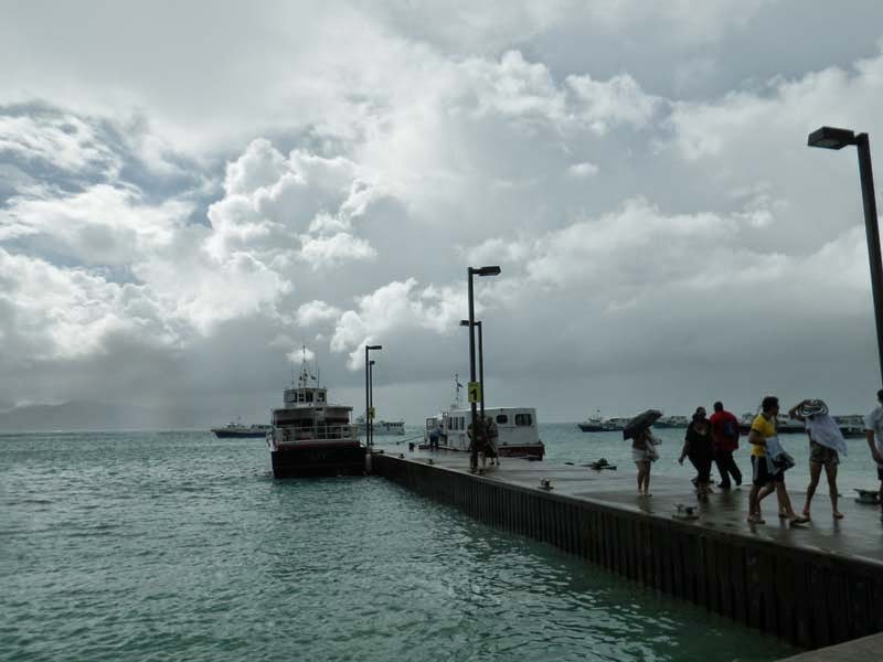


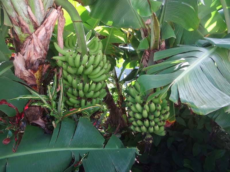


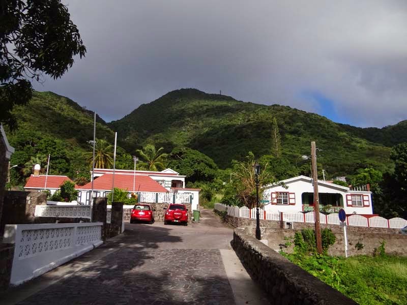


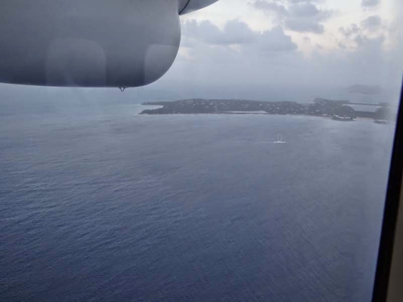


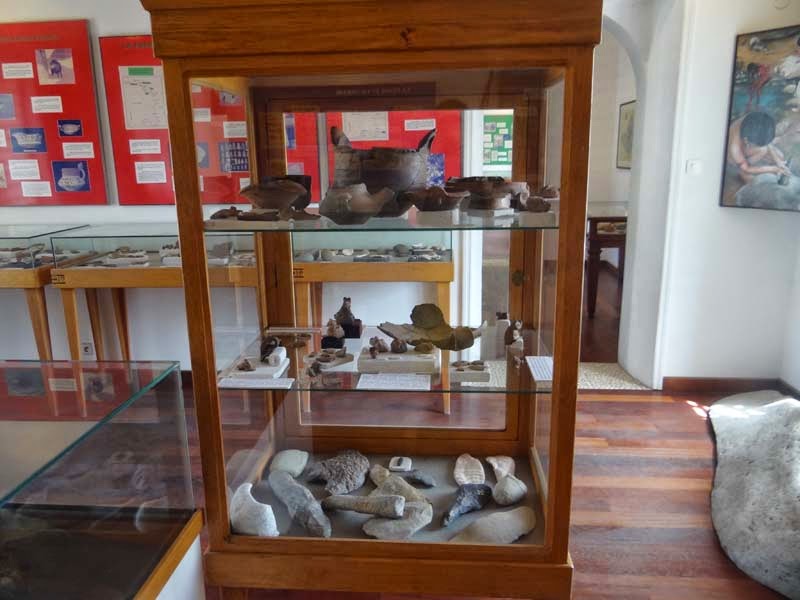


No comments:
Post a Comment