Australia is a country that was on our travel radar for some time due to its unique wildlife and other attractions however we were always put off by its enormous size - simply put we didn't know where to start. But enough is enough we decided this year and so we put together a trip to explore as much as we could comfortably in a two week period. Our plan is to start with the Melbourne area for a week and then a few days around Darwin exploring Kakadu NP and a few others and the last few days in Sydney.
THe trip doesn't start that auspiciously as Qantas doesn't allow seat selection prior to the flight without paying and when we arrive in Los Angeles with our connecting flight they cannot give us seats next to each other on the long flight to Melbourne - seriously this is the first time that we have ever seen that scam basically forcing people to pay for the seats in advance or else placing you far from each other. And I mean far - one was seated in the lower level of the plane and one on the top level. Luckily the cabin crew was much more understanding and convinced the people seated next to one of us to move but that shouldn't have happened especially given that we booked far in advance. Which in another story was also quite painful as the online booking engine was showing different dates than what you selected so you had to play around and guess in order to get to correct one to book. The flight however was great with much bigger individual TV screens that we were used from our BA flights and good food.
Passing through immigrations and customs is fast and we are out around 8 AM. We spend a bit more at the airport trying to buy a SIM card which is past security however here in comparison to US you can do that easily without a boarding pass so it is relatively easy. And then we get the rental car and have to decide where to go as it is too early to go to the hotel. In the end we decide to go to a park close to the airport, Woodlands Historic Preserve, so close in fact that you can see the planes taking off which is quite interesting.
 |  |
| Park is close to the airport | Competition between bird and plane |
Woodlands Preserve is quite a big park with lots of hiking trails and we decide on a loop trail hoping to see some native wildlife before going into the city. And it doesn't take long just a few hundred meters in we notice some brown "rocks" in the distance that after zooming in are clearly kangaroos - our first kangaroos. They aren't really doing anything interesting except lounging around so we move on after studying them for a few minutes and just resting our feet after the long flight.
 |  |
| Start of the trail system | Beautiful trail |
 |  |
| First kangaroos seen in the "wild" | Ok...those are lot of kangaroos |
It is early spring here and with the beautiful weather it makes for great hiking. There are flowers almost everywhere, trees are in flower so different from Arizona (in the summer). We stop to smell them and marvel at them as some of them are quite interesting.
 |  |
| Trees in flower | Close up of flowers |
 |  |
| Another type of flowering bush..yellow again | Different type of flowers..fluffier |
 |  |
| Spring flowers are everywhere | Another type of wildflower |
The trail veers into a forest and pretty soon we have another exciting first - our first parrots. We didn't expect to see any here and certainly not that many and chatty. They were flittering among the trees stopping there and here and making lots of noise.
 |  |
| Parrot in the forest | Close up of parrots |
 |  |
| Australian forest | Parrots seem to be everywhere |
Parrots are not the only birds of course there are some more common ones including magpies and swallows. The type of forest also seems to change as we move along from a more new forest to an older forest with trees spaced farther apart that allow us to see the kangaroos zooming in parallel with us and then crossing the trail at fast speed some 50 m in front of us.
 |  |
| Common magpie | Swallow resting for a moment |
 |  |
| Old tree | Lots of stumps in the forest |
After a couple kms of walking we arrive at a fence. We know from the informational materials that it was built to keep the foxes out from the protected area behind it. The area behind the fence is a recovery site for threatened Eastern Barred Bandicoots and it is wilder than the area that we walked through so we wanted initially to enter it. However now in front of it we decide to walk the loop back as our stamina is really low after the long and mostly sleepless flight. Walking back the trail transforms into a road with even a car (maintenance) passing us by. Soon the forest gives way to fields with some interesting rocks from which you can survey the surrounding area.
 |  |
| Protective fence to keep foxes out | Path passes through here |
 |  |
| This is more a road than a trail | Interesting rock formations near road |
The nature continues to surprise is with some interesting pine like trees that don't resemble anything we have seen and then a bit further even a sulphur crested cockatoo that can be heard from quite a distance but proves to be quite difficult to photograph.
 |  |
| Pine like trees | Not really the same to the ones we know |
 |  |
| Flower on the meadow | Sulphur crested cockatoo |
Arriving back at the entrance we take a look from a distance at the horses - the farm is also a retirement home/pasture for former race horses. And then we enter the farm house now restored as a museum and walk into the few rooms and read the history of the farmstead and how it became a park.
 |  |
| Farm entrance and horse van | The renowned horses |
 |  |
| Inside the farm house | Flowers in the farm garden |
When we exit it is almost one in the afternoon so we can go to do the hotel check in. We know that the major roads into the city are toll based but we have time so we take the backroads which is more time consuming but gives us a better glimpse of the city. The hotel is quite central on Lygon street and after we sleep the whole afternoon (we are really tired) we go out in the evening to buy groceries and find something to eat. There are two groceries stores however they seem to be poorly stocked. WE don't have a choice so we buy what we can including the last loaf of bread and then move to the Italian restaurant we selected. The food is wagyu steak (who can resist that?) and lamb ravioli and is good enough for two tired travellers even though it is a bit expensive. After that it is back to bed as tomorrow our plan is to leave the area and we have a long drive ahead of us.
 |  |
| Hotel on Lygon street | Inside the room |
 |  |
| Steak at the italian restaurant | House specialty |
 |
| Murchinson Gap View |
Today we are driving inland to Mildura a city on the edge between Victoria and New South Wales. It also lies on one of the major rivers in Australia, Murray River, long the lifeline of this arid area. But first we have to get out of Melbourne - and today it is a cold rainy day which makes for slow going through the suburbs. At least we see quite a few of the well known Melbourne trams - Melbourne has the longest urban tram system in the world and it shows.
 |  |
| Cloudy Melbourne Day | The ubiquitous Melbourne tram |
We take a more roundabout way to Bendigo our first planned stop as we want to drive through the mountains/hills surrounding Melbourne. While it is a good idea in theory with the cold and wind it is daunting to exit the car so the stops are by necessity short. The first is on Murchinson Gap from which we have some great views of the surrounding hills. There are flocks of parrots flying around and we even see one in a tree that is likely nesting there. The second stop is at an trestle of the old railroad running between Bendigo an old mining town and Melbourne. Unfortunately at this point the rain is falling constantly so we take just a few pictures before running towards Bendigo. As we drive we also understand why there is a large penalty for one car accidents as we see lots of killed animals on the side of the road from wombats to kangaroos so we drive really carefully the reminder of the day.
 |  |
| Murchinson Gap Road | View of the valley from the crest |
 |  |
| Nice mountain scenery | Natural or artificial pond? |
 |  |
| Parrot nesting in a dead tree | Old railroad bridge |
Bendigo is not far and we arrive soon however it is still raining so we decide to first get some supplies in a supermarket. This one is a real supermarket so we can buy what we want however when paying it is difficult for us as Australia has shifted to chip+pin credit cards and even though they are still supposed to accept foreign signature cards it takes some time to convince the checkout girl. After that we have lunch in the car in the covered parking lot before noticing that the rain is slacking off so we decide to move to the nearby museum which is listed as quite good in our guidebook. However after arriving we find out that the entrance fee is $20 which we find excesive so we decide just to wander around the downtown area as the rain had stopped by now.
 |  |
| Bendigo in the rain | Old downtown building |
 |  |
| Tourist information center building | Expensive museum view |
The city was quite important in its mining heyday and this is still visible now - the houses on the main street are huge and impressive. But with the rain lurking around the corner we decide to return to the car however this time through the nearby park.
 |  |
| Main street near central park | Looks out of place |
 |  |
| Museum entrance | Old buildings from mining heyday |
The Central Park, Rosalind Park, is quite interesting especially given that it is filled with birds. The first ones we see are the galahs which are fun to watch as they wander around searching for food. It takes some time to find them in our bird book but we are happy that we bought one specific to Australia as there are many birds that we have never seen before and probably won't again.
 |  |
| Bendigo Rosalind Park | Trail through the park |
 |  |
| Galah enjoying the rain | What are they eating? |
There are other parrots too in the park and even a few ducks. The most interesting building that we see on our walk is a high school that looks like a palace - again a sign of the good old days.
 |  |
| Can you see the parrots? | Other parrots are also enjoying the weather |
 |  |
| Impressive high school near park | Ducks in the park |
From here to Mildura it is still a long way so we don't stop plan on stopping anywhere else. However we have to stop for a few moments to take pictures of the beautiful sunset - very similar to an Arizona sunset. And then we have a forced stop as supposedly Mildura is a quarantine area so we have to throw all our fruits and vegetables that we have just bought in Bendigo - this makes us a bit mad as we had no idea about it.
 |  |
| Driving into the sunset | Only open sky and a nice sunset |
The motel in Mildura is close to the main tourist street in the city and to the Murray river and it looks cozy however it is quite cold inside and the heating does not work that well it seems. In the morning it has birds flittering around in the surrounding vegetation however when we arrive it is late in the evening and we have a long day planned the next day so we go to sleep relatively soon without exploring the area.
 |  |
| Mildura motel entrance | Bird eating flowers near our room |
 |  |
| Inside the room | Quite a small TV |
 |
| Is this Sahara? Nope..Mungo NP |
Today we deviate from our usual MO of driving ourselves to the different attractions as the road to Mungo NP where we intend to go is dirt road and muddy and the rental car is per contract not allowed to go far on dirt roads. Therefore we hire a tour company to take us there and tour the park. It is also the only way to enter the Chinese Wall area which is now closed off for non guided visitors. We are ready early in the morning after a quick breakfast including vegemite (an acquired taste) and find out that we are the only tourists in the van for the 100 km drive to Mungo besides the tour guide and a friend. THe discussion soon revolves around the differences between the countries and what we are fascinated about - we ask about kangaroos and the Australians if every person is carrying a gun in the USA:). On the drive he shows us a few highlights including the "Rest Area" he created for fun - not really the best place to stay in the hot summer.
 |  |
| "Road" to Mungo | "Rest area" on the side of the road |
 |  |
| Not an uncommon sight | Where should we go? |
We enter the National Park and even though the landscape doesn't necessarily change what changes quite suddenly is the number of native animals we see. Suddenly everywhere we see kangaroos and emus some battling some eating and some just lounging around. The guide tells us that the first place we are going is the Chinese Wall in order to avoid large number of tourists (which doesn't seem likely) and we are the first in the parking lot. Before entering however we are offered breakfast which is jam and bread and some hot coffee which is welcome as it is quite windy and cold.
 |  |
| Mungo National Park | Is this dancing or battling? |
 |  |
| Glad that we didn't use our rented car | Breakfast |
The China Wall is named from the fact that it looks from the distance like a wall on the plain but its importance is due to the number of fossils that are discovered here which is the official reason why it is closed for non guided tours but likely economic reasons also played a big role. At the start of the boardwalk is a memorial stone for a guide who died here - from natural causes not any animal attack or such. The boardwalk soon gives way to the desert landscape it is surprising how swift the change is - suddenly you are on hard sand looking over a Sahara like landscape.
 |  |
| China Wall from a distance | Memorial stone at the boardwalk start |
 |  |
| Entering the Wall of China | Lunar like landscape |
The guide explains to us how the sand covers human artifacts and fossils. As we move around he shows us an old aborigene fireplace here, some fossils there and soon we are absorbed in examining the landscape looking for hidden clues. After every storm new things appear and some old ones are covered and because we arrived right after a storm things have changed from his latest walkthrough.
 |  |
| Sand covering fossils and human artifacts | Old aborigene fireplace |
 |  |
| One of the bones on the surface | Bone fragments |
He also shows us how the rangers force the sand to cover certain artifacts - basically sticking a few wood sticks against the prevalent wind which causes the sand to accumulate. But even naturally we can see how the sand accumulates around small bushes creating "hills" some bigger than the others.
 |  |
| Protective sand | Wood is placed to accumulate sand |
 |  |
| Big hill on the sand plains | Small hill:) |
As we get to the top of the dune the view is impressive especially along the dune side where the sand seems to go on forever and you can imagine how it is moving along the plains for centuries driven by the wind. We wander around and notice even some wildlife (actually it was shown by the guide) a colorful lizard examining us from his hill before continuing his hunting expedition for food.
 |  |
| Dunes at the top | Wind created small dunes |
 |  |
| Colorful lizard | And his food |
The descent is through a different area an interesting small canyon that looks very different than the dunes that we were walking on previously. After each rain it is changing according to the guide and it is not a place that I would like to be during a downpour. There are some fun sand formations to look at reminescent of Bryce Canyon and some swallow nests to examine as we walk down. However the canyon is short and soon we are back at the entrance to the protected area.
 |  |
| Descending into the canyon | In the canyon |
 |  |
| Mud formations | Close up of formations |
 |  |
| Canyon exit close up | Canyon exit from a distance |
Before returning to the van we take the boardwalks to a few other viewpoints which are mostly for the unguided visitors and then return to the van to go towards the visitor center.
 |  |
| Return boardwalk | Flowers near the boardwalk |
The visitor center parking lot is quite empty so we want to enter the visitor center and small museum as soon as soon as possible however before entering we notice something in the bushes. Looking more closely we see that it is an emu and it is actually coming towards the road. To our surprise when it comes out of the bushes it has multiple chicks with it and it goes to a puddle to start to drink with the chicks. It is a very special moment for us and we are glad that we are able to witness it.
 |  |
| Mungo Visitor Center | Is that an emu in the distance? |
 |  |
| Yes an emu with 3 chicken | Never seen one sit before on the ground |
The museum is relatively small however it has an interesting collection of fossils and recreation of ancients animals that lived here. There are also aborigene related displays which give a little more insights into their lifestyle and traditions.
 |  |
| One of the many artifacts found | Model of one of the extinct native animal |
 |  |
| Aborigene art from the area | Modern aborigene art |
AS we still have an additional hour in the area we decide to take a hike on the trails near the visitor center. However as we try to find the trailhead we discover an interesting outdoor exhibition of the footprints that were discovered in Mungo NP. THe descriptions are quite informative so we examine them before finding the trailhead right behind the exhibition and we start on the trail through the bush.
 |  |
| Interesting outdoor area | Copy of old footprints |
 |  |
| View from trail near visitor center | More interesting bush |
The trail is deserted and it is good to be walking a bit alone in the area. There are some nice views of the Chinese Wall and a few dried up ponds to explore. Birds are everywhere but no parrots and soon we have to return towards the car. Before continuing however we want to explore the sheep shearing station near the visitor center.
 |  |
| Dry lake near the trail | Resting on a fence |
 |  |
| Sheep barn in the distance | Where they kept the sheep |
Even though the shearing station hasn't been used for some time it still has some residual sheep smell so it feels quite authentic. There are some explanations how the shearing process worked in order to go through as many sheep as possible as fast as possible and we have fun looking at the old electrical tools used during the process.
 |  |
| View of barn from parking lot | Inside the barn |
 |  |
| Specially done so it remains clean | Sheep shearing station |
Starting again the guide takes us to a different area of the park close to the visitor center where there are some different remains of the homesteads in the area. The most interesting one is an old icebox room dug into the ground to keep it colder in the hot winter months. We also are shown the infamous Spinifex a grass really tough and sharp that is dangerous for the introduced animals as well as unaware hikers.
 |  |
| Spinifex - don't touch | Old farmhouse ruins |
 |  |
| Walking through the remains | Cold storage the old way |
Close by is another barn where we eat the lunch a number of sandwiches brought by the guide. While eating we wander around and notice two roseate cockatoo outside the building which we observe for some time as they move around strutting and eating from the ground. Inside the barn we also discover a swallow's nest due to the cries of the chicks that stopped only when the parents were coming in.
 |  |
| Not really inviting | Do they still use it now? |
 |  |
| Roseate cockatoo eating | Showing off |
 |  |
| Inside the barn..what are they waiting for? | Parent is back with food |
Returning we see even more kangaroos some of them crossing the road at high speed. But the most interesting thing that we see is a blue tongued lizard that our guide tries to help by moving him outside the roads but after a few hisses he gives up and we continue on our way.
 |  |
| Need to be careful when driving | Mama kangaroo with little joey |
 |  |
| In the middle of the road..sooo peaceful | Or maybe not |
After our return there is still time in the afternoon for us to investigate the city a bit more. We decide first to walk to the Murray River and after crossing the railroad tracks (more difficult than expected) we arrive at the riverfront park right as the sun starts to set. Again we are surprised at the number of birds that we can observe here - of course this is due to the fact that water is a sparse commodity here so the river is attracting lots of birds.
 |  |
| Mildura Arts Centre | Fancier pigeon |
 |  |
| Park from above | Snack before going to sleep |
The Murray River is quite large - in fact the friend of our guide was living on a houseboat and sailing up and down the Murray River - and Mildura has built locks to protect the city from flooding. We see a couple of them on our walk on the riverfront.
 |  |
| Mildura Lock | Pelican on the water |
 |  |
| One of the many houseboats | Wandering waterbird |
In the evening we decide to eat at a Thai restaurant close to our hotel which has good reviews on Tripadvisor and opens faster as the majority open quite late in the evening or not at all on this day it seems. The food is spicier than we hoped for but good so full we go back to our room to prepare for the trip south next day.
 |  |
| Chicken thai food | Beef with peanut sauce |
Today we start our roundabout trip back to Melbourne going in a few days through the Grampians and then down the Ocean Road to Melbourne. The first day is all about arriving in the Grampians with us planning to stop in Hattah NP on the way. Hattah NP is protecting a large wild mallee area - the original vegetation of this part of Australia that since has given way in most parts to agricultural fields.
 |  |
| Wild mallee | And tamed mallee |
There is a short side road through the NP that goes to a lookout point and then continues to the visitor center and we decide to take that road and stop at the lookout point. It is a short walk and the view over the mallee from the top gives us an idea how Australia must have looked like to the first people that arrived here - a sameness of vegetation as far as the eye can see.
 |  |
| Road through Hattah NP | Start of trail to lookout |
 |  |
| Stairs to the platform | View over the surrounding mallee |
The visitor center is quite disappointing with no additional information except that most roads are closed but the loop drive we intend to do is only partially closed so we have to check what that means. More interesting outside we see two sulphur crested cockatoos much closer than we did before and they seem quite tame at least for a while. There is also an interesting informational panel about the malleefowl - it is a bird that accumulates a lot of leaves in a shallow depression and then lays its eggs inside where the fermentation gives them warm until the eggs hatch. Unfortunately we do not see one during our time here.
 |  |
| Sulphur crested cockatoo eating | Finally noticed us |
 |  |
| Very interesting bird | Flooding near the road |
We have the information for the self drive loop printed from home which is good as there is no information at the visitor center and limited one on the loop. The first stop for us is at an old railroad pump station - we look for rails but they are long gone. However everything is flowering which makes for a great stop to take pictures.
 |  |
| Flowering tree and road in the background | Yellow flowers are widespread in the spring |
 |  |
| No train has passed here for years | Inside the pump station |
Soon we notice why the roads are closed - everything seems flooded and the road we are going seems to have barely escaped it. We stop a few times to take pictures and also to study the parrots that are everywhere.
 |  |
| Almost everything near the road is flooded | Some of the trees impacted by the flood |
 |  |
| Interesting growth on a tree | Colorful parrot |
We have to be careful however especially after an emu runs at high speed right in front of the car to stop on the side and look at us quizically. We also see a few galahs and some ducks in the flooded marshland. We eat lunch at a nice parking spot and then discover that the road that closes the loop is flooded so we have to return the same way we came unfortunately.
 |  |
| Emu after passing the road | Galahs resting |
 |  |
| Ducks enjoying the unexpected water | Fully covered water |
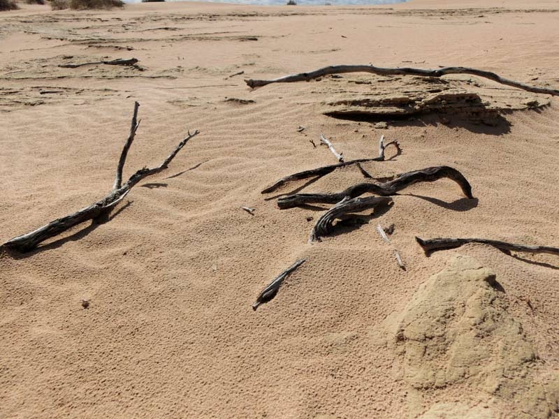
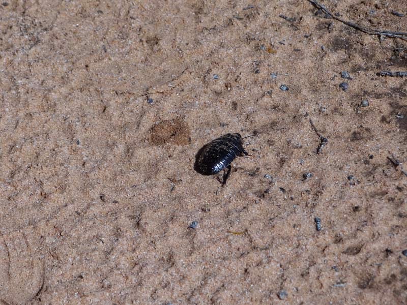
On the way back to the main highway we stop at the small nature trail - we barely see it and actually pass it first. There is no clear parking spot so we park on the side of the road and then start the walk. The trail is easy to follow and especially now with all the flowers it is a fun short loop through the mallee. We do not see any animals on the walk but there are lots and lots of beetles so we have to jump a lot to make sure we do not crash them.
 |  |
| Nature trail | And the nature |
 |  |
| Only white flowers in the area | Everything is yellow |
 |  |
| Beautiful yellow flower | Another type of yellow flower |
We continue on the way to Halls Gap, the town at the base of the Grampians where we will stay over the night. We stop a couple times to stretch our legs however beside a one person seesaw there are no other interesting sites so we make good time and arrive late afternoon in Halls Gap. The most interesting sight on the way is in a town called Speed which has prominently a sign "Speed kills" - obviously we speed as fast as we can out just to make sure that the sign is not literal.
 |  |
| City on the way...not that inviting | A one person seesaw..interesting |
The motel is again relatively cold inside with a heater that we have to direct where we seat so we don't freeze as it is really cold outside. The views from the motel are great as there is a meadow adjacent to it and no other buildings. It also has outlets that you have to turn on which to us is a novelty and leads us to miss charging up the GPS for the next day.
 |  |
| Motel in Halls Gap | Veranda with view of mountains |
 |  |
| Inside the motel | You have to turn on the outlet...weird |
With the meadow come the animals and birds including kangaroos far in the distance and crows and parrots closer to us. One cockatoo is especially interested in our room and wants to enter it insistently so we almost have to push him outside and close the veranda door. It is late already after that so after eating dinner we go to sleep as tomorrow is a hiking day.
 |  |
| There are kangaroos near the water | A curious crow |
 |  |
| An even more curious cockatoo | Sorry...you cannot enter |
 |
| Grampians View |
Today we plan a hike that is supposed to be easy in the Grampians mountains near Halls Gap and later to visit a few ancient petroglyphs in a different section of the park. We park in the downtown area and walk past a pond with a few ducks through a park full of playing children and then arrive at the trailhead and our adventure starts.
 |  |
| Halls Gap downtown | Ducks in nearby park |
The trail starts deceptively easy with a large wide flat trail. However soon it actually starts to climb with some easy stairs - no worries for us. And then the stairs become steeper and there are bridges over steep drop offs - where is the easy trail?!
 |  |
| This looks easy | Maybe not so easy |
 |  |
| And still going up | Really? This is a stroll through the forest?! |
Even at this higher altitude in the cold the spring is still coming and there are lots of flowers to look at and smell. There are also lots of birds and we are envious of them as we see them flying effortlessly while we climb with more and more difficulty up the trail.
 |  |
| Wish we could also fly | Flowers by the trail |
 |  |
| Spring is here | These ones look familiar |
The views as we climb are good when we get out of the trees. Of course outside of the tree cover the sun starts getting to us but at least it is not that warm. There is even a short even portion but then suddenly there are long flights of metal stairs - it feels like the climb is neverending it is already about two hours in and there is no end in sight.
 |  |
| Grampians mountain view | Still have a bit to climb |
 |  |
| Not that much better ... metal stairs | Almost looks like art |
Finally we arrive at a viewpoint and decide that this is as good a turning point as any - there is still room to go up but it is getting late and we are getting hungry and we do not have a lot to eat with us, unusual poor planning for us. The views of Halls Gap from the viewpoint are quite nice and we can see our motel and even a lake far in the distance. The sign at the viewpoint is interesting - we come to the conclusion that it is faked partially :).
 |  |
| Interesting warnings | Halls Gap from above |
 |  |
| Great view from the viewpoint | Taking in the view |
After descending we decide to also visit the Venus Baths a set of pools on the creek next to the path. It is an interesting place which is probably a nice place to be in the heat of the summer to cool down.
 |  |
| Bridge to Venus Baths | Path near river |
 |  |
| Venus Baths | Nice canyon |
Returning to the town we pass through a sculpture garden where the most impressive thing for us is the live kookaborra - one of the few we have seen in Australia.
 |  |
| Kookaborras | Emu sculpture |
It is lunchtime so we decide to see what options we have in Halls Gap and the answer is not many. Before eating we first visit the souvenir shop where we buy a boomerang and a few other knickknacks but again the attendant does not know whether signature credit cards are allowed - she has to phone the owner to see whether it is allowed - absolutely bizarre. Then we go to the nearby fast food/sit down restaurant and order a chicken schnietzel and a kangaroo kebab which look suspiciously similar but are good enough. We also decide to buy a few more groceries where to our surprise the checkout girl is the same one from the souvenir shop - at least this time it is clear that we can pay with our credit card.
 |  |
| Very american looking lunch | But this one has kangaroo meat |
The last hike in the area is to a waterfall, Crimson Falls - we saw a sign on the way and it is only 1 km so we think it is doable in the time we have left. Right at the start we find a field full of kangaroos and we cannot resist taking lots of pictures of them in different stances before moving on as they become more and more aware of us. The trail is short and relatively flat and soon we arrive at the waterfall. It is a bit disappointing as the water is almost not flowing at most it is a spray and a mist when we stand right below it.
 |  |
| Walking towards the waterfall | But we always have to stop to examine kangaroos |
 |  |
| Defensive position?! | Becoming alert |
 |  |
| Waterfall is not really flowing | Pool at the bottom |
It is getting late in the day so we leave Halls Gap to go to another viewpoint, Boroka Lookout, this time with the car. The road winds up rapidly and it is mostly empty. The north part of the park has burned during a wildfire and it is closed with this being the only open viewpoint. The views are great however it is quite cold - we are almost 1,000m up from our starting point sosoon we have to run back to our car for warmth.
 |  |
| End of road to the viewpoint | Flowers at the top of the mountain |
 |  |
| Great view from the top | Unlimited view |
Last stop of the day is a more remote area of the park with the only rock paintings accesible since the fire. They are not considered to be the best in the park but with the other sites closed we have to make do with these ones. As a bonus due to the remoteness we see only one car on the dirt road to the first site and a few suicidal kangaroos jumping in front of the car. Due to this we drive very carefully to ensure we avoid a collision. From the parking lot we take the almost overgrown trail towards the petroglyphs in Bilimina shelter. We don't know exactly the distance as after our morning walk we don't trust the signs that much but at least it looks easy and flat enough. However after a few hundred meters we encounter a bush kangaroo on the trail - it doesn't seem to care about us but the trail is unpassable on the sides for us so we have to slither around at a distance of a couple meters from the impassive kangaroo. Which after all the stories that our Mungo guide told us about kangaroos disemboweling people is a bit scary....After that the trail opens up and soon we arrive at a waterfall - a real one this time with lots of flowing water.
 |  |
| Trail to the rock paintings | How should we pass him? |
 |  |
| Very carefully | Waterfall on the way |
After the waterfall and a short climb we arrive at Bilimina shelter which is heavily protected with iron bars - unexpected for us used to the usually easier access at the sites in the US. From the distance it is a bit difficult to pick details - we can see the stick figures and the lines that possibly are days (or years or who knows?) but not much more. A bit disappointed we walk down, past the kangaroo again to the car so we can drive the 2 km to Manga Shelter, a more well known petroglyph site.
 |  |
| Rock art site | Rock art detail |
 |  |
| Counting the days?! | Similar rock art |
 |  |
| View from the site | River near trail |
This trail starts again with another kangaroo which is a bit more interested in us from a distance. It is getting dark so we hurry through the bush to the paintings however when we arrive there they are again protected with heavy iron bars and we cannot see a lot from the distance even with our flashlights in the falling darkness. However it is quite impressive to be in the bush with the sounds from the birds and animals and no other human being for miles so we enjoy the walk back to the car in the darkness.
 |  |
| Kangaroo near trail | Interesting plant |
 |  |
| Barely visible handprints | Sunset in the bush |
While Portland our next stop is only about 100 km away it is slow going as we have to be careful due to the kangaroos jumping randomly in front of the cars. Actually on the main road we see more foxes and a type of raccoon but an animal is an animal and we don't want to hit them. We make it safely though without encountering more than 1 car the whole hour. FInding the B&B is a bit trickier but we discover it finally tucked behind a garden that was obscuring the sign. It is probably the best accomodation we had during our trip with a lot of character and quite a few of nice touches including free beer and wine(!). It also is the only one that has breakfast which even sparse is good to have in the morning.
 |  |
| B&B from outside | Nice bed |
 |  |
| Breakfast coffee | Breakfast room |
 |
| Loch Ard Gorge - Thunder Cave |
Today we have a long drive to Melbourne along the Great Ocean Road with lots of stops planned. So we start early right after breakfast and soon arrive at our first stop - Tower Hill Wildlife Preserve. The major reason we came here is that they are supposed to have koalas in the wild. So the first thing we do we is go to the visitor center and we ask on which trail it is more likely to see koalas. The caretaker is really friendly and actually runs with us out of the door to a tree in the picnic area and shows us high in the tree a koala - we are really happy that it was that easy even though we can barely keep up with him after our previous day. Uncharacteristically our muscles hurt like crazy after all the climbing the previous day so we can barely move especially uphill so after seeing the koala we have to choose an easier trail for hiking.
 |  |
| Tower Hill Visitor Center | Tree near visitor center |
 |  |
| Emu in the picnic area | Koala - far above |
In the end we settle on the marshland trail which sounds easy enough. And it is with a boardwalk snaking over the marshland with nice views of the lakes and mountains. In the distance we can even see some black swans which are Australian natives so we can cross another animal we wanted to see from the list. There are also lizards to see and even a snake (python?) well hidden in the vegetation that we avoid carefully.
 |  |
| Boardwalk through marshland | Cattails near the boardwalk |
 |  |
| Lizard sunning | Maybe we should move back a little |
The trail then enters the forest and as we examine the trees we notice a lump far up in the tree. We zoom in with our camera and lo and behold we have found another koala on our own. We are really happy and start gawking up all the time leading to some weird glances from a few passerbys. We take a few side trails and wander through the forest everything is blooming and the weather is beautiful.
 |  |
| What is that? | Yay...another koala |
 |  |
| Wide trail through the forest | But sometimes it looks like this |
There are some nice views of the surrounding hills all in flower and beautiful to look at. Birds are everywhere from parrots to some overactive birds that we can barely observe before they fly on. But after a couple hours we have to move on but we thoroughly enjoyed the visit.
 |  |
| Nice colors | Mix of marshland and woodland |
 |  |
| Observing us | Rare moment of rest |
Soon we arrive at the main part of the Great Ocean Road that runs near the ocean for quite some distance and it has multiple points to stop and enjoy the wild coastline and the few beaches. Almost all the attractions here are part of Port Campbell NP and we are happy that we have printed information from home as there is almost no information along the way. We stop at the first spot that we find for a short walk and a few great views of the coastline and small islands full of birs.
 |  |
| View from the Grand Ocean Road | Some of the thousand islands |
 |  |
| Not where you want to take a ship | Birds enjoying the safety of an island |
Soon afterwards we see on our map a trail to a shipwreck viewpoint and we are interested to see it so we decide to do the short trail. It is a nice level trail through low brush that is also flowering. We pass a few beaches including one that you can get to but it has stairs and we are in no condition to ascend/descend stairs.
 |  |
| Trail to viewpoint | Level path with flowers |
 |  |
| Stairs to beach | Beach from the top |
There are no shipwrecks to see from the viewpoint but there are great views of the coastline so it doesn't feel like we did the trip for nothing. Returning we notice that we didn't meet anyone else on the way which makes the trail even better for us.
 |  |
| Beautiful coastline | Close up of secluded beach |
 |  |
| Everything is flowering | Small pond close to the sea |
There are a few more viewpoints on the way with other impressive views of the coastline and we even see an arch in the distance. But as usual we are running against the sunset so we continue on to the next major attraction the "former" London Bridge.
 |  |
| View in the distance | Closer to us |
 |  |
| Shipwrecks were common | An arch in the distance |
The London Bridge is a former rock bridge that was quite popular to walk upon and with two arches was similar to the London Bridge. One day one of the arches crashed stranding tourists on the far side of the bridge until the authorities could save them - glad we were not those people as it sounds scary.
 |  |
| Broken London Bridge | Broken part...now an island |
The next stop is at a nice arch that requires a small descent that feels like hell for us but it is worth it as the views are great and the arch impressive. AS we watch two ducks actually land on top of it just to make it more interesting.
 |  |
| Wouldn't want to navigate here | But it is a nice arch |
 |  |
| Duck on top of the arch | This plant we know from the stores back home |
Our next major stop is at Loch Ard which has multiple hiking trails and to our surprise is full of tour buses and tourists and feels quite different than the rest of the stops till now on the Ocean Road - almost like a tourist destination. We make a short hike near the parking lot but there are too many people so we move to a longer trail with a smaller parking lot which is empty. The views are spectacular again and this stretch of ocean had its fair share of shipwrecks including one where most people died and were buried in a cemetery close to the trail that we visit.
 |  |
| Loch Ard coastline | One of the difficult navigational stretches |
 |  |
| Cemetery for people who died in a close by shipwreck | Quite a few people died |
The trail continues and passes arches and the Thunder Cave, a blowhole which really rumbles with the movement of the water, ending at a viewpoint with nice views of the coastline.
 |  |
| Another arch at Loch Ard | Thunder Cave entrance |
 |  |
| End of trail viewpoint | Expansive view |
From here it is a short hop to our last destination, the most well known destination on the Ocean Road, the Twelve Apostles. The sun is already set when we get there as the parking lot is on the other side of the road with an underpass leading to the viewpoint which is not easy to find. THere are lots of people however so we go to the flow and arrive at the viewpoint right after the sun has fallen below the horizon which leads to some nice pictures of the Twelve (or Nine or Eight who is counting?) Apostles. There are quite a few people taking pictures it is difficult to find even a spot from which to take a picture without someone else in it but we manage it in the end. As we leave the fog and cold are coming in making for a treacherous drive through back roads until we reach the main highway to Melbourne and then after an hour drive we reach the city.
 |  |
| Underpass from visitor center at the Twelve Apostles | Lots of people are here |
 |  |
| Sunset at Twelve Apostles | They are not really twelve |
 |  |
| Headland in the other direction | The fog is coming in |
We sleep near the airport so we have to drive down to the downtown area in order to start our visit of Melbourne. We are not sure where to park but in the end we decide to do it at the museum which is close enough that we can walk and use the tram from here. We exit from the underground garage right in front of the Royal Exhibition Building, a World Heritage Site and one of the oldest remaining exhibition halls in the world. While it cannot be entered we admire it from outside before continuing through the park to the tram station.
 |  |
| Royal Exhibition Building | Interior of Exhibition Building |
 |  |
| Carlton Gardens and front of Exhibition Building | Fountain in Carlton Garden |
 |  |
| Skyscrapers from the garden | Still winter in Melbourne |
One of the nice things about Melbourne is the free tram for tourists and locals alike that makes a tour along the downtown area about every half hour. We wait for it to come and then use it to get to the Central train station and take in the first views of the city from the tram.
 |  |
| Preferred method of transportation - free | Central train station |
From the train station we start walking and the first stop is right across the street, Federation Square. It is a relatively new development in the city and as such it has both its detractors and supporters - for us it looks like an interesting and modern part of the city with some quite interesting buildings. It is also quite popular with musicians, theather acts and whatnot at every step.
 |  |
| View from Federation Square | Buildings in Federation Square |
 |  |
| One of the interesting building in the Square | Festival in the Square with skyscrapers in the background |
 |  |
| Interesting structure | View over the river from Federation Square |
From Federation Square we descend to the Yarra River where we notice that there is a Korean festival that is going on and because it is lunch stop and buy some dumplings and also some turkish gozleme. Both of them are quite good and filled we can continue with our exploration of the city.
 |  |
| View from the Yarra river promenade | Korean festival on the promenade |
 |  |
| Korean dumplings | Gozleme |
We cross the river to take a look at a few buildings on the other side but the initial north side is more interesting to us so we cross back in order to explore it a bit more.
 |  |
| View from the bridge | Emblem on the bridge |
We pass and enter first the cathedral and when we exit we see a march with police going down the main street - wonder how oftern they have some kind of protest in Melbourne. Continuing on the road we arrive at the main street in Melbourne - Bourke Street. On it there are two icons of Australia department stores - Myer and David Jones. We enter in both of them to see what's on offer and while the assortment of goods is quite large the prices are also quite high so we exit after we had enough of window shopping.
 |  |
| Bourke Street | David Jones store on Bourke Street |
 |  |
| Inside of Myer store | Old money moving machine |
It is getting past lunchtime now and we are getting hungry so we decide to go to Chinatown and find a good place to eat. Soon the mission changes to finding any place to eay as most restaurants are closed at 3pm even on Saturday it seems. Finally we find a Hong Kong restaurant that is open and the food is acceptably good and at least we don't have to remain hungry for the rest of the day.
 |  |
| Chinese quarter entrance | Inside the Chinese quarter |
 |  |
| Chinese/Hong Kong food | Chinese beef dish |
After eating we continue our walk through the downtown area visiting the shopping centres and a few of the more well known arcades. As we window shop (and even real shop) through the arcades we move slowly back towards the river and the ring tram route.
 |  |
| Block Arcade View | Block Arcade detail |
 |  |
| Delicious food | Interesting store window |
We walk a bit more along the river and looking at the sights including the Immigration Museum which is already closed for the day before catching a tram to finish the ring road and our sightseeing tour.
 |  |
| View across the river | View of the river |
 |  |
| Immigration museum | Interesting passageway |
There are some nice views of modern developments as we go along the wharf section and then along the Etihad statium. After that the tram passes some older buildings before stopping where we left however we don't exit there. In fact our plan is to go in the evening to a couple nearby parks, the Treasury Garden and Fitzroy Gardens, to observe wildlife that we have read about on the web.
 |  |
| Modern building on the wharf | New development on the wharf |
 |  |
| Parliament House | Princess Theater |
 |  |
| The Windsor Hotel | Treasury Building |
The parks are actually quite popular even in the evening and they also has some historical buildings including the Cook's Cottage and the St Patricks Cathedral nearby. But what we are interested in is the possums and it doesn't seem initially that we will see any. However after walking halfway through the park we notice some movement and when looking closer we saw that it is our first possum and after that it seems that the floodgates open as we see one in almost every tree. We even see a couple on the ground running from cover to cover. After that it is a short walk to the car and then to the airport to return the car. Everything is fine and they help us to find the hotel shuttle that we use to return to the hotel. Tomorrow we are flying north to Darwin to explore another part of Australia so we go to sleep early to be rested for the next days.
 |  |
| Cook's Cottage | St Patricks Cathedral |
 |  |
| Possum in a tree | Happy possum |


No comments:
Post a Comment