Our big goal this year is Easter Island and because we have to go through Chile to get to it we decide to also visit part of Chile while passing through it. As such the trip is split in a few parts - first a few days in Easter Island, then a few days in Northern Chile with a couple days in Santiago at the end.
The flight to Easter Island goes through Dallas and Santiago with a long layover in Santiago. In fact we bought two separate tickets one to Santiago and back and one to Easter Island from Santiago and back and as such we need the long layover just to make sure we do not miss the Easter Island flight. We use the long layover to buy some provisions for Easter Island, change dollars into pesos and eat a good steak at one airport restaurant. Here we encounter for the first time the unusual seating arrangement for Chilean restaurants where you sit on your own and only then a server will (may) approach you. If you wait for someone to sit you that will never happen. We also buy a map/guidebook of Northern Chile which is inspired as we don't see map/guidebooks anywhere afterwards.
 |  |
| View from Santiago airport | Andes mountains in the distance |
 |  |
| Dallas airport food | Santiago airport food |
The plane to Easter Island is a modern one with much better food and entertainment options than the American flight to Santiago. We arrive in Rapa Nui late in the evening and we have to wait for the luggage for a long time before it finally arrives. After exiting the terminal we are met by the hotel representative with a flower necklace who then takes us to the hotel with the other arrivals in a van. After checking in we get to our hotel room full of flowers where we soon fall asleep after the long days we had.
 |  |
| Easter Island hotel room | Kitchen - good to have |
 |  |
| Dinner table with flowers | Flowers are everywhere |
In the morning the breakfast is brought into the room which is great as we can eat at our leisure. AFter breakfast go outside to pet the cat which really wants to enter our room and then to the reception where we rent a car. It takes a bit but in the end we are the proud owners of a small Suzuki Jimmy for the next days.
 |  |
| In room breakfast | Fruit bowl |
 |  |
| Hotel from outside | The separate suite lodging |
 |  |
| Flowers in front of hotel | Resident cat |
Our first stop is to visit the only major city on the island - Hanga Roa. It lies on the coast even though it does not have a deep enough harbor to allow cargo ships or cruise ships to dock. The cargo ships are offloaded farther away from the shore into smaller ships that can enter the harbor. We stop near a small statue (moai in Polynesian), the first one that we see since we arrived and then walk through the downtown area buying water and a few provisions and checking souvenir stores before moving on.
 |  |
| Cargo ship - vital for Easter Island | And a military one |
 |  |
| First moai - a small one | Is this ancient or a newer one? |
Our next goal is the Rano Kau crater one of the impressive natural sights of Easter Island. The drive up is quite curvy and interesting and with the fog we are lucky that not many cars are coming down as the road is also narrow. Unfortunately the fog also prevents us from seeing anything inside the crater so we walk around the rim catching glimpses of Hanga Roa and a few of the bottom of the crater.
 |  |
| Rental car in rain/fog | Trail in fog - nothing to see |
 |  |
| Rano Kau - the crater is full of fog | Hanga Roa View |
Along the trail we see a few cows that wander freely here on Easter Island and quite a few birds. There are also flowers seemingly everywhere along the trail which is no surprise given the rain. Which actually picks up as we approach the Orongo Trail start and we are quite wet when we enter the Conaf (Chile national park authority) guard station.
 |  |
| Cows do not care about rain | Neither do birds |
 |  |
| Flowers on the trail | Weird plants |
After signing in - Chileans are really obsessed about signing in at all tourist attractions - we start on the trail. It is raining and foggy and we are wet but we still enjoy the walk through the ruins of the ceremonial village. Orongo was the center of the birdman cult which followed the moai cult - a cult centered around a race to bring the first sooty tern egg from a nearby islet. The winner brought his village multiple benefits and he lived in seclusion for a year with quite a few restrictions on his behavior (only eating and sleeping was allowed).
 |  |
| Orongo trail start | Unfortunately it is raining |
 |  |
| These ruins look impressive | A closer look - spooky a bit |
The houses are quite interesting mostly built underground with no windows and small doors - it is assumed that the whole village was used only during the ceremony of the birdman and it is actually the only prehistoric stone village that we see while on the island. Unfortunately with the fog we cannot see anything from the promontory where the ceremony ended.
 |  |
| Ceremonial house | Underground house |
 |  |
| Orongo ruins | Birdman cult promontory |
As soon as we exit Orongo the rain ends and as we descend with the road from the mountain the fog also lifts partially so we decide to stop at Ana Kai Tanata cave at the base of Rano Kau. It is a nice walk with the bonus that our clothes have a chance to dry as we approach the cliffs from where the trail descends perilously to the cave located at sea level.
 |  |
| Signs are bilingual | Trail to the Ana Kai Tanata cave |
 |  |
| And we are going down to the cave | View from the cave |
We wanted to see the cave mostly because it is one of the few with prehistoric paintings. But when arriving in the cave we have a hard time finding anything as we explore the shallow cave. The best we can find initially is an old mortar and pestle and we are quite puzzled until finally observing them on the ceiling. The bird paintings are quite interesting and we enjoy them for a while before starting on the way back.
 |  |
| Is it really safe in here? | Beautiful but just a tad depressing |
 |  |
| Where are the paintings? | At least we found this |
 |  |
| We found them | Quite a good painting |
Before returning to the car we walk along the cliffs to see the wild coastline and we even find a hidden sea cave which is impressive to watch especially with the waves coming in.
 |  |
| Wild coastline | Ocean cave |
Close to where we parked starts also the foot trail to Orongo and we decide to walk a bit on it until it starts to climb more vertiginously. The most interesting thing on our walk is an area inside the closed Conaf visitor center where there are multiple manavai which are circular stone circles where crops/plants were grown because they are holding rainwater. There are also a few reconstructed sample huts that we enter before returning back to the car and then to the hotel to change our clothes and rest a bit before continuing on our tour of the island.
 |  |
| Foot trail to Orongo | Trail through manavai (circular stone walled gardens) |
 |  |
| View from trail | Recreation of old hut |
Refreshed and dry we start up the east coast of Easter Island and the first stop is at Akahana Ahu - one of the major ahu (platform with statues) on Easter Island. With the rain there is no one else so we have the area for ourselves. It is for ourselves if we do not count the eagles which are everywhere and eye us cautiously. The trail to the Ahu is short and soon we have the first view of the platform. It is quite impressive and we can already see a few of the toppled moai - they were toppled by the villagers when they moved to the birdman cult and also during wars as they thought that the moai provided protection to the villages that built them. In fact moais were built so that they were looking like dead ancestors and looking over the village and protecting them with mana.
 |  |
| Akahana trail start | One of the many eagles |
 |  |
| Base of the Ahu | General view of the area |
There were over five moai on the ahu and when they were toppled their red pukao representing the topknots/hair of the statues have rolled away some even fallen in the ocean from where they were salvaged by archaelogists. We examine a few of the moai more closely - you are not allowed to touch or get close to the ahu but there are still a few fallen ones that you can get very close to.
 |  |
| First view of Akahana | Fallen down pukao (topknot) from the fallen statues |
 |  |
| Fallen statue | Same statue from a different angle |
There are a few more fallen moai to see and in general we enjoy the views and the solitude - until the rain starts again and we are forced to return to the car.
 |  |
| Fallen statues | All of the statues were toppled |
 |  |
| Looks beautiful | Interesting contrast |
Undeterred we continue on along the coast trying to find other ahu based on a map we received from the hotel. To our surprise on the way we find an open gate/road block that can close the road - reading the information it seems we have to exit by a certain hour or something like that - it is not clear and we hope that even if they close they will let people out that are late. Mostly we are apprehensive as it is already 5 pm and it seems that many archaeological sights have nominal closing hours at 5 or 6 even though they are not actually closed/guarded in any way. At the next ahu a car stops and the guy in the car starts speaking excitedly but because we don't understand anything we decide to leave. FInally we arrive at the major ahu that we intended to see - Tongariki.
It is one of the few where the moai were re-erected using a Japanese crane and support. As thanks the Rapa Nui people loaned a moai to Japan that wandered across the world for a few years and after returning has been known as the travelling moai and placed at the entrance of Tongariki. Tongariki itself with no people and with the fog/clouds is a bit otherworldly with the fifteen moai towering over the landscape.
 |  |
| The travelling moai | Ahu Tongariki from a distance |
 |  |
| Tongariki with Poike in the background | There were a lot more statues on the Ahu |
We walk closer a bit to the moai from whom one even has a topknot placed on the head and are marvelling at the effort it must have taken to actually built this with the primitive tools available at that time. We even see a rat near the protective stone wall - quite interesting. As we return to the car we drive a bit around encountering a few wild horses that block our path and we have to be careful to avoid. After that with the rain picking up again we return to the hotel.
 |  |
| Close up of moai | The 15 moai of Tongariki |
 |  |
| Poike Peninsula | "Wild" horses near Tongariki |
The receptionist recommends us a restaurant nearby but when we go it is closed for the day. Therefore we go again downtown and find one open (many are still closed) that we can easily access from the car without getting too wet. We are almost the only customers but the food is good and we sit on a covered terrace watching the rain falling incessantly. We are full when we leave the restaurant and return the hotel to dry our clothes and prepare for the next day. We are also really tired and soon fall asleep hoping for a sunnier day the next day.
 |  |
| Fish for dinner | Good food on this rainy evening |
 |
| View of Easter Island |
After the in room breakfast and checking the weather - it is sunny, yay - we decide to start our visit for the day with Ahu Vinapu near the airport. The description of how to get there is a bit hazy and for once the signs are not that great but our GPS takes us correctly even though at the end we are a bit undecided whether we should descend to the parking lot or walk (descend by car was the choice we made). Ahu Vinapu was the site where Thor Heyerdal explored and left convinced that there was contact with South American cultures due to precise stone fitting of the ahu. There are actually two ahu and we examine both of them with little luck in finding the precise stone fittings at least in the beginning. There were fewer moai here than some other sites we visited however it is still impressive to see the toppled giants.
 |  |
| View from Vinapu | Vinapu ruins - don't look that impressive |
 |  |
| Moai fallen from the ahu | Ahu close up |
 |  |
| Broken moai close up | Free standing column |
Besides moai there are a few free standing columns - a rarity as far as we can tell - and a large manavai. Finally we decide to check to back of one of the ahu and find the stone fittings described by Thor Heyerdahl - while it looks very precisely built together it doesn't strike us as non archaeologists as something that couldn't have been by the Easter Islanders on their own. In fact during our visit we find a few more of this well fitted walls and become convinced that many may have looked this way but where destroyed by settlers or during the wars or toppling of the statues.
 |  |
| This one is protected | Old manavai |
 |  |
| Wall examined by Thor Heyerdahl | Wall with fallen moai |
There are also quite a few birds flitting from stone to stone and not caring about the keep out signs from the statues - in fact it seems that they enjoy to sit on the statues.
 |  |
| Birds are everywhere | Even on the statues |
Exiting the parking lot we regret for a few moments that we drove down with the SUV as we have trouble exiting but finally it gets some traction and we are out. The next target is the Puna Pau quarry - this is where the moai builders were taking the red stone for the pukao. After arriving we have a new problem, there are two dogs that are sitting outside the car door jumping and barking and we cannot decide if they are friend and foe. We give up finally and exit and they are really friendly and follow us around the site, when not actually chasing some horses that dared to approach us.
 |  |
| One lane road to Puna Pau | Sign at start of trail |
 |  |
| Guides or bodyguards? | View from top |
There are multiple pukao's left in the field, it is surprising how they remained here for centuries and not been used for something else. It is quite impressive also that the native people were able to move them to the different ahu's and also to mount them on top of the moai.
 |  |
| View of pukao's left in the quarry | Crater is full of pukao's |
 |  |
| Close of of the topknots | So many are still left here.. |
You can even see the slots that were used to affix the pukao to the head of the moai in a few cases. Also some of the pukao have petroglyphs likely from a post - quarry period. We also enjoy the surroundings with many trees and flowers before returning to the car to continue our visit.
 |  |
| Slot to affix to the head | Some pukao were used for petroglyphs later |
 |  |
| Very common flowers | Close up of flower |
Our next stop is a short one at Ahu Akivi. For whatever reason we are forced to park on the grass instead of the pavement by some people building a stand here however we can visit freely the ahu. It is similar to the ones we have seen before so after taking a few pictures we move to the next attraction.
 |  |
| Ahu Akivi - another restored ahu | Close up of moai |
Our next goal is Ana Te Pahu one of the many caves on the island. However the road to it is in poor shape especially after the rains so we have to park and hike on the road to the cave. This is a decision that we do not regret given the number of deep pools on the way. Also this way we can also stop and examine the horses more carefully and we even see the one plane that leaves Easter Island towards the mainland.
 |  |
| Road to Ana Te Pahu | We decided walking is better than driving |
 |  |
| Walking past wild horses | Plane leaving Easter Island |
As we walk towards Ana Te Pahu we notice some side trails going into the fields and we follow one of the trails to take some pictures of the hills. To our surprise the trail takes us to a hole in the ground from which we see the crowns of some trees. We look around and we find a lava tube that we decide to enter after finding a path going down into the cave. It is actually a way to get to the grove of underground trees we have seen from above. It is clear that it is still visited by locals as there are a couple stone walls that we have to pass and a path to the underground garden is clearly visible. Walking through the grove is a bit weird - we are walking though a small underground forest after all. After finishing exploring we return to the surface and to the main road and continue to the advertised cave further ahead.
 |  |
| Trees growing from a hole in the ground...really | This is the entrance to the discovered cave |
 |  |
| Should we really go down there? | Light at the end of tunnel/cave |
 |  |
| Interior wall before the skylight garden | Almost a forest in the middle of the cave |
Ana te Pahu is more developed - which means it has a parking lot and maintained stairs going down to the cave. The developed part stops there - you can explore as much or as little of the cave as you want. It has a similar underground grove as we have seen in the previous cave with banana trees interspersed with other palm trees. It is much longer and darker in areas so we have to take out our flashlights. Interestingly there are multiple man made structures underground including one that looks like a manavai.
 |  |
| Stairs down into Ana Te Pahu | It also has an underground garden |
 |  |
| Moss covered stones in the cave | Underground manavai? |
The most dangerous thing we discover in the cave is a hive of bees/wasps close to the entrace that you have to pass to get deeper in one direction of the cave. Soon however that branch of the cave deadends at a lake so we have to return back past the bees. No surprise that there are bees here as there flowers almost anywhere as long as you pay attention, some of them being quite interesting.
 |  |
| This looks dangerous - especially in a cave | Water from the previous day rain |
 |  |
| Flowers on the way | One of the more interesting plants |
After leaving the cave we continue on the road where a short distance ahead is Te Peu an ancient site near the ocean. It consists of an ahu and multiple other old buildings including a manavai and a few houseboats. It even has some archaelogists examining the ruins and measuring distances.
 |  |
| First view of Te Peu | Manavai at Te Peu |
 |  |
| Interesting structure | A houseboat - the big house/hara nui |
The ahu is not restored so the moai are on the ground with the heads broken and the pukao rolled away. We cannot get used to how the destruction has been so well preserved you can guess which head and pukao belong to which moai. The back of the ahu shows the same stone fitting proficiency as Vinapu in our opinion. We wander around looking at this and that before walking back the 2 miles to the car and then driving to our next goal, Anakena Beach.
 |  |
| The ahu from a distance | Close up of the fallen moai |
 |  |
| Ahu from back - nice craftmanship | Ahu construction is similar to Vinapu |
 |  |
| Broken off moai head | This one is more protected |
The drive to Anakena Beach is uneventful and it is easy to find because it is at the end of the road. Before walking around we have to eat something as it is already post launch and our plan is to eat at one of the empanada stands described in our guide book (there are not a lot of lunch options on Easter Island outside of Hanga Roa). To our surprise there are not really stands anymore but some mini beach bar type things but they still serve empenadas and that is what we need. At the first one we cannot get any servive so we move to the second one where we finally get a server's attention and order our empenadas. While waiting we notice a chicken wandering around and we are hoping that it is not part of our empenada with chicken (it isn't). The empenadas are much bigger than expected and quite good and of course we order beside them a natural fruit drink which is also very good.
 |  |
| Anakena Beach - food place | Not the food - yet |
 |  |
| Easter Island empanada | A natural fruit drink |
First we go to Ahu Nao Nao at the end of the beach - the ahu with the best preserved moai. They are better preserved than most because they fell in the sand and as such were not impacted by rain and wind as much as the other moai. Most of them even have their topknots on which makes it of a rarity between the restored ahus.
 |  |
| Ahu Nao Nao on the beach | View from the front... |
 |  |
| ...and from the back | Closer view - most of them have topknots |
We look at the detail and it is one of the few moai where you can see the carvings of hands and the face has also more detail than usual. It is great to see this much detail as it gives us a much better idea how the moai and ahu looked way back when they were built and maintained. After the ahu we walk down to the beach where there are a lot of people but most don't really enter the water and just enjoy the beach from the shore.
 |  |
| Details on the moai were well preserved in the front... | ....and on the back mostly due to the sand |
 |  |
| Anakena beach | Not many people in the water but a lot on the shore |
It is getting late so we get back to the car and continue our tour of the island with Te Pito Kura. It is not a big site but it is well known because it has the biggest moai on the island that was finished and placed on an ahu. It was also the last one toppled maybe because of its size. And we almost cannot visit it because there are two local woman at the entrance who tell as that there are only 5 minutes left till the unspecified closing time. But they let us in in the end and we run to the ahu to take pictures and then return back to the car. Of course while passing later there is a van parked with tourists visiting it so we are not sure how right they were about closing time.
 |  |
| Te Pito Kura - a well known site | Biggest moai placed on an ahu |
 |  |
| It was the last one to be toppled... | ...after European discovery of Easter Island |
Our last stop on the tour of the island is Papa Vaka the major petroglyph site on Easter Island. There is another group there already coming in on bikes which is a preferred (though it seems dangerous) mode of transportation for tourists on the island. The area is well set up with platforms to stand on to look at the petroglyphs from above. The most well known petroglyph is that of a 12m long canoe however many of them are interesting to see and compare against what we have seen in other countries and continents.
 |  |
| Papa Vaka - major petroglyph site | Trail through the petroglyph field |
 |  |
| First petroglyph we see | Largest petroglyph - of a 12m long canoe |
 |  |
| Lots of petroglyphs on this stone | Wonder what this is? |
Returning from the north side of the island we drive to Hanga Roa where we plan to spend the evening browsing through the stores and visiting a few of the attractions. One of them is the main church which is different from other churches and has an interesting architectural style.
 |  |
| Major downtown street in Hanga Roa | Not a real one...probably |
 |  |
| Hanga Roa Church | Close up of church |
Next we buy some sweets from a corner bakery and then continue to the cemetery another one of the attractions in Hanga Roa due to the unusual headstones. From here we continue on the shore to the nearby Ahu Tahai that is supposedly the place to be at sunset.
 |  |
| Lost statue | Small bakery |
 |  |
| The well known Hanga Roa cemetery | Shore line |
Of course it is the place to be at sunset as long as the sun is actually visible which it isn't when we arrive there. However there is a large crowd of people gathered which makes taking pictures a bit difficult and the ahu is also not that impressive compared to what we saw during the day.
 |  |
| Remnants of old buildings | Ahu Tahai in the evening |
 |  |
| A bit more uneven in height than usual | Ahu likely had more than 5 moai initially |
However soon we are engrossed in examining one well restored single moai which even has the eyes restored and seems to us exactly like the original moai must have looked like when they were built. And suddenly the sun is out and we can capture some good pictures of the sun setting down behind the main ahu and the moai.
 |  |
| Separate moai | This one is really restored including the eyes |
 |  |
| Taking lots of pictures of the ahu | Even the sun graciously appears for a few seconds |
We continue snapping pictures with the beautiful sunset until we notice that the military ship in harbor is carrying mock rescue operations so we snap a few pictures of that too. We hope they were mock and not real as it looked scary.
 |  |
| We are not the only ones | Sunset in Easter Island |
 |  |
| What are they carrying to the military ship? | Is that training or real? |
After the sun falls below the horizon we walk back to the car - we are tired so it is slow going as we walk along the shore to our parking spot. Arriving at the hotel we fall almost instantly asleep after a very nice and exciting day.
 |
| Sunset on Easter Island |
 |
| Ranu Kao Crater |
On our last full day on Easter Island we wake as usual to the in room breakfast and some sweets from the day before before starting our day by driving to Hanga Roa to see the well known Father Sebastian Englert Anthropological Museum.
 |  |
| Making tea in the morning | Breakfast in house |
While we expect that other tourists are also visiting the museum we do not expect the full complement of the military ship in harbor to do the same - it seems it is a very busy day at the museum. The museum is famous due to the Easter Island artifacts it has in its collection the most famous being the original eye of a moai found during archaelogical excavations. Until that point nobody was sure if the eyes were filled in so it was a major find that helped explain how the statues looked before being toppled.
 |  |
| Warship in harbor | Soldiers are visiting the museum |
 |  |
| Inside of museum | The original eye |
Otherwise the museum is small (one exhibition room only) but it has interesting artifacts and information. We find out the answers to some of the questions we had including how many moai have been found (~900 and out of them ~400 are still in the quarry at Rano Raraku). Also we see the only rongo rongo tablet on our trip - rongo rongo is what appears to be writing developed by Easter islanders that cannot be deciphered anymore given the few surviving tablets and the loss of the knowledge about the script among islanders.
 |  |
| Interesting archaeological find | Petroglyphs found close by |
 |  |
| Not your typical moai | One of the few rongo rongo tablets |
 |  |
| Ancient tools | Colors used for decorating |
Our next stop is Ranu Kao Volcano, we have been here the first day but couldn't see anything due to fog and now we want to try again. The view is quite impressive now and we are happy that we spend the half hour to make the detour to the viewpoint.
 |  |
| Ranu Kao Volcano | View of Hanga Roa |
And then we start the drive again on the east coast of Easter Island. We have been here the first day but with the rain and time constraints we weren't able to stop everywhere and today we are planning to do a more careful survey of the ahu on this side of the island. And we start with Ahu Vaihu, one of the major ones that we skipped last time due to the rain. From the parking lot it is a 5-10 min walk to the ahu which even though has all moai toppled is quite impressive.
 |  |
| Start of walk to Ahu Vaihu | Ahu can be see in the distance |
 |  |
| Stone circle in front of it | All moai are toppled |
We walk around looking at the moai and the pukao fallen all around the ahu. It is a big and secluded site so we have it for ourselves except a fisherman who comes to explain to us that he is fishing (which was obvious from the beginning).
 |  |
| Topknots are a way off | Another view of the toppled protectors |
 |  |
| Close up view | From the back - not so neatly aligned |
As usual some moai have broken down upon impact after being toppled which makes it unlikely that they will ever be raised again. The pukao however were gathered close by anyway some even being fished out of the ocean. A few of them have even petroglyphs (Easter Island is the Polynesian island with most petroglyphs).
 |  |
| Some have broken in half at impact | Together we stand together we fall..I guess |
 |  |
| Some pukao were recovered from ocean | Pukao with petroglyph |
After spending some time we return to the car looking wearily at the eagles who are watching us from everywhere - just to make sure they don't intend to reenact the movie Birds :). While the weather is better the ocean is quite stormy and interesting (and scary) to see.
 |  |
| Watching us... | ....always watching us |
 |  |
| Ocean is quite wild | Not really a beach setting |
WE continue our drive and stop at a few more small ahu on the way. Some don't even have parking lots or have overgrown paths to them which makes us feel like we are discovering them for the first time which is quite fun.
 |  |
| Road to a lost ahu | Restored moai |
 |  |
| Back of ahu | Ahu with Poike peninsula in background |
Soon we arrive at our main goal for the day the Rano Raraku quarry. This quarry is where the vast majority of moai have been carved and there are still a lot of abandoned ones to see. It is a very impressive site as we soon discover with moai seemingly just growing from the montainside. In fact surprisingly many well known photos of moai are not of finished ones on ahus but taken here from the unfinished moai.
 |  |
| First view of Rano Raraku quarry | Trail to the moai |
 |  |
| One of the most well known moai | Close up of moai |
Walking around we don't even know where to look as there are moai everywhere in different stages of being finished and it is quite exciting to see these many moai in one place.
 |  |
| Same moai froma different angle | One of the many unfinished moai |
 |  |
| There are a lot of them | Rano Raraku slope is full of moai in different carving stages |
Some of the most interesting moai are up on the slope and still in the process of being carved out of the stone. Between them is the biggest moai ever attempted - a huge 72 feet (24m) one that we have trouble to even capture in a photo from the overlook.
 |  |
| Climbing up the slope | Moai still carved from mountain |
 |  |
| Close up of moai | Largest moai ever attempted (it is huge) |
The other moai that stands out is Tukuturi - it is the only moai that is kneeling and likely done towards the end of the moai building period. As we turn around we see a large number of horses coming towards us at high speed but luckily they veer off - it looks like a stampede but more likely they were just moving from one area to another. Before returning to the car we also decide to go on a secondary trail that goes inside the crater to a very cool fresh water lake tucked inside.
 |  |
| Two moai side by side in carving stage | Tukuturi the kneeling moai - a rarity |
 |  |
| The horses are coming, the horses are coming | A bit scary when they are coming right for you |
 |  |
| Tongariki view from Rano Raraku | Rano Raraku crater lake |
There are also a lot of birds around here including the observant eagles, frigate birds and a couple of very interesting Chilean tinamou. It is a bit surprising that from all places we see this many birds right here at Rano Raraku which seems to also be a magnet for birds.
 |  |
| Frigate birds are common | Curious bird |
 |  |
| They are everywhere | What is this?!...Chilean tinamou |
The next stop is Tongariki for a second visit, this time without the rain and a bit earlier. It also has a lot more tourists visiting it than last time which makes it a bit more difficult to take good photos of the ahu and moai.
 |  |
| Again at Tongariki | There were a lot more moai than now |
 |  |
| Still it is quite impressive | Only one has the pukao - a crane was needed |
But on the other hand we can of course wander around much easier without the rain and examine the moai and the ahu which are impressive before returning to the car and passing again near the (same?) horses on our way back to Hanga Roa.
 |  |
| Close up of moai | Three of the better preserved ones |
 |  |
| Weather has made an impact | Horses are still near the ahu |
On the way back we explore a few more small ahu sites that we skipped on our way to Rano Raraku. They are all fun to visit and we enjoy the solitude and sense of discovery at these smaller sites.
 |  |
| Another ahu on the way back | What was this used for? |
 |  |
| It was a smaller one | Or it is more destroyed/less excavated |
 |  |
| View of the length of the ahu | Poor moai |
Another attraction at these sites are the views of the wild ocean - there are no beaches here only stretches of untamed coastline. We are happy that we are going to leave by plane as it doesn't look like any ship ever could reach the shore (of course we know we are wrong but it looks that way).
 |  |
| Poike peninsula | Wild ocean |
 |  |
| Protected bay | No sun today either |
After one more stop at another small ahu - the last one outside of Hanga Roa that we visit - we are soon back in Hanga Roa earlier than usual and ready to find a place to eat (we are really hungry).
 |  |
| Last ahu on the way | Only one moai? |
 |  |
| Broken off cleanly | Ok..there is one more moai |
The restaurant that we chose today is near the seashore so we have a better view of the sunset while we have a good steak and fish for dinner as well as the ubiquitous fruit drinks. At the end as hungry as we were it seems that we are too full so we decide to take an evening good bye walk through Hanga Roa.
 |  |
| Oceanside boardwalk in Hanga Roa | View from the restaurant |
 |  |
| Steak - quite good | And some fish |
We decide to take the walk on the shoreline and enjoy the great sunset views of Hanga Roa as we explore a few sights on the shore that we never saw during the day including a good replica of a moai.
 |  |
| Hanga Roa view | Coastline at Hanga Roa |
 |  |
| This is how they looked like | Carved stone |
We end our walk at Ahu Tahai that we enjoyed so much the previous day. We wait for the sun the fall completely below the horizon before returning to the car and to the hotel where we pack as tomorrow we are leaving back for the Chilean mainland.
 |  |
| Another beautiful sunset | We are back at Ahu Tahai |
 |  |
| Ahu Tahai at sunset | Solitary moai |
Today we have a few more hours on Easter Island before our plane leaves in the afternoon. We arrange with the hotel to take us to the airport right when the baggage claim opens but in order to do that we have to spend half an hour after we check out in the hotel gardens and surroundings while waiting for the shuttle to take us to the airport. We meander through the area walking to the main street on the dirt road that we have taken so many times in our rental car. The fields next to to the hotel are planted with banana trees however they are not yet completely ripe but it looks like a good harvest when they will be ready. We return to the parking lot right when the shuttle arrive and we take it to the airport where we leave the luggage before starting our last walk in Hanga Roa.
 |  |
| Road to the hotel | Fields near the road |
We decide to walk down the main street past the restaurant we have eaten at on our first night here which has the ubiquitous Easter Island dogs running right in front of it. Continuing farther down we pass the City Hall and are surprised at the heavy police presence in town. Soon however we discover the reason behind it - there is a demonstration for the freedom of Easter Island from Chile with a few dozens demonstrators waving flags and signs. They are very well behaved stopping to ensure cars pass but we still take a side street to avoid being tangled up with them..
 |  |
| First day restaurant and ubiquitous dogs | Souvenir shop |
 |  |
| City Hall | Easter Island freedom demonstration |
We walk a bit more on the seashore looking at a few more moai and a saint statue that supposedly protects local fishermen. The area here is one of the few where swimming and snorkeling is possible and we even see a few hardy souls entering the water.
 |  |
| Moai in Hanga Roa | More recent statue protecting the fishermen |
 |  |
| One of the few places good for swimming on Easter Island | Wild coast |
After one last look at the coastline and watching how a cargo ship unloads cars for delivery to the island (the ship cannot anchor as the harbor is too shallow) we start back towards the airport. We pass the only gas station on the island that we know because here we filled up our rental car and then arrive at the airport.
 |  |
| Moai in the distance | This is how they bring new cars on the island |
 |  |
| Only gas station on the island | Dead of a car |
We already have the boarding pass so we enter the waiting area which has also on outdoor area with some interesting sculptures that we enjoy before the plane arrives. Everyone in the waiting room is of course waiting for the same plane so a long line forms but in the end everyone is boarded and off we go to Santiago. THe flight is relatively long however the plane is brand new with good entertainment options and also food which is useful as we arrive late in Santiago.
 |  |
| Lizard in the airport | And a bird |
 |  |
| Our plane coming in | It is a big one |
Tonight we sleep in Santiago right in the airport before we play further to Iquique the next day. This is great because we can basically walk to the terminal to get our boarding ticket - which we can't due to issues with the machine. A LAN representative however is very helpful and soon with boarding passes in hand we retire for the night.
 |  |
| Santiago Hotel | Otherworldly interior |
The flight to Iquique is uneventful however getting the rental car is more difficult than we expected. The person at the counter does not speak English however there is something wrong and finally she calls someone else who explains us in English that the car we were supposed to get an automatic SUV broke down on the way to the rental place so they are sorry but they have to switch to a manual truck. We try to get another smaller car but there is no way around it and we get the truck for a day. They promise they will deliver the SUV to our next hotel in Arica 300 km away in the evening. We are not sure about that but with no choice we take the truck and are on our way. The airport is at a bit of distance from Iquique and we have to go that way to reach the Panamerican highway. The desert is quite dry here with no vegetation at all it seems - it looks a lot more desolate than the desert around Phoenix.
 |  |
| Not the rental car we asked for | Statue in the Atacama desert |
As we pass through Iquique we admire the interesting houses as we try to find our way to the top of the cliffs - it is a steep road with great views of Iquique and some views of the people paragliding from the top to the beaches below.
 |  |
| Colorful houses in Iquique | Row of houses in Iquique |
 |  |
| View of Iquique | Iquique is well known for paragliding |
There are a lot of signs as we climb through the hills regarding what to do in the fog but there is no fog so we wonder what it is about as we search the entrance to Humberstone our first goal for the day. Humberstone is a World Heritage site, an abandoned mining town, well preserved, that we intend to visit. We pass it as there is no entrance from our side of the divided highway and return from the Panamericana to the entrance.
 |
| Humberstone View |
The parking lot has very few cars and in fact throughout our visit in Humberstone and the neighboring site of Santa Laura it felt we are the only tourists that visited these impressive well preserved abandoned towns. In fact northern Chile is full of these abandoned mining towns especially after saltpeter extraction become unprofitable due to the development of artificial saltpeter. But Humberstone stayed functioning longer than most and as such is better preserved as we soon observe. After paying the entrance fee we are directly on the main city street and we start exploring from here.
 |  |
| Humberstone World Heritage Site entrance | Main street in the abandoned town |
Some houses have been refurnished and the doctor's house is one of the first we discover which is almost modern in some amenities and even has a nice painting hanging from the wall.
 |  |
| Reconstructed office | Painting - quite nice |
 |  |
| Restroom in the doctor's house | Old stove |
Obviously not all houses are preserved as well and the sheet metal is rusted through in many places so you can see in the prefabricated homes. Many of the old doors and window frames have been collected for safekeeping in a small museum which is a nice diversion from the heat outside. And yes it is hot even now in the winter especially after coming from Easter Island and the relative cold there.
 |  |
| Side street through sheet metal homes | Is this really best in the desert heat? |
 |  |
| Window and house museum | Another view of the window frames saved in the museum |
Wandering around we arrive at the central square of Humberstone with the town hall on one side, the church nearby and a hotel and other buildings enclosing a large plaza with a fountain/monument in the center. The town hall hosts a small open air market where we could buy some souvenirs however we have no idea of the prices yet so we skip buying for now.
 |  |
| Monument in the square | Church interior |
 |  |
| Town hall and clock | Close up of clock |
Next we explore the hotel which has still a functioning restroom, normal and VIP rooms and a dinner hall. Most are not furnished but you can easily see the layout of the hotel and the dinner hall has some fun lighting through the holes in the ceiling and walls.
 |  |
| Hotel in Central Square | Close up of hotel |
 |  |
| Hotel restrooms - still working | Dinner hall - fun lighting |
 |  |
| One of the rooms | Original wooden floor |
Next in our tour is the swimming pool. It is quite impressive especially being built out of metal sheet and it is quite deep. We wander around the bottom but don't dare to test the jumping platforms.
 |  |
| The swimming pool | Probably shouldn't jump now inside |
After the swimming pool our next target is the theater one of the major attractions of Humberstone.
 |
| Theater interior - so well preserved |
It is such an important sight as it is well preserved - surprisingly so. All the seats are still here, you can enter the theater boxes and even go behind the stage for that exclusive view. It is a large building and we can imagine how important this building was for entertainment for both management and labor.
 |  |
| Theater from outside | Inside the theater |
 |  |
| The seats are well preserved | Theater boxes for rich people |
As we walk around we wonder at the many large buildings - it was a seemingly large town and it must have been impressive in its heyday.
 |  |
| Humberstone building | Some buildings look impressive |
One of the more interesting buildings is the former hospital where you can still distinguish the wards, surgery rooms and patient examination rooms. It almost looks like we are in a horror movie as we move from abandoned room to another abandoned room with surgical implements laying around, words scribbled on the walls and weird sounds from the outside.
 |  |
| Abandoned hospital...creepy | Hospital room |
 |  |
| Treatment/operating room | Different medical instruments and beds |
The workers houses are relatively similar - smallish with a small interior courtyard where poultry and other animals were kept. They had 1-2 rooms a kitchen and a small living area so they seemed pretty large compared to what we were expecting.
 |  |
| House interior courtyard | Bathroom |
 |  |
| Typical shelves | We are not going out this way |
The company house is probably the biggest one - likely the store was here and the management was working here. There is even a tennis court nearby - no luxury was missing for the town elite.
 |  |
| What is that in the distance? | A tennis court |
Next we start on our way along the path of the old railway line to the processing plant. Soon we arrive in the plant area which is interesting from the beginning with many huge abandoned halls that we enter and explore as possible.
 |  |
| Humberstone left equipment | Former train station |
 |  |
| Processing plant | Road near the processing plant |
We decide to climb an artificial hill for a better view of the abandoned city - the view from the top is amazing and we can see the full layout of the city and far in the distance. There are even some vultures on a tower that keep a close eye on us so we decide to be careful as we go down the hill back to the processing plant.
 |  |
| View of the processing area | Humberstone abandoned town |
 |  |
| Canal in the mining area | View at the top |
 |  |
| Close up view of Humberstone | Hope they are not waiting for us |
The processing plant is well preserved with the basins and the different steps of the process explained in different well documented English signs.
 |  |
| Destroyed processing area | Saltpeter was produced here |
 |  |
| Basin part of the production process | Machinery shed |
There is also a machine house with different parts for the train with a few preserved locomotives also visible among the different parts. Other halls are also interesting with various machines and some very fun lighting from the different holes in the walls.
 |  |
| Inside the shed | Abandoned train |
 |  |
| Row of train carriages | They are everywhere |
 |  |
| Lighting is otherwordly...why? | The gaps in the ceiling are creating the effect |
Walking back we enter in a few more houses and also see on the way a few old cars some in parts but some that seem to still be able to function.
 |  |
| There are also abandoned cars | Old jeep - almost looks functional |
 |  |
| Typical kitchen | Pigeon coop |
Before exiting we discover another small museum with objects found in the area from electricity poles to knifes and forks. It is quite informative and interesting to see how the people lived here decades ago.
 |  |
| Electricity and phone poles | Cooking collection |
 |  |
| And the food | Cutlery collection |
We exit Humberstone and drive a bit farther to Santa Laura the second part of the park where the major attraction is a huge well preserved processing plant. The entrance here is free so after we get the usual instructions (do not touch, do not climb) we are left to wonder around the premises. The first stop is the small museum where we see the different tools used for processing the salt into saltpeter and other by-products.
 |  |
| Santa Laura Salitrera entrance | View of the renowned plant in the distance |
 |  |
| Hammers to crush the salt blocks | Different tools used historically |
And then we arrive at the huge plant - it is an adventure to pass below it and look at it from different angles and enter the surrounding buildings trying to understand how the process worked at least in broad terms. It is quite fun even though time is getting short so we try to hurry up as we still have a long drive to Arica, the city where we will stay the night.
 |  |
| Close up view of the plant | View from the back |
 |  |
| Part of the feeder line is gone but still well preserved | Vats for salt evaporation |
 |  |
| There is a salt crust everywhere | Wood is surprisingly well preserved |
Before leaving we discover a few more sheds and even an underground processing area - but unfortunately it is getting quite late so we have to take our leave and start the drive north toward Arica.
 |  |
| Salt crusher - we think | Part of the plant |
 |  |
| Channel beneath the ground | Train depot |
 |  |
| Electricity plant not a lot left | Except one of the generators |
On the way we plan to see a few geoglyphs and being prepared we even find them even though first we find a different section. But after examining the first one we find the second one with the informative plaque and after looking carefully we see the renowned sun geoglyph that gives the panel its name. After taking a few pictures we continue on with one more stop planned before Arica.
 |  |
| Attractions are well signposted - if you can find the sign | Can you see the geogyphs? |
 |  |
| Closer view | Renowned and rare sun geoglyph |
 |  |
| Another geoglyph section | Close up of second geoglyph section |
The last stop is at Salitrera Dolores - a less well preserved salitrera but still interesting. Besides the ruins here we can walk on the salt pan and look at the relics from close up and in addition the place also has historical significance as it was a place of battle between the Chileans and the Bolivean/Peruvian forces in the battle of the Pacific where Chile annexed a large part of Bolivean/Peruvian territory.
 |  |
| Salitrera Dolores - not a lot left | Clearly human made |
 |  |
| View of desert with ruins | Monument for a battle in the war of the Pacific |
The rest of the drive is uneventful and we arrive in Arica late in the evening. The parking for the hotel is a bit difficult to find especially with our truck on narrow city streets but we get there and find out that the rental agency didn't bring the new car. Given that it is late we cannot contact anyone anymore so we assume we are stuck with the truck and go up to our room where we freshen up before deciding to go outside to eat something.
 |  |
| Hotel room | Nice bathroom |
Even though it is late (after 10 pm) there are still enough places open and we eat in a fast food type place where we order a sandwich which we learn means a burger here and an enchilada. The owner is very friendly and talks with us explaining how to identify counterfeit money and in general being nice to us. After that we go back to the room and fall asleep after the long day - tomorrow we are going into the mountains.
 |  |
| A "sandwich" | And an enchilada |
In the morning the hotel has breakfast on the roof which we always like as the view is quite good but the food is also quite varied and interesting. They offer us an omelette and just as it arrives hot on our tables the phone rings - our new rental car is here. We run downstairs and the car is right in front however of course our rental truck is not here it is in the parking lot in the back. The rental car guy takes as with the new car to the old car which we still have to fill with gas so we go with him to the nearest gas station, fill the tank and then return to the hotel. Needless to say our omelette is quite cold when we return to breakfast but at least we got our desired automatic car before the climb up the Andes.
 |  |
| Breakfast buffet in Arica | View from Arica hotel restaurant |
But before climbing up the Andes we plan to visit Arica and the areas around it. In fact we have built the trip around this because we were very interested to see the Chincorro mummies about which we have seen a few documentaries. We start our walk down the major pedestrian street towards the catedral. The catedral is also interesting because it was built by Eiffel in France out of steel and then shipped out in parts to Chile and rebuilt in Arica. Other attractions in the downtown area are the custom house which supposedly is a museum but seems abandoned to us and the former train station.
 |  |
| 21 de Mayo boulevard - pedestrian area | Catedral de San Marcos de Arica - Eiffel-built out of steel |
 |  |
| Former custom house | Former train station |
Today the downtown plaza is the place of a festival where different teenager groups dressed in "traditional" clothes perform on a stage. It is interesting to watch but we have limited time and start our ascent to the main attraction (for us) in Arica - Museo de Sitio Colon 10.
 |  |
| Downtown festival | Lots of dancer groups |
 |  |
| Climbing to the museum | Museo de Sitio Colon 10 |
The museum is actually a house where during reconstruction a lot of Chinchorro mummies were found. Instead of relocating them a decision was taken to make the whole house a museum which is what we are visiting. The mummies are preserved below a glass floor and you can walk above them and look below you. It is a bit disconcerting and spooky but also very interesting. On the wall in front of you are the descriptions and the places of each mummy so you walk to each of them and look at it identifying the different characteristics. We are really happy that we made this side trip for this unique experience.
 |  |
| Protecting the Chinchorro mummies | A few of the mummies |
 |  |
| Original hair is preserved for a few of them | Another one of the many mummies |
At the end of the visit we climb to the second floor for a nice view of the city and the harbor.
 |  |
| View of the city from the top | Harbor view |
After the museum we return to the hotel and take our bags (we checked out before leaving for our walk) and load the car for the next part of our trip. In fact the next point of interest is not far away on the outskirts of Arica, the Museo Arquelogico de San Miguel de Azapa but just getting there is a bit of an adventure as there are no signs so we are happy that we researched ahead and somehow manage the navigate the traffic to the suburb of Azapa where we find the museum. There are very few visitors here which is surprising given the wealth of artifacts on exhibit here. It actually consists of two buildings and we start with the older building where the visit includes a free folio with interesting info about the different exhibits. There are a few mummies in the first exhibits but still we are surprised how few there are given that this museum is supposed to hold the majority of Chinchorro mummies found in the area.
 |  |
| Interior - Museo Arqueologico de San Miguel de Azapa | It was a date mill before being a museum |
 |  |
| Interesting diorama | Mummies and other tomb findings |
This doesn't detract from the other exhibits which are quite interesting with a lot of pottery and some surprisingly well preserved fabrics from the area. We cannot believe for some time that the fabrics are that old but the folio confirms that they are the originals and not some replicas.
 |  |
| Pots and other utensils from the area | Well preserved fabric |
 |  |
| Duck pottery | Another well preserved fabric over 600 year old |
Soon we find a second exhibit with mummies this ones quite interesting with a small child mummy being the highlight - everyone was mummified from unborn children to old people.
 |  |
| Pottery was important in the area | Chieftain clothing |
 |  |
| A mummy is inside | Small child mummy |
After finishing the tour of the first building we move to the second one - it is much newer and we are the only people inside except one lonely guard. After descending to the exhibit level we soon find what we were looking for - the storage room for mummies. There are literally tens of them in a room, it is a bit creepy but also exciting in a way to see this many of them in one place. The best of them are exhibited separately in a well explained and well done central exhibit that we study for quite some time.
 |  |
| New wing of the museum | Interior - we are the only visitors |
 |  |
| Tens of mummies are held in one room | Principal mummy exhibit |
The mummies here are quite varied including one of an unborn child and of different colors with each color representing a different phase in mummies creation. It is quite interesting to observe the evolution of mummification along the centuries with increasing sophistication as they learned what they can do to better protect from putrefaction.
 |  |
| Preserved heads | Beautifully preserved mummy |
 |  |
| Child and unborn child mummies | Another well preserved mummy |
There are also other artifacts here including some well preserved clothing and bags some which look quite wearable even now. After looking at everything carefully we exit and decide to find a few more historical sites in the Azapa Valley.
 |  |
| Different utensils | Old basket |
 |  |
| Coloring was done with this | Clothing items |
Azapa Valley was always important as it has a permanent river flowing to it and you can easily see where the influence of the water starts and where it ends. Even now the valley is a major agricultural center producing everything from vegetables to grapes for wine. AS we drive around we see a lot of temporary houses built arguably for the seasonal workers. But our tourist goal is the Pukara de San Lorenzo which is a bit more difficult to find than we expected. However finally we find the correct road up the hill and we arrive at the pukara (Pre-Inkan native fortress).
 |  |
| Driving past the temporary farm workers housing | Greenhouse |
 |  |
| Pukara de San Lorenzo sign | Where should we park in this featureless expanse? |
From here we have a great view of the valley which is good as the ruins are not that impressive. We walk around a bit and then return to the car and descend back to the valley.
 |  |
| Green valley in the desert | Life giving river |
 |  |
| Not a lot to see in the Pukara | Ia this old or just for campfires? |
We drive a bit more around searching for the many geoglyphs in the area but we find only one of the major ones. And then as it is already afternoon we start our ascent towards Putre. From Azapa we drive on a local road towards Route 11 which is one of the major highways traversing the Andes connecting Bolivia to its former port of Arica. The local road is well paved and maintained which is good as it is a real mountain road with some good drops and some hairpin turns. We actually climb a hill to descend on the other side however on the crest another paved road is marked to Putre so we try to follow that one. It is a half hour wasted as the pavement ends and we do not trust Andean roads that much so we return to our initial road and descend to Route 11. Route 11 is more busy with a lot of trucks both climnbing to and descending from Bolivia. From Arica to Putre the road climbs 3,000m (9,000 feet) in 100 km which means it is quite steep and therefore the trucks are quite slow when climbing. This leads to what we call Chilean passing - in turns without visibility everyone is passing everything.
 |  |
| Lluta petroglyphs | No one else on the road |
 |  |
| Except for trucks | Snow capped volcano in the distance |
As the road levels between climbs we notice something on the barren hills...we look closer and there are candelabra cacti growing on the hill side for some time. Continuing we take a breather at an overlook from which we can see the Copaquilla Pukara - it looks a lot more impressive but we decide to skip it for now as we want to arrive in Putre during daylight.
 |  |
| Atacama desert - one of the driest in the world | Can you see the cacti? |
 |  |
| Pukara de Copaquilla | Entrance into the Pukara |
However we cannot resist and stop at the next attraction the Tambo Zapahuira. It is an old Incan trading post and it looks well preserved and we even find a few pottery shards - quite exciting.
 |  |
| Helpful signs | Tambo Zapahuira |
 |  |
| It is well preserved or reconstructed | Pottery shards are all around |
Another reason to stop is to take pictures of the Tarapaca volcano - it is very impressive even in the distance and looks forbidding.
 |  |
| Tarapaca volcano in the distance | Close up of Tarapaca volcano |
Not long afterwards we find the side road to Putre and after descending start the search for our lodging. The location is a bit weird - about 10 min walk outside the village and the road is a bit iffy especially if something should come the other way (luckily it never happened). Before entering we are greeted by an annoyed llama and after stopping we can relax and enjoy the birds all around us - it is a great place even though it is cold.
 |  |
| Llama at the entrance in our lodging | Black winged ground dove in front of our window |
After checking in which is more complicated than we expected we unpack a bit and then after the sun sets walk to the village to eat something.
 |  |
| Pretty chalets | Very utilitarian |
 |  |
| The heater was not enough | Table was useful |
We find a nice restaurant with some interesting rooms where we order llama and coca tea. The food is acceptable as we gain energy for the next day when we are going to climb even higher into the Andes to 4,500 m (14,000 ft). Returning we go to sleep but even the heater is not enough so we dress ourselves with all possible clothes for a good sleep at probably 5 degrees Celsius (40 F).
 |  |
| Interior in Putre restaurant | Each table looks different |
 |  |
| Food was good enough and filling | Coca tea |
 |
| Lauca National Park |
Today we plan to spend the whole day in Lauca National Park - a park in the Andes that borders Bolivia and protects an area of wetland that is used by birds and animals as a refuge from the surrounding unforgiving desert. But first we eat breakfast at the hotel which isn't that good and the common room is a bit cold even though we were hoping to warm up a bit. Outside however with the sun it gets warm fast and soon we are on our way stopping a bit in Putre to walk around the central square and admire it during the day.
 |  |
| Putre main street | Fortified church in downtown Putre |
 |  |
| Close up of entrance | Church from 1670 |
The road from Putre to the border appears to be under repair for most of its length with many one way stretches where we have to wait for long periods of time for the incoming traffic to pass. Finally we arrive at the top plateau where the Lauca National Park starts.
 |  |
| Most of the road towards and in Lauca is under construction | Earth or Mars? |
The park is a bit different than we are used too with seemingly fewer maintained trails/areas but we plan to visit the majority of those that are easily accesible from the main road. The first one where we stop is the Las Cuevas section. Here our info says there is a ranger station with info and restrooms however the station is closed while the restrooms while open have no water. However we are here for the 1/2 mile trail which is open so we park and start on that. There is a small creek flowing through the area and it is shocking how green the area is compared to the dry high desert that we have driven up till then. The weather is cold and windy with temperatures hovering close to zero but the sun helps a lot in keeping us reasonably warm.
 |  |
| Las Cuevas section of Lauca | Ranger station - closed |
 |  |
| A creek flows through the area | Yes that is ice - it is cold |
Soon we observe something a bit odd on the green and looking closer we get very excited - they are vizcachas a rabbit like high altitude chinchilla that seem to graze very lazily in the morning sun. We take lots and lots of pictures as they are very photogenic and cute and don't seem to care about us.
 |  |
| Vizcachas are everywhere | Really not interested in us |
 |  |
| Are they sleeping while eating? | They are so cute |
 |  |
| And they are lazy | Otherworldly moss |
The loop trail then passes the thermal spring which is in a protected cabin so we put our feet in it for a few minutes before crossing the bridge over the river and then the busy highway to continue through a slightly different habitat, more rocky and less water.
 |  |
| Loop trail is well marked | Bridge over the creek |
 |  |
| Thermal spring - yes we put one foot in to check | Thermal water flowing from the pool |
There are some great views of the Parinacota volcano on the way and a lot of birds especially on a couple small lakes. We especially like the Andean Gull who seems quite gentlemanlike in his contrasting colors.
 |  |
| Parinacota volcano rising behind the plains | Sparrow like bird |
 |  |
| Andean Gull | Crested ducks at 4,000 m |
And of course there are a lot of vizcachas on this side also - still very unimpressed by us.
 |  |
| He is aware of us... | ..he isn't or doesn't care |
But then we notice something in the distance and looking closer we see a herd of vicunas observing us from far away. Vicunas, the wild ancestor of alpacas, are common here but we didn't expect to see them so soon are are quite happy that they are not running away so we have time to enjoy them before moving on.
 |  |
| What are those in the distance? | Vicunas (wild ancestor of alpacas) |
 |  |
| Soo many vicunas | Andean geese |
Almost immediately after leaving the Las Cuevas area we see a sign for a chacu - so why not visit it? It is a nice drive through the desert to the chacu which is a stone enclosure hidden behind a hill which was used to capture vicunas and llamas for wool gathering. It is an interesting historic spot and we are happy we made the short drive to it.
 |  |
| Let's go to see a chacu | Glad we have a SUV |
 |  |
| Chacu - used to capture wild vicunas for wool gathering | The end of the funnel |
The road afterwards is very scenic with some great views of the twin volcanoes of Parinacota and Pomerape. We stop multiple times to take pictures both of the volcanoes and the llamas and alpacas we notice on the fields close to the road.
 |  |
| Parinacota and Pomerape volcanoes | Volcanoes with llamas |
 |  |
| Our road - very scenic | Domestic llamas are everywhere |
We decide to do a side trip to Parinacota, a small pictoresque village which is the starting point of a long hike into the park. In this case getting there is half the fun with the road winding through imposing boulders and marshland with great views of the volcanoes. We stop a few times to enjoy the wildlife especially the Andean geese that relax near or in the small ponds near the track.
 |  |
| Ruins with the twin volcanoes in the background | Another set of ruins |
 |  |
| Crested duck | Pensive Andean goose |
Parinacota is quite pretty and it seems a ghost village to us with no one anywhere in sight as we pass through the village arriving into the central square.
 |  |
| Parinacota entrance | Ghost village |
 |  |
| Courtyard and typical house | Frozen in time - Parinacota church |
The major attraction is the old reconstructed church in the middle of the village with its interesting tower. We explore it thoroughly before continuing towards the trailhead which is hear the CONAF (National Park) headquarters.
 |  |
| Church entrance | View through the entrance |
 |  |
| Bell tower | 17th century church |
We walk around a bit but at this altitude walking is difficult and with only few birds on the first lake we see we decide to return to the car and continue to the main attraction, Lake Chungara, which promises a lot of more birds.
 |  |
| There are a few hiking trails but hard to find | Lake near Parinacota - no noteworthy birds |
Returning to the main road we soon pass near the otherworldy Cotacotani Laguna and then we reach Lake Chungara. Almost immediately we see a lot of wildlife especially vicunas and the major attraction here, flamingoes.
 |  |
| Cotacotani Laguna | Vicunas near Lake Chungara |
 |  |
| Close up of vicunas | Lake Chungara with Parinacota volcano |
 |  |
| Flamingoes in the lake | Quite a few flamingoes |
We stop at the Lake Chungara ranger station which is open and has a few open air stalls selling souvenirs. From here we take the self guided trail near the lake and as promised there are a lot of birds from giant coot to ducks finches and andean gulls.
 |  |
| Lake Chungara ranger station | Crested duck on Lake Chungara |
 |  |
| Black hooded sierra finch | Giant coot |
 |  |
| Andean gull relaxing near the lake | Close up of crested duck |
We also get a much closer look at the flamingoes that are eating in the shallow waters near the edge of the lake. It is quite impressive how many there are even though it is a relative low point of the season.
 |  |
| Flamingoes surrounded by ducks | Row of flamingoes |
 |  |
| Close up of young flamingo | Beautifully colored flamingo |
We climb a bit higher for a better view of the volcanoes and the lake - the views are really impressive.
 |  |
| Parinacota volcano view | Volcanoes over Lake Chungara |
There is a nice contrast of the pink flamingoes eating in a deep blue lake at the base of a snow capped volcano that we enjoy while exploring the many weird mosses growing on the mountain side that we climbed to have a better view.
 |  |
| Close up of Parinacota volcano | Snow on top of the volcano |
 |  |
| Moss and stones | Beautiful contrast |
It is getting late and colder however so we have to return to Putre before the sunset to avoid driving the one lane parts of the road at night. Even so we witness a few close ones including a truck trying to pass multiple trucks and us in a blind curve and when noticing incoming traffic almost pushing other cars off the road when trying to return to the correct lane.
 |  |
| Road back to Putre | Putre in the distance |
After arriving back at our cottage we notice we have a llama guarding the entrance. We convince it gently to move away and then after leaving our stuff in the cottage we follow it to take a few more photos.
 |  |
| Our cottage | Unexpected visitor |
 |  |
| Now we are the unexpected visitors | Finch like bird near our window |
In the evening we walk into town to eat at one of the restaurants. This time we choose another one and eat a good steak a la pobre before returning back to our room for another night cocooned inside multiple layers to ward off the cold.
 |  |
| Putre at night | Chosen restaurant |
 |  |
| Steak a la pobre | Enchiladas |
Today we are leaving Putre and the highlands and return to Iquique in the lowlands while stopping at different sights along the way. Paying for the lodging takes a bit as we have to pay in cash for a discount but soon we are on our way. At the entrance we stop to take a picture of the cacti that we admired as we passed by every day and then we stop also in the central plaza to buy a big bottle of water for the road.
 |  |
| Cacti and view near our lodging | Close up of cactus |
 |  |
| Last time on Putre main street | Putre central square |
While exiting to the main road we stop a few more times to take pictures of the flowers on the side of the road and also to see Putre one more time from high up.
 |  |
| Flowers near the road | Close up of flowers |
 |  |
| Putre terraces view | View of Putre village |
There are a few more viewpoints that we stop for including one for the small village of Socoroma where we can see ancient terraces carved in the side of the mountain. The other reason for stopping are the flowers on the side of the road with some being quite weird and special.
 |  |
| Socoroma View | Ancient terraces in Socoroma |
 |  |
| Still a green area | Very interesting flower |
As we descend the vegetation changes again to a dry desert with only candelabra cacti being seen from time to time. The only thing that doesn't change are the warnings of "zona de baches" which means to us to brake sharply as the road is in bad shape afterwards.
 |  |
| Candelabra cactus in the distance | Multiple candelabra cacti |
 |  |
| Ubiquitous warning - braking is advised | Descending towards sea level |
Arriving in the lowlands we stop in Poconchile to see one of the oldest churches in Chile. Here an old man approaches us and starts asking something and we do not understand but he insists and finally a girl comes to help translate - he wants to hitchhike into another town but we don't really have space due to our luggage. The church is reconstructed and looks quite well from the outside.
 |  |
| Poconchile Church - one of the oldest in Chile | Close up of church |
From here we drive on a new road for us towards Arica - previously we have come over the mountains from the Azapa valley but now we continue on to see the Lluta geoglyphs. They are not really signposted so we scan the mountain sides for any signs and then stop to examine them more carefully. We find a few interesting ones but not the major one that we read about - a frog one especially that we wanted to see.
 |  |
| Lluta geoglyphs | There are many of them |
 |  |
| Llamas are quite common | Close up of llama |
Next we have to buy fuel in Arica because our car is almost empty as there is no gas station in the highlands but even in Arica finding a gas station is not easy. Luckily our GPS is showing a few even though none of them are on the bypass and we find one close enough where after a bit of wait we fill our tank and are ready for the long drive to Iquique. Today we have a change to stop at a few geoglyphs along the way that we skipped the other way as it was night already. The first one is Geoglifos de Chi where we look around for some time noticing some other geoglyphs before noticing the main panel a bit farther which is quite a bit more impressive.
 |  |
| Are these ancient or new? | Two headed llama |
 |  |
| Where are they? | We must have been blind? |
The road here is very straight and boring with nothing to break the monotony which makes it supposedly quite dangerous even though it doesn't look that way. To us it is not that different from Oman and Arizona and other deserts except there is virtually no vegetation.
 |  |
| Supposedly dangerously boring road | Look ..some rifts |
Our next stop is at one geoglyph location that we wanted to see since we heard about it. As such we have an idea where to look for them which is good as there is virtually no sign at the pullout. The geoglyphs here are mostly llamas driven by two herders one small one and one larger following behind the herd that seems to be getting away. It is quite impressive especially that we see the geoglyphs over a canyon and they are still quite large and visible.
 |  |
| Tiliviche geoglyphs in the distance | Zooming in |
 |  |
| Those are a lot of llamas | And their overweight herder |
However the major attraction of the day is coming and in order to reach it we have to turn off the Panamericana on a smaller road going into the highlands. How difficult can it be? More than we expected because the intersection is in a city where there is a police checkpoint that we pass without being stopped while also missing the intersection next to it. So we turn around and get on the correct road and soon arrive at the entrance of the 1 km dirt road to the Gigante de Tarapaca geoglyph. The Gigante is a huge geoglyph, in fact is it is the largest prehistoric humanlike figure in the world with a height of 119 me (390 ft) and of course we cannot find it. There is a hill in front of us with a road going in each direction around it both of whom are under repair (or were under repair at some point). We go left and soon the road is closed but looking at the hillside we see the Gigante - yes he is really huge and very impressive. We take many pictures with the geoglpyh and the vegetationless desert before continuing to Iquique.
 |  |
| Found the entrance to the Gigante de Tarapaca | Is this it? Where is the human figure? |
 |  |
| Ok - this is better | It really is a huge geoglyph |
In Iquique we have chosen a hotel by the seaside near the downtown area and we get a room with some great view of both the downtown area and the sea.
 |  |
| Our hotel | Hotel room - high up |
 |  |
| Iquique view | Colegio Ingles with Arturo Prat statue |
We sit on the balcony for a while and relax enjoying the birds both on the parking garage and in the abandoned city swimming pool nearby.
 |  |
| View from the balcony | Shoreline near hotel |
 |  |
| Is that a pool....for birds? | For turkey vultures? |
Iquique sits between the sea and the nearby hills and as the sun sets the hills are covered with clouds/fog...maybe this is the fog we have been warned about on the road through the hills? But now we are safe and we can enjoy a beautiful sunset over the Pacific Ocean. We are hungry however the restaurant doesn't open till 8pm so we exit in the downtown area trying to find an open restaurant but no luck. At least we find a gas station where we buy some water before returning to the hotel to wait for the restaurant to open.
 |  |
| The fog is coming in | The mountains are getting swallowed by the fog |
 |  |
| Sunset from the balcony | Bye bye sun |
Luckily the restaurant was worth the wait as the food as very good and the waiters are courteous and we even receive a free pisco sour - the Chilean national drink. After this full and tired we retire for the night as next day we have another long drive ahead of us.
 |  |
| Free pisco sour | Very good steak |
 |
| Chilean beach |
As in all hotels here the breakfast is included in the rate and what a breakfast it is. It is served in the same dining room we ate dinner in and we can sit where we want so we choose to sit near a window to look over the ocean and the beach outside. The food is buffet style and very varied with lots of things to choose from from hot appetizers to cheese and meat to fruits and sweets. There are 5 types of bread even. As we want to try all of them it takes a bit to finish the breakfast.
 |  |
| Breakfast near the ocean | Choices...choices |
 |  |
| So many sweet things | Fruit choices |
Of course while eating we study the birds playing in the tide pools outside - there are quite a few of them and even a few lizards.
 |  |
| Relaxing...busy morning? | Interesting lizard lounging on the stones |
In the morning we plan to visit Iquique and then we have a long drive ahead of us to San Pedro de Atacama where we will spend the following nights. The hotel is right at the edge of the Baquedano, the main pedestrian area, so we decide to walk along it and see the different mansions, the signs of the bygone time of wealth from nitrate mining. From the beginning the mansions are impressive however some of them don't look that well maintained likely still a remnant from the tsunami that swept through the city just a year earlier.
 |  |
| Out hotel on the seaside | Entrance to Baquedano - pedestrian area |
 |  |
| Old building along the Baquedano | Restored building - quite beautiful |
The sidewalks are basically elevated boardwalks like we have seen in old recreated Western town in the US - same solution for same problem. We also notice the fact that no one else seems to be on the Baquedano very similarly to the evening before when we were looking for a restaurant which is a bit strange given that this is supposed to be a central area of the city.
 |  |
| Old Western style sidewalk | Close up of sidewalk |
 |  |
| Not many people out this morning | The train tracks are here - where is the train? |
The other thing missing is the free Baquedano tram that is described in our guidebooks but as we walk along the Baquedano we find it stationary and it doesn't look like it has moved for some time. Hope that it will be fixed soon as it looks like a cool way to get around the Baquedano.
 |  |
| Ah - this is the well known Baquedano train/tram | Doesn't seem to be working anymore |
 |  |
| High school - looks impressive | Unexpected Croatian Club in downtown square |
The Baquedano ends in the central square anchored by the theater and casino with a clock tower in the middle of it. It is quite a classic colonial plaza and here we finally see more people after the dearth of them on the way. And also a lot of pigeons - lots and lots of them.
 |  |
| Municipal Theater | Clock Tower |
 |  |
| Close up of clock tower | Lots of pigeons |
We walk a bit more in the neighborhood and we find two relatively rare wooden houses - they tend to burn down in the fires that regularly engulf the cities. As we return we also notice the Palacio Astoreca one of the major mansions along the Baquedano that supposedly houses a museum but we cannot find any sign of that.
 |  |
| Wooden house - quite rare | Another wooden one nearby |
 |  |
| Building restored by a bank | Palacio Astoreca |
We find however two other museums the maritime museum and the regional museum of Iquique, both of them look interesting but we have limited time so we skip them.
 |  |
| Maritime Museum - we think | Regional Museum of Iquique |
Somehow returning we see more interesting houses as maybe we are not as hurried as we now we are going to make it in time back to the hotel. We even get an escort of dogs for a while - quite surprising how friendly the dogs here are compared to other countries we have been in.
 |  |
| Another house full of character | Renovated house |
 |  |
| Walking back - only dogs are around | This house was not renovated |
Returning to the hotel we check out pack our car and start the drive to San Pedro. There are two routes - one along the seashore and one using the Panamericana. We decide to go on the seashore route and return using the Panamerica. From the hotel it is quite a long drive just to exit from Iquique as we pass beach after beach and hotel after hotel - some of them being abandoned probably after the tsunami a year ago.
 |  |
| Seashore promenade | Iquique view |
 |  |
| Driving along the seashore | Entrance to abandoned hotel |
We have done before the initial part of the trip up to the airport but today we stop to take a look at the seashore where we find a lot of pelicans doing their best to stay on a rock that barely can fit all of them. Walking around we also find some weird lines on the empty plain - we cannot decide what they are for - boundary markers or something else?
 |  |
| Empty plain | What are these lines? |
 |  |
| Lots of pelicans | Do they ever leave this place? |
After passing the airport the road is uneventful with village after village, beaches and some nice seashore views.
 |  |
| Typical village | Driving along the coast |
We have to stop of course at one of the beaches and we decide to do that at Aguila Beach - it looks quite interesting from afar and we hope that we can see some birds and maybe find some shells.
 |  |
| Road to Aguila Beach | Our car with a dune as a backdrop |
 |  |
| Shells on the shore | It is blackish sand |
 |  |
| Plants on the beach | Aguila beach view |
We have no luck with the shells but we find a lot of water birds like cormorants, sandpipers, gulls and of course huge pelicans.
 |  |
| Bored birds | Cormorants - kingx among seagulls |
 |  |
| Seagull - king among sandpipers :) | Pelican - ruler of them all |
Next stop is Huanillos an anbandoned guano extracting/processing site and city. At least that is the plan but we pass it first without finding the entrance but after passing around we find an steep way down to the village from where we can start exploring. THe most attractive building is a castle like structure likely the house of the foreman but we also enjoy just to wander around and look at all the artifacts we can find.
 |  |
| Huanillos - overall view | Lots of salt - even though guano was extracted here |
 |  |
| There is even a castle | Close up of castle |
There are a lot of abandoned houses and we can see which were workers houses and which were production facilities - it looks similar to other abandoned company towns we have been in. Interestingly we even find paint on some of the walls which to us means that it hasn't been that long since this was abandoned as we haven't seen this before in any other abandoned city.
 |  |
| View of Huanillos | Close up of delapidated structure |
 |  |
| Worker homes in a row | This was an important building |
 |  |
| You can still see the paint on the wall | In colors sometime |
After Huanillo the next stop is at the internal customs checkpoint before entering the Antofagasta region which is a much bigger deal than we expected - we have to run back to the car a couple times just to get everything that is needed. Especially funny is that they want a paper that is given when you enter the region but we never entered it and it is the first time we leave it. Finally he understands and lets us pass - one think that we learned is that Chilean checkpoint are quite haphazard with no information regarding what is needed and where to go and what to do - you are expected somehow to know all of this. Soon after the checkpoint we stop at Rio Loa the only permanent river for quite a distance in every direction and decide to take a short walk along along an interpretative trail.
 |  |
| Passing between regions - a bigger deal than expected | Waiting for us to slip and fall |
 |  |
| Internal customs houses in the background | The only permanent river for 100s of kms - Rio Loa |
The trail is short but interesting and we can see the vegetation and birds and of course just stretch our legs for a bit.
 |  |
| Dry channel | Out path near the river |
 |  |
| So green near the river | The path ends abruptly |
 |  |
| River plain and mountains | Really dry area otherwise |
From here the road is in much worse shape with some recent mudslides on the road and lots of repair going on. We are a bit scared that the road might be closed completely before we can go inland but take heart that there is incoming traffic. But still we are happy when we reach Tocopilla and start going inland and even more when we reach the Panamerica. Of course this time we just cross it and soon after we try to find some geoglyphs on a very rutted road with no luck so we return to the main road and reach Calama. Here we need gas which takes a bit to find as all roads are under repair and the gas station is almost impossible to get to but we manage somehow. WIth the tank full we drive the remaining hour to San Pedro and our hotel.
 |  |
| There are tunnels | And the road is in repair almost everywhere |
 |  |
| A common sight - one way stretches of road | Also common - not paved while under repair |
The room is quite simple but functional however the hot water is quite intermittent which makes taking showers a bit inconvenient. Also we are 10 min from the main shopping area so we have to walk in the darkness on a village road just to get to the centre of the action.
 |  |
| Room in San Pedro de Atacama | Dream catcher |
The walk however is worth it as the city is quite lively. Today we don't have energy for shopping we just want to find the restaurant that the hotel recommended and eat something. THe restaurant is quite interesting and very full and the food is very good both the beef tongue and the mushroom casserole so with our stomach full we can now return slowly to the hotel while doing some window shopping on the way. In our room we unpack a bit before going to sleep after the long drive here.
 |  |
| Recommended by the hotel | Good for cold nights |
 |  |
| Very good mushroom casserole | And beef tongue - very good also |
 |
| Pukara de Quitor |
In morning we wake up and prepare ourselves for the breakfast as the guy at the reception has told us that the breakfast is served in the room and even asked us when we want it (we said 8). However soon it is 8:30 with nothing happening so we look outside - nothing is happening. We walk around and finally after 10 more minutes we find a cleaning lady who of course doesn't speak English. Somehow we make ourselves understood and she is quite surprised and points us to a cabin on the other side of the compound - we walk there and lo and behold there is a breakfast buffet there. We eat as fast as we can as we are now a bit late and we have a lot to do today.
 |  |
| Lodging in San Pedro de Atacama | Our room |
 |  |
| Outdoor sitting area | Yes - there was a breakfast buffet |
First we start with the Pukara de Quitor which at the outskirts of San Pedro. We drive there but we have to be careful to avoid all the other tourists that walk or bike in that direction. In fact San Pedro seems to be very popular more so than all other locations in Chile we have been to including Easter Island.
 |  |
| Driving to Pukara de Quitor | First view of the Pukara |
We enter the pukara after paying the entry fee and listening to a speech in Spanish from the caretaker. The only thing we understand is that there are 2 paths one on one side of the pukara close to the fortress and one that goes to an overlook higher up with great views of the Valle de la Muerte (Death Valley). Neither of them goes through the Pukara which is protected by the native people due to its (bloody) history. It is said that here the Spanish attacked the people defending the pukara by jumping over the walls with horses and then decapited some of them and exposed them on the walls - gruesome but probably effective. We decide to start first on the easier trail next to the fortress and we are treated to some great views of the valley next to the pukara with a permanent stream - likely the reason the area has so many ancient settlements.
 |  |
| Climbing rapidly | River that makes life here possible |
 |  |
| You can see the luxury resort to the left | Irrigation channel |
The views of the fortress are not that impressive from the fortress trail in fact we like the views from the overlook trail a lot more - it can capture the whole fortress which is quite large and impressive.
 |  |
| Stairs to the fortress | There is a gruesome story about it |
 |  |
| Nearby trail has some great views | Fortress was built for control of the trade route |
The fortress was likely used mostly in time of war of which there was plenty - between the local people then with the Inca and then with the Spanish who razed the walls after conquering the fortress.
 |  |
| It looks impressive even now | Looking from above |
 |  |
| Walls are quite high - but the Spanish leaped over them | View inside the Pukara |
After an exhausting climb in the sun (a few people we see returning before reaching the summit) we reach the top and are treated to some great views of the surrounding area. There are also a few monuments here dedicated to the Pukara defenders that were killed and decapitated - which is why there are representations of the heads in the walls in our opinion.
 |  |
| We have climbed a long way | Snow capped mountains in the distance |
 |  |
| Interesting monument 3/4 of the way up | That is the final overlook |
 |  |
| It is erected in the honor of the Pukara defenders.. | ...killed by the Spanish |
Of course the attraction for which many people make the climb are the views over the nearby Valle de la Muerte which are nice but it doesn't look that dangerous to us from far above.
 |  |
| Valle de la Muerte view | Close up of Valle de la Muerte |
 |  |
| Interesting colors and formations | Many ridges |
After descending we walk a bit around the village finding a few irrigations channels that look eerily similar to the falaj system we have seen in Oman. We also climb an additional hill close by for a different view of the pukara before returning to the car and continuing through the canyon towards the Tambo de Catarpe.
 |  |
| Irrigation channel | Narrow road |
 |  |
| Why not climb this mountain? | Interesting site |
Tambo de Catarpe is the fortress built by the Incans to keep an eye on the area inhabitants and it is a lot more difficult to find than the pukara before. While the pukara was signposted there is no sign at the Tambo so we pass it before returning and exploring a bit more and finding the way up. And what a way it is - the trail is steep and looks dangerous climbing through an almost slot canyon towards the plateau were the ruins are.
 |  |
| Tambo de Catarpe walls | Very steep trail to the Inca fortress |
 |  |
| Looking down the trail | We have climbed again a long way |
The walls are less well preserved than the pukara however the tambo is more isolated from the village and there are no other visitors which makes the visit less hurried. Some walls are still standing while many buildings are just outlined using the foundation stones.
 |  |
| Beautiful mountains and fallen walls | Some walls are still standing |
 |  |
| Some just trace the outline of the building | You can imagine where the buildings where |
 |  |
| No imagination needed here | Quite an interesting spot |
In fact the tambo is dispersed on two plateaus which are split by the canyon we climbed through. We have to look carefully before finding a path that goes from one plateau to the other so we can examine also the second plateau before returning to the car and then to town.
 |  |
| Trail between two hilltop ruin sites | Climbing out the canyon |
 |  |
| Well preserved building | Is this really a outline or random? |
 |  |
| Fortress with mountain in the background | Close up of wall composition |
We are quite hungry so we go through the downtown area searching for a good restaurant. There are a lot of restaurants but we can't decide so we walk quite a bit entering some stores and admiring the old renovated church of San Pedro.
 |  |
| San Pedro downtown | Many stores on the roadside |
 |  |
| Dogs are everywhere | San Pedro old church |
The restaurant we choose is quite good with a steak and lamb for us and we have a lazy late lunch before our afternoon trip to the Valle de la Luna.
 |  |
| Steak with quinoa | Lamb meal - quite good |
It is getting late and we have to drive towards the Valle de la Luna where the entrance closes around 5pm even though the attraction is the sunset - so you have to get in early but you can leave later. In fact the only attraction that we are aware of when we start is a huge sand dune which can be climbed for great sunset views. The views right from the entrance are quite entrancing and after showing our ticket to a second control point we are routed to something unexpected - the Salt Caverns.
 |  |
| Dunes in Valle de la Luna | Lots of salt |
We park in the parking lot next to a few vans full of tourists taking guided tours and follow one of them into the cavern. It looks more like a slot canyon to us getting narrower and narrower even though this is the first slot canyon made out of salt that we have seen.
 |  |
| Trail to the Salt Caverns/Mines | Entering the canyon |
 |  |
| It is getting narrow | Lot of salt in the walls |
Soon we clamber and squeeze through tight openings before reaching a more open part of the canyon from where you can climb above and return to the entrance. Fun!
 |  |
| You have to squeeze through | Salt formation on the rocks |
 |  |
| We have to climb up there | Top of canyon |
Next we stop at the Big Dune but it isn't sunset yet so we walk to the edge of the sand climb and take some pictures before returning and continuing on our way.
 |  |
| Walking towards the big Dune | Yes it is big |
 |  |
| The geology is also interesting | Looks artificial but is natural |
There are no maps of the area so we stop whenever we see something interesting or a lot of people parked in the same spot as happened at the next attraction - the three Marias. There is a story behind it about three woman turned to stone and it seems quite popular with many people even as a picnicking spot. From here the road is supposed to loop out of the park but the exit is closed so we have to return the same way we came.
 |  |
| Three Marias in the distance | The three Marias up close |
As the sun is setting the views are getting more and more impressive - we stop and stop to take pictures of the salt and the red dunes shining in the setting sun.
 |  |
| Sunset makes the colors otherworldly | Interesting formation on the salt plain |
 |  |
| Wouldn't be out of place on the moon | Salt everywhere |
The most impressive parts are those where the dunes are covered by a sea of salt, it just looks otherworldly. We enjoy the sights before returning back towards San Pedro still with some great views of mountains in the distance. Arriving at the hotel we decide that we are full but still decide to go downtown to look at the shops. That takes the whole evening - searching and buying souvenirs before returning back to the hotel and falling asleep.
 |  |
| A salt pan | Close up of salt pan |
 |  |
| The road - deserted (not often though) | Night is setting over the Atacama desert |
 |
| Laguna Miscanti |
Today our main goal is to see the flamingoes in nearby "Reserva Nacional de Flamencos" which consists of multiple units including the ones that we are visiting in the Salar de Atacama, the third largest salt flat in the world. After a fast breakfast we are on our way and soon we turn off the main road to drive toward Laguna Cejar the first attraction for the day. The road is dirt but good going through the vast Salar de Atacama.
 |  |
| Road to Laguna Cejar | Salt as far as the eye can see |
At the Laguna we are surprised that the entrance is $20 per person and decide to skip it as there aren't even flamingoes here, it is more like a bathing place which is not what we wanted. The guard directs us to another cheaper lagoon nearby, Laguna Tebinquiche and we decide to try it as it is down the same road from Laguna Cejar and basically we already went halfway there. The road continues to pass through the salt pans before finally arriving at two sinkholes that look like the eyes of a monster. We take a few pictures with them and debate whether to take a bath - not seriously but they look quite inviting.
 |  |
| Really featureless expanse | Finally a feature |
 |  |
| Ok - that is unexpected | A pond/sinkhole in the middle of nothing |
Soon afterwards we arrive at the entrance to Laguna Tebinquiche where we are the only visitors so it is a great experience. There are multiple trails and we choose one that goes towards the lagoon and then loops around back to the entrance station. The trail goes through the the salt pan initially with great views of the mountains surrounding the salt pan.
 |  |
| Entrance to Laguna Tebinquiche | Trail through the salt pans |
 |  |
| Reminder that we are surrounded by 5,000+m high mountains | Mountain over the lagoon |
The lagoon and the salt pan are very interesting and look quite inhospitable and even though we know birds live here we don't see any at first glance. The views are great though and we enjoy the solitude - it feels like we are on a different planet with no signs of life around us.
 |  |
| Shallow lagoon | Finally some vegetation at the edge of the lagoon |
 |  |
| It looks wild and inhospitable | Lagoon and mountains |
 |  |
| Close view of lagoon | Better don't approach the edge |
As we continue we find one lonely bird, so unfortunately we do not get to see flamingoes here. What we find is a dry evaporated lake which is reminescent of the evaporation pans we saw in the Namibian saltworks. Soon we return to our car after finishing the ~ 3 km loop hike and start the long drive to the main road.
 |  |
| Birds were here | Only bird we saw here |
 |  |
| Evaporated lake | Close up of salt ground |
THe next stop and the best hope for flamingoes is the Laguna Chaxa which is also at the end of a dirt road which is quite corrugated. After paying for the entrance we walk a bit and soon notice our quarry - a group of flamingoes just a bit ahead into the lagoon. We inch bit by bit closer to take a few photos with them and the mountains in the background because we are afraid that they are going to leave and who knows if other flamingoes are around.
 |  |
| Laguna Chaxa - our next destination | We are here for the flamingoes and here they are |
 |  |
| Quite a few of them | Testing setting on the camera |
We shouldn't have worried there are quite a few doing their own flamingo things - it is quite exciting to view them so close as they go about their business eating and socializing. However our attention soon is distracted by some sounds coming from the salt pan - we look closer and we find 2 lizards fighting - it looks like mortal kombat but it ends well with a victor and a loser both of them with still all their limbs attached.
 |  |
| Don't run away - please come back | Settling for a short while |
 |  |
| What are they doing? | Fighting - quite brutal |
Besides flamingoes there are of course other birds too especially plowers and avocets - the avocets especially look great and we enjoy watching them eat too and make their way around the flamingoes.
 |  |
| Lone flamingo | And a lonely Puna plower chick |
 |  |
| So far away.. | This is much better - Andean avocet |
While watching the avocet we almost miss a group of flamingoes coming really close to us - they are unconcerned but still we talk in hushed tones while snapping pictures of them eating syncronized as they move through the water.
 |  |
| Finally a group close to us | The guard |
 |  |
| Syncroneous eating | Soo fun to see this parallel eating behavior |
Before returning to the car we take a short loop hike trail through the salt pans. It has some interesting informative panels including one talking about what the flamingoes eating and one small pond exemplifying the insects that live in the salty water.
 |  |
| Trail through the salt plains | We are in the middle of the salt lake |
 |  |
| Water hole on the trail | What are those? |
 |  |
| Supposedly nothing lives here | Except these insects |
Back on the main road we decide to continue south and soon pass over the Tropic of the Capricorn which needs to be immortalized - in one year we have passed both tropics quite an achievement for us.
 |  |
| Crossing the Tropic of the Capricorn into the temperate area | Canyon on the way |
Next we pass through the small town of Socaire - here we can see the old church (all of them in the area are old) and the terraced fields used likely for hundreds of years.
 |  |
| Socaire church | Socaire terraced fields |
After passing Socaire the road starts to climb and the vegetation is changing as we are exiting the Salar. Soon grass is everywhere and with grass we also start to see vicunas almost everywhere.
 |  |
| Vicunas - quite a few | Ok - that is a lot |
 |  |
| Close up of vicunas | Watching in every direction |
Our goal is to reach the Miscanti and Miniques lagoons and the side road to them is really like a storybook road with some exceptional views of volcanoes and yellow fields of vegetation.
 |  |
| Beautiful mountain road | Climbing up the crest |
We arrive at the entrance station just in time and brave the cold - it is almost zero degrees Celsius again and windy - to get inside the guard shack and get our ticket. It is that cold because we have climbed back to 4,300m and there is even some snow hidden in the hills around us. From the guard station we start descending and we can't wait to see the two lakes.
 |  |
| Arrived just in time to be let in | Going down to the lagoons |
 |  |
| Looks impressive | There is even some snow |
And soon we see the first lake it is a beautiful deep blue framed by the mountains - it is a picture perfect image. We walk the trail towards the lake but you cannot go that close and it is really cold and windy so we return soon and drive towards the second lake which is quite similar (and beautiful). We know that the road continues as a loop trail but this is not correct anymore - it is closed in order to protect a local duck which can be seen in the distance sitting on his artificial nest - hope the investment is worth it.
 |  |
| Beautiful setting | Trail to Miscanti lagoon |
 |  |
| Laguna Miniques | Such a beautiful blue |
 |  |
| Bird at the edge of the lake | Protected ducks climb their water nest |
Returning we take a few more pictures of the mountains and vicunas grazing on the vegetation, we cant have enough of these great views. In the city we have to buy gas at the only gas station which is much more difficult to find than we expected - we are lucky that it is shown on our GPS. It is hidden inside a hotel compound in a maze of one way or two way one car roads that makes getting there quite difficult but we succeed in the end and fill our car.
 |  |
| Unreal and so beautiful | Doesn't care about us |
Returning to the hotel we have to go out again to eat some dinner which this time is not that good. While walking the food off and shopping for souvenirs we notice that a lot of people are staring at the shop TVs so we take a closer look and we find out that a huge earthquake hit Chile farther south and that there are evacuations and that there is a tsunami warning up the whole coast. As a result we have to write a short email to our families/work places/friends to let them know we are ok - we are so far inland that we haven't felt anything but few know exactly where we are. But we are also starting to get stressed because the next day we have to go back to Iquique which was hit by a tsunami previously and our hotel is near the seashore. We look online and hear that Iquique has a mandatory evacuation so we are happy we are not there. It is getting late and we don't find out anything more so hoping for the best we go to sleep.
 |  |
| Schnitzel - not that good | Chicken/corn casserole - not bad |
 |
| Aldea de Tulor |
Today we start the day as usual with the hotel breakfast which today is a bit different with crepes made on the spot which are quite good. There are good news on the internet with nothing hit by a tsunami and all evacuations being cancelled. Heartened by this news we we pack the car and are on our way.
 |  |
| Starting the day with a full breakfast | Crepes on the menu today |
We pass through San Pedro the last time looking at the different details we observed throughout the day. The most fun thing is a wall of empty glass bottles that protects one of the many hostels in San Pedro.
 |  |
| It is cold - even for horses | Road to lodging is very narrow |
 |  |
| Wall with empty glass bottles - artistic | Last view of San Pedro downtown |
Today we are driving back towards Iquique but the first stop is very close to San Pedro - the Aldea de Tulor. This prehistoric site predates both the Pukara and the Tambo and it is another sign how important this area was for the people living in this area. It is a short trail to the site where the first thing we notice is two reconstructed buildings based on how the archaeologists assume the ancient buildings might have looked.
 |  |
| Aldea de Tulor entrance gate | Walking through the sand to the site |
 |  |
| So well preserved? No - reconstructions. | You can enter them |
They are quite interesting and we can enter them and look at the different artifacts inside them. It is a good idea to have the reconstructed buildings besides the site else it would be difficult to imagine how they looked back in the day.
 |  |
| Lots of space | Even fake humans |
 |  |
| Roof is well done | Close up of roof |
The foundations of the old building are quite protected with the visitors walking on an elevated boardwalk. The view of the foundations is quite interesting with the houses being grouped almost like an alien hive and not like anything human.
 |  |
| Original part is well protected | You can see the outline of the homes |
 |  |
| 2,000 year old walls - well preserved | You can see the wall running around the settlement |
 |  |
| Close up of the walls | Protective wall and the homes behind it |
At the entrance station is a small museum that we also visit before leaving and moving on towards Calama.
 |  |
| Finds from Tulor in the museum | Quite a few were found |
At Calama we decide to do a detour to visit a few more attractions in the area. The first one is the Laguna Chiu Chiu, a large sinkhole full of blue water which looks quite fun to swim in. There is even a channel going down to the sinkhole but we don't have time for bathing today so we just look at the many birds enjoying the rare water before returning to the car and continuing to the next attraction in the area.
 |  |
| Laguna Chiu Chiu entrance sign | View from a distance |
 |  |
| Close up view with channel/access | There is some green at the edges |
The second attraction that we want to see is the Pukara de Lasana and there are two roads going towards it. We are not sure which to choose but the signs point in one direction so we go that way. The road closen goes through the canyon and it is one lane only even though it is two way so we are a bit scared we are going to meet a car especially in a blind curve. While the road keeps uss at the edge of our seats the views are great iwth many ruins, canals and animals visible as we pass through two villages and arrive at the pukara.
 |  |
| Canyon walls | Small ruins are everywhere |
 |  |
| Our narrow road near an irrigation channel | Llamas are quite common |
Finding the pukara is easy as it is visible from all directions finding the entrance to it is a bit more difficult but luckily it has a nice parking area and after paying the entrance fee we are in.
 |
| Pukara de Lasana |
We start with the small museum which has some interesting artifacts, a replica of the fortress and the coordinates of petroglyphs in the area that we write down for our return trip.
 |  |
| Well done replica of the fortress | Artifacts in the museum |
This pukara is different from the one in San Pedro, you can walk through it and examine it from close up which is much more interesting than seeing it only from a distance. We climb up to some great views of the mountains around us before entering the pukara proper.
 |  |
| Here you can enter the pukara/fortress | As long as you stay on the trail |
 |  |
| View from the hill | Speck of green in an arid area (and a volcano) |
The walls in the pukara are quite well maintained and we explore as much as we are allowed - there are lots of rooms and niches to enter into and explore.
 |  |
| Some walls are well preserved | A lot of them actually |
 |  |
| Entering the fortress | Doorway |
You can almost get lost in the pukara while exploring the many rooms and even a few half standing towers. It is even more fun as there is no one else around which makes for a great experience.
 |  |
| Beautiful view | Where should we go? |
 |  |
| A square (maybe) | Remnant of tower/granary |
There are some features which suggest channels and benches but the ones we recognize are the manos and metates used for grinding.
 |  |
| Narrow channel | Benches? |
 |  |
| Manos and metates where everywhere | Well preserved manos and metate |
However soon the trail leads down and we have to exit the fortress which even now looks very impressing and wouldn't be out of place among the castles in Europe. We are happy we made the side trip because it was a completely different experience from the San Pedro pukara.
 |  |
| Looks impressive if you are at the bottom | Still could repel some invaders |
On the way back we stop to find the petroglyphs for which we have copied the coordinates. The first one is easy to find this way - there is a one car parking space and a faint path that goes to the boulder where there is a panel of petroglyphs with llamas and a human figure.
 |  |
| Stone with petroglyphs | Closer look |
 |  |
| This is unversal it seems | And a human figure |
At the next panel we are not so lucky - we climb all along the mountain side on goat paths and even though we find multiple ruins we don't find the panel we were looking for.
 |  |
| Ruins on the hillside | Quite a few of them |
 |  |
| View from high up of the valley | Climbing is...interesting |
Continuing we find a few more panels that we missed going in it is surprising how many there are in the relatively short canyon with one showing quite an interesting mythical animal.
 |  |
| Now we see the signs - after looking everywhere | Lots of interesting petroglyphs |
 |  |
| Mythical animal | Lots of stones have petroglyphs |
After this we return back to Calama and after buying gas we shortly pass the biggest copper mine in the world, Chuiquicamata mine. We don't visit it as it is difficult but we can see the big trucks from the documentaries working in the distance.
 |  |
| The biggest copper mine in the world - those are huge trucks | Unexpected green spot on the road |
After arriving at the Panamericana we know there are multiple geoglyphs alongside the road and we even see a few in the distance as we drive north towards Iquique.
 |  |
| Somewhere there are geoglyphs | Here are some of them |
 |  |
| Another hill with geoglyphs | Close up of hill |
Other attractions along the highway are the many abandoned mining towns. We stop at one, Oficina Rica Aventura, which is far less preserved than Humberstone but still interesting for a short visit.
 |  |
| Oficina Rica Aventura | Road through the ruins |
 |  |
| Looks like a hurricane went through | These are still standing |
Other mining towns on the way seem better preserved but we dont have time to stop at them as we plan to arrive in Iquique before nightfall. That plan falls to pieces when we arrive to the internal border control - there is a long line of cars on the highway and some are exiting on the side of the road and parking. We decide to park and walk and follow some other people to a kiosk where there is another line. We notice that people have their car documents with them so we go back and get them and then wait for an hour in line to get a piece of paper. Then it is back to the car and pass through a checkpoint where we get a stamp on the piece of paper and we are through. No idea why this is implemented it is almost 2 hours lost in the middle of nowhere.
 |  |
| Another abandoned salitrera on the way | View of the ruins |
 |  |
| Better preserved walls | Almost lived in |
Because of the checkpoint we arrive late in the mountains above Iquique and have to experience the fog that all the signs were warning us about. It is dense but not that bad and soon we are at our hotel.
 |  |
| Bed in Iquique | Room at the hotel |
We are lucky that the restaurants are open so late here as we can stop at the hotel restaurant for an 11 pm dinner before going to sleep - tomorrow we fly towards Santiago if all goes well.
 |  |
| Beef dish at restaurant hotel | And pork dish |
Today in the morning the breakfast buffet at the hotel is quite good but there are more people than at most hotels in Chile we have stayed at which makes it difficult to find a relatively quiet space to eat.
 |  |
| Lots of people at breakfast | Sweets choices |
After breakfast we wander a bit around the hotel grounds, it has some nice grounds with a path snaking around through some trees before some nice views of the ocean from relatively high up. It doesn't seem like a tsunami could ever hit the hotel but looking at the neighboring buildings it seems like the previous tsunami actually came in quite high. There are also some interesting birds on the grounds especially some colorful sparrows.
 |  |
| Hotel pool | Hotel with the hotel garden |
 |  |
| Path through hotel grounds | Nicely landscaped |
 |  |
| Sandpiper in the sand | Colorful sparrow like bird |
We still have some time before leaving for the airport so we exit on the street and walk a bit on the sidewalk to see the high rises and the dunes behind them for half an hour before returning to the hotel and checking out and leaving for the airport.
 |  |
| Iquique high rises with dunes | Iquique is quite long |
At the airport we have a little trouble finding where to return our rental car. We drive in front of the airport twice with no luck of finding any signs so we stop in front and one goes in while the other one waits outside in the car ready to move it. In the end we have to take it in the paid parking lot and leave it there. Then we wait for the rental car guy to go out and check it before finally being done with the car and going to check in. Check in is fun as the girl cannot comprehend we go only to Santiago as a final destination for now and even calls an English speaking coleague to confirm. He starts asking us if we have been through earthquakes because he assumes that there still be some aftershocks in Santiago but we convince him that we are not that scared of them and we finally get our tickets and can leave the bags.
 |  |
| Art outside the airport | Art inside the airport |
We arrive in Santiago late in the afternoon and after taking the taxi to our hotel it is around 7 pm already when we are ready to exit. The hotel is relatively new, a boutique hotel, where the only negative thing is the view to a small interior garden. It even has a free high quality cappucino machine in the common area that we use to get a coffee before going out. We find out from the receptionist that today and tomorrow are national holidays and not many restaurants are open but she directs us to two areas. We wander around the city a bit and everything is closed so we move to one of the areas mentioned, Barrio Lastarria, to find 3 open restaurants between tens of them.
 |  |
| Hotel room in Santiago | View out the window |
We choose one of them and are lucky because the next people in are rejected because it is already closed - the food is quite good especially the osso bucco. After this we return to the hotel - it is 11 pm but it doesn't feel dangerous in fact the only interesting thing we see is a rat running along the sidewalk. After returning we go to sleep soon as tomorrow is a long day because we plan to visit Santiago.
 |  |
| Bone with marrow | Lucky we got any food |
In the morning we eat a varied breakfast where the only mishap is the advanced cofee/tea/cocoa machine which dispenses our cocoa next to the cup instead of in it. After laughing a bit we put the cup below the right dispenser and after finishing our breakfast are ready for a day in the town.
 |  |
| Hotel hallway | Breakfast area |
 |  |
| Our breakfast table | Bread toaster |
We start with the area near the hotel with the Museum of Contemporary Arts which is incongruously housed in a classical building. However the statues nearby are really more what we expect of contemporary art.
 |  |
| Hotel front | Museo de Arte Contemporaneo |
 |  |
| Ok - this is a weird horse | Beautiful pigeon |
We walk a bit through the downtown area which has some interesting houses while trying to find the central market which is our next planned stop. We hope it is open as everything else is closed due to today being a national day. WE don't see any stores or restaurants open it is like a ghost town - the only people that we see are some homeless people sleeping on the street from time to time.
 |  |
| Old interesting house | That is a cool balcony |
The market is open and there are actually quite a few people here so we enter it to see the multitude of fish that are supposed to be sold here. And yes there are a lot of fish in row after row which makes for a very pungent smell that we cannot bear more than a few minutes.
 |  |
| Mercado Central | The center of the central market |
 |  |
| We catch a glimpse of the fish | Lots of fish and varied (and smelly) |
Next we walk around the river that flows through Santiago, Rio Mapocho until we reach the former train station Estacion Mapocho and then move on towards the central plaza, Plaza de Armas.
 |  |
| Rio Mapocho | Estacion Mapocho |
The Plaza de Armas is a bit more lively than the deserted streets surrounding it with a preacher loudly reciting from the Bible (or not) and a few people listening to him. Other people just sit on the benches and enjoy the day while others like us are visiting and are just walking around the square looking at the major buildings. The major ones are the Catedral which is closed today to our surprise and the Central Post Office which is closed to no one's surprise.
 |  |
| Plaza de Armas | Central Post Office |
 |  |
| Catedral de Santiago | Impressive building |
From Plaza de Armas we walk down the the Ahumada pedestrian mall - a central shopping area which is closed and shuttered today - not really a lot to see on an official holiday it seems. The only place open is the McDonalds at the end of the passage in front of the University of Chile on the large O'Higgins Boulevard.
 |  |
| Ahumada pedestrian mall - everything is closed | Except the McDonalds |
 |  |
| Universidad de Chile | Club de la Union on O'Higgins Boulevard |
From here we walk towards the Palacio de la Moneda, the seat of the president of the Chilean Republic. The palace was the scene of the tragic events of the 1973 Chilean coup when it was bombed during the coup while President Allende was inside and after the capture of the palace he either was assasinated or killed himself. Today it is a much more cheery place and you can walk relatively close to it. There is also supposedly an exhibition space but intimidated by the carabineros stationed near the palace we don't dare to search to much for the entrance to the exhibits which likely are closed anyway. However we find the entrance to the O'Higgins mausoleum (which is also closed today), O'Higgins is one of the founding fathers of Chile and one of the leaders of their war of independence (a Chilean George Washington if you will - similarly he became president of Chile after independence but less democratically).
 |  |
| Palacio de la Moneda | "Moat" in front of La Moneda Palace |
 |  |
| Entrance to O'Higgins mausoleum | You can see the tomb from above (not in the photo) |
What we find interesting is that the Chilean capital is full of graffiti some of which is very well done as we notice on our way to the next attraction the Londres/Paris district.
 |  |
| Graffiti is quite common in Santiago | Some graffiti is quite cute |
The Londres/Paris district is quite small, basically a smalls square bisected by the Londres and Paris streets. It has some beautiful and interesting houses however it also houses a house with a more tragic history where people disappeared during the Pinochet dictatorship. THe names are engraved on a memorial plaque at the entrance and it is a somber reminder of what happened in Chile during the decades of dictatorship.
 |  |
| Londres/Paris district | Well maintained district |
 |  |
| Not a lot of people | Interesting house |
 |  |
| This house has a tragic history | Here people "disappeared" during the Pinochet dictatorship |
Leaving the Londres/Paris district we stop at the only open church it seems in all Santiago - the Iglesia San Francisco. In fact there appears to be a wedding going on but with no one inside we sneak in for a short visit before moving on.
 |  |
| Iglesia San Francisco | Inside San Francisco Church |
The next attraction on our walk is the Cerro Santa Lucia Park. It is the most well known park in Santiago and it is attractively maintained and landscaped around an isolated peak. The entrance is guarded like a national park with a sign in guestbook and a guard but it doesn't cost anything to enter. There are some interesting palace like buildings right after the entrance and soon we start climbing. Weirdly a lot of trails are closed inexplicably so it is difficult to find the right path to continue our climb a few times. It isn't just us - all people seem confused but we manage it in the end arriving at a higher plateau.
 |  |
| Entering Cerro Santa Lucia Park | There are some beautiful monuments inside |
 |  |
| Many trails are closed inexplicably | View while we catch our breaths |
We assume it is the top but soon notice that you can climb even further but before doing that we explore the plateau which has some good views and a seemingly out of place European like tower.
 |  |
| Not the top | Out of place tower |
 |  |
| Ok we are higher up | Trail is steeper |
We climb to the top where suddenly there are lots of people on two relatively smalle platforms likely because of the great views in all directions. We enjoy the views for some time before starting the descent.
 |  |
| View from the top - mountains in the back | Many highrises in an earthquake prone area |
 |  |
| It goes on an on forever | Many hills in Santiago |
The descent is quite interesting on a steep path that leads us down to a pond with a few pigeons and other birds just resting near the water.
 |  |
| Really? That is the way down? | At least we pass through a gate |
 |  |
| Pond at the middle of the way down | With birds relaxing |
Near the pond we finally find an open kiosk which sells a local specialty the mote con huesillo. We buy one and it is quite an interesting drink with wheat, one peach, honey and nuts. A weird mix but which tastes quite good so we are happy we tried it.
 |  |
| Something open at least | Mote con Huesillo |
Continuing down we find a more overgrown path which is quite fun to descent and soon we are down at a different gate.
 |  |
| Overgrown path | Beautiful flowers |
On this side there is also a castle it seems that the park is full of them but this one cannot be approached as it is closed for the holidays. Exiting we pass again our hotel and the Museo de Bellas Artes while walking towards another area of the town, Bellavista, that we hope is more open and where we expect to find something to eat for dinner.
 |  |
| Castillo Hidalgo - no entrance | Museo de Bellas Artes |
One of the attractions here is the cable car up to Cerro San Cristobal. While we don't have time to take it we go to visit the cable car base station before wandering a bit through the pictoresque barrio and ending at mall which has more shops open than we have seen the whole day.
 |  |
| Cable car station | Houses in this fun |
 |  |
| Some houses have more character | And some have a lot of character |
We decide to eat at a steak restaurant that has wagyu steak on the menu unfortunately it is one of the worst dinners we have eaten in Chile as it is too salty and the meat is too tough but at least it is some food and we return to our hotel for the night afterwards - tomorrow is our last day in Chile.
 |  |
| Wagyu Steak - looks better than it tasted | This was relatively good |
After a good breakfast in the morning we check out but leave the bags at the reception so we can explore the city freely during the day. Our plane is leaving late in the evening so we basically still have a full day for exploring. We start by walking again to the Plaza de Armas where today the Cathedral is open so we enter it for a short look.
 |  |
| The aliens are here | Modern building at the edge of Plaza de Armas |
 |  |
| Santiago Cathedral | Inside of cathedral |
Our biggest goal today is to visit the Museum of Precolumbian Art which was closed for a couple of days before but is supposed to be open today and closed again the following day. It is one of the major archaeological museums in South America and we really don't want to leave without visiting it first. We are not sure that it will be open but certainly want to try it as it is very close to the Plaza de Armas, right next to the Supreme Court. We are happy when we see that the museum is open and after paying for the entrance we are inside.
 |  |
| Supreme Court | Entrance to the Museum of Precolumbian Arts |
 |  |
| Internal courtyard | Part of the covered area |
The museum consists of two levels with the bottom one being dedicated to Chile and the upper one to the rest of South America and Central America. We head first to the Chilean part which has some cool artifacts including some textiles that are so well preserved they seem modern.
 |  |
| View of the museum interior | Chilean Hall |
 |  |
| Different headgear | Well preserved textiles |
Another interesting artifact is the Quipu, an Inca recording device, used for counting and tax collection purposes. There is also a lot of pottery and some wooden statues from different areas of Chile - some of them are quite interesting.
 |  |
| These look positively modern | Quipu - Inca recording devices |
 |  |
| Beautiful pottery | Wooden statues |
But the most interesting statues come from the southern part of Chile - they are wooden and huge - almost Easter Island size and there are a lot of them. Quite interesting is also a multicolored piece of textile that wouldn't be out of place in a postmodern museum - it is beautiful.
 |  |
| These statues were huge - impressive | This looks postmodernistic not 1,400 AD |
Next we move to the upper level where we start with the major hall with artifacts from all over America with a focus on South America but with a few good Mayan frescoes also thrown in.
 |  |
| Typical statue | Looks mayan |
 |  |
| Beautiful bird motif | Stone was used for many statues |
 |  |
| Ok - this is certainly Mayan | This one certainly also looks Mayan |
One of the major attractions are the few gold objects that survived from the pre-Spanish times as the Spanish preferred to destroy all pagan objects and to send the gold back as bars. Pottery objects are quite common though however from an artistic perspective they look quite special - it is surprising with what patterns and motifs the populations living in South America could come up with.
 |  |
| Ok - this is weird | Very ornated figurines |
 |  |
| One of the few surviving gold objects | Pottery objects are more common |
We continue through the exhibits admiring the many different objects - while the museum is not that large it has quite a few very interesting objects that we enjoy, especially given those related to birds due to our interest in them.
 |  |
| Beautifully decorated | They liked their birds |
 |  |
| This is scary | Pottery from a different region |
Lastly we go into the textile hall which is separated from the main exhibits due to the need to keep the humidity low and lighting to a minimum. While the textiles are interesting we liked the ones in the Chile hall more and after taking a look at all of them we are on our way out of the museum.
 |  |
| Textile hall | Detail in the textile hall |
Next we return to the Ahumada pedestrian passage - today there are more shops open, about 10%, and we enter a couple of those before retracing our footsteps from the previous day as we are walking again towards the La Moneda Palace.
 |  |
| Ahumada passage | Different names for the main boulevard |
Today we explore a bit more and find the passage towards the downstairs exhibition hall - the exhibits are expensive but just the subterannean hall is interesting to see and we also look for something good to eat with no luck.
 |  |
| Ah..there it was | Hidden beneath the La Moneda Palace |
 |  |
| Quite a modern building | Real or not? |
We explore a bit more the downtown area - we are not as harried as the day before and as such we have more time to stop and investigate the different buildings, monuments and churches that we discover.
 |  |
| Casa Colorada/Museo de Santiago | Baslilica de la Merced |
 |  |
| Downtown mansion on the way | Museo de Arte Contemporaneo |
In the end we arrive again in the Bellavista Barrio that we explore a bit more in depth. What we are looking for is the Pablo Neruda house - La Chascona - which we hoped can also be seen from outside but it isn't that impressive. We also pass by the mall where we ate the day before but today we eat some crepes which are quite good and enjoyable. We also buy a few souvenirs - we have a lot of pesos left so we buy whatever we like (within reason of course).
 |  |
| Open air mall | Art in the mall |
 |  |
| Lots of sidewalk cafes | La Chascona - Pablo Neruda house |
We walk a bit more aimlessly through the neighborhood looking at the funky houses and weird graffitti before deciding to start back toward the area of the hotel.
 |  |
| Beautiful house/restaurant | It has chocolate in the name - must be good |
 |  |
| What is story behind this grafitti? | Grafitti can be quite fun |
We return along Rio Mapocho which gives us the opportunity to enjoy the flowers and marvel at the many graffitis along the river wall - they are well done but some are quite "disturbing".
 |  |
| Flowers along Rio Mapocho | Lots of purple ones as well |
 |  |
| Is this grafitti or official art? | This is well done grafitti |
As there still is some time left before we have to leave we decide to enter the Museo de Bellas Artes, we discover it is free to enter so why not? The collection seems to be a bit more modern than we expected but it is interesting and a good way to pass the half hour before returning to the hotel and requesting a taxi. The taxi arrives on time and we are soon on our way to the airport. Passing through customs is easy and then we have another hour to spend the remaining pesos in the airport shops before our uneventful flight home. Overall we enjoyed Chile a lot, we were surprised at how many things there were to do and see as soon as we started researching a bit.
 |  |
| Inside the Museo de Bellas Artes | Two story museum - but not an overwhelming one |
 |  |
| The golden bull | Interesting |


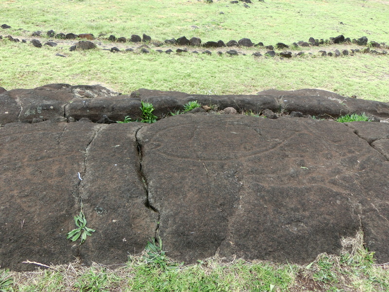


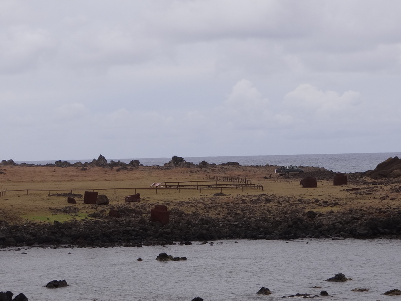


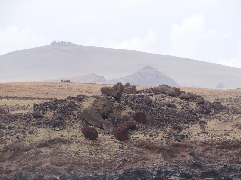


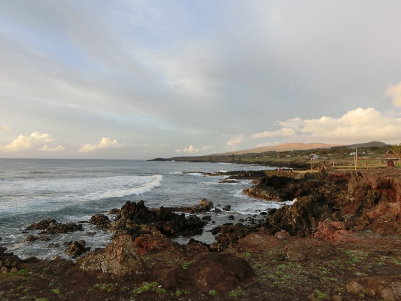


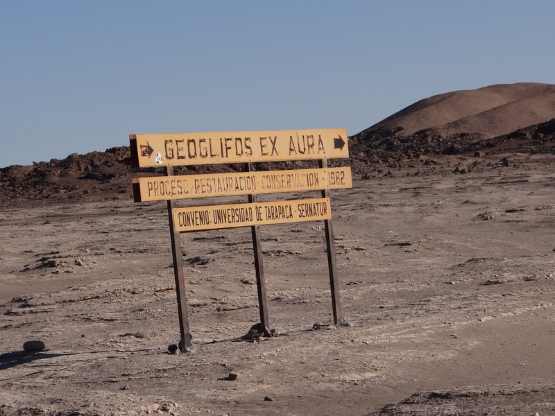


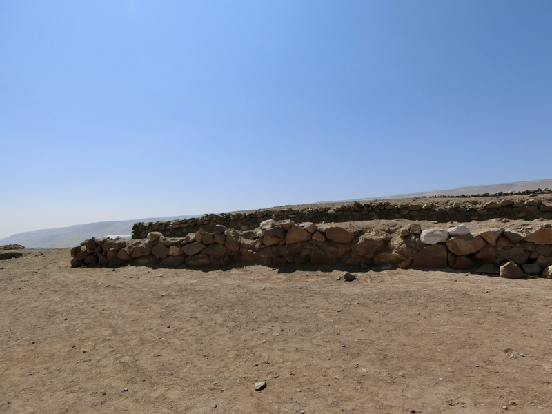


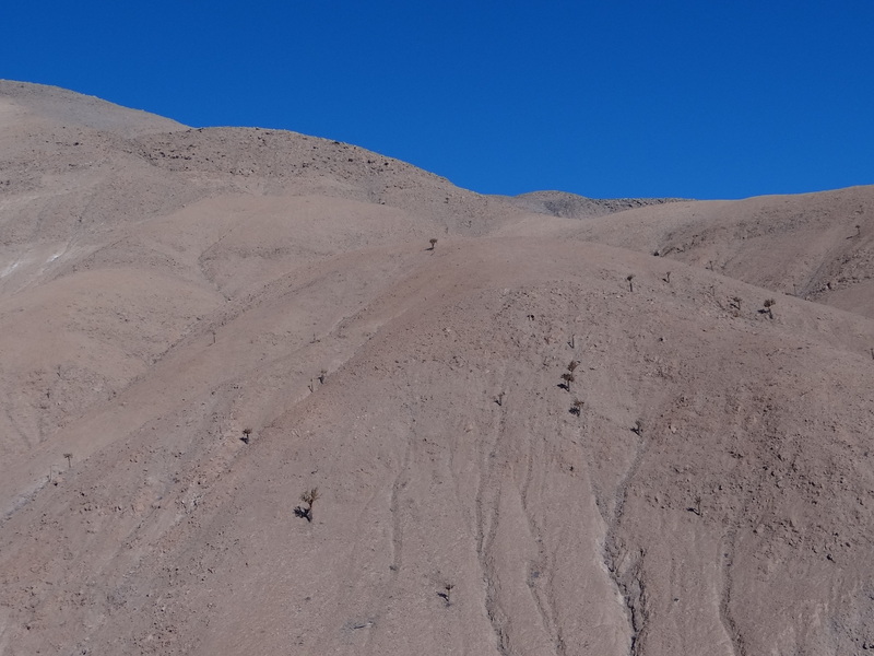


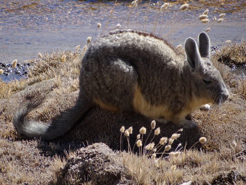


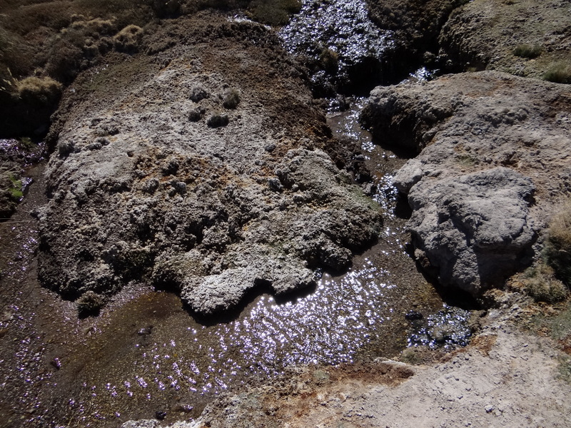


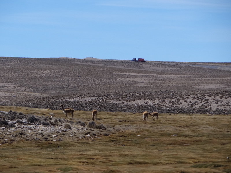


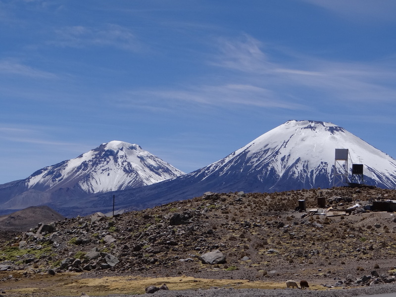


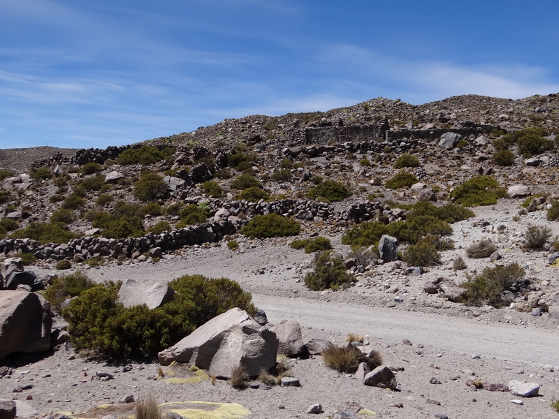


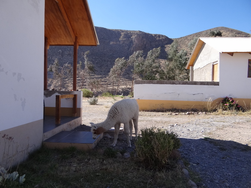


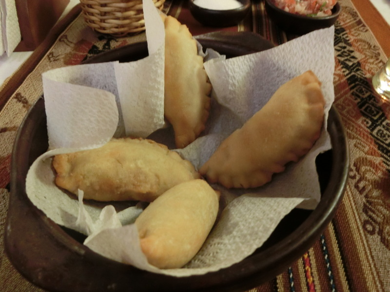


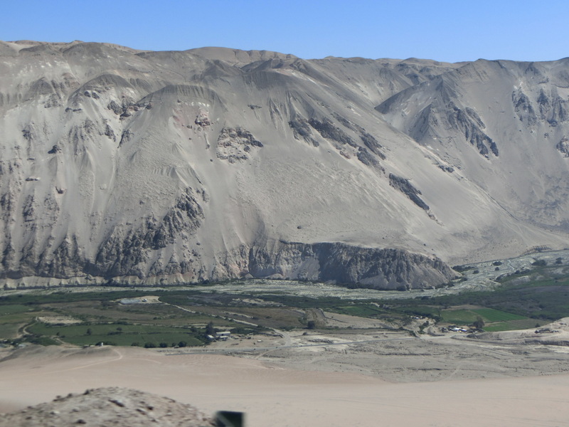


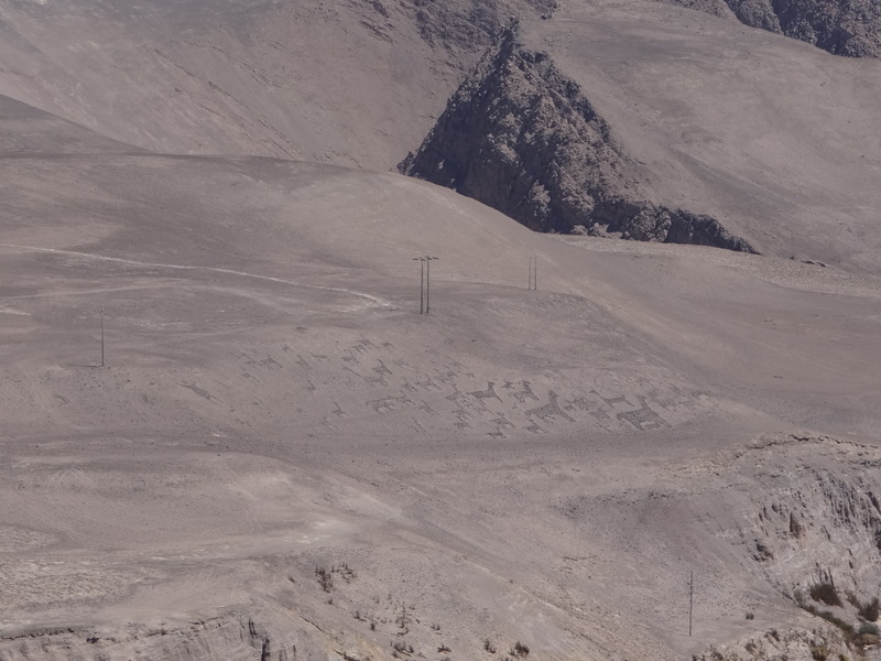
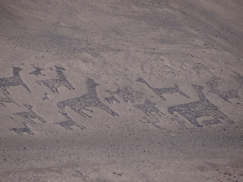


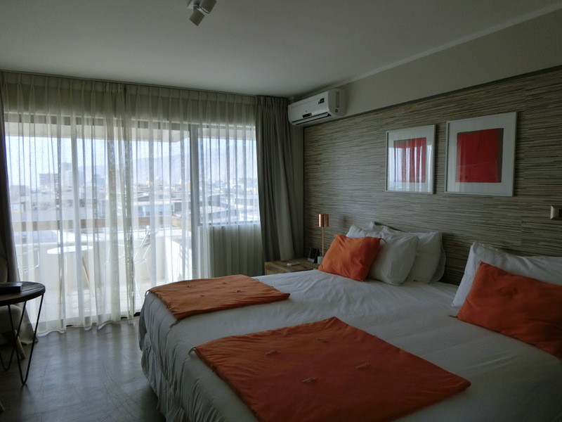


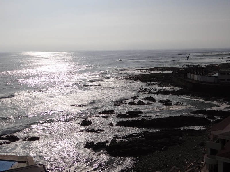


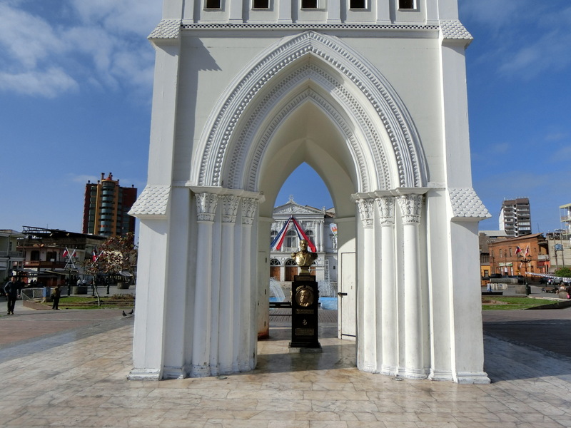


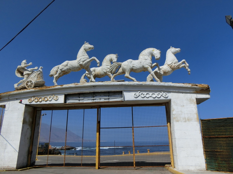


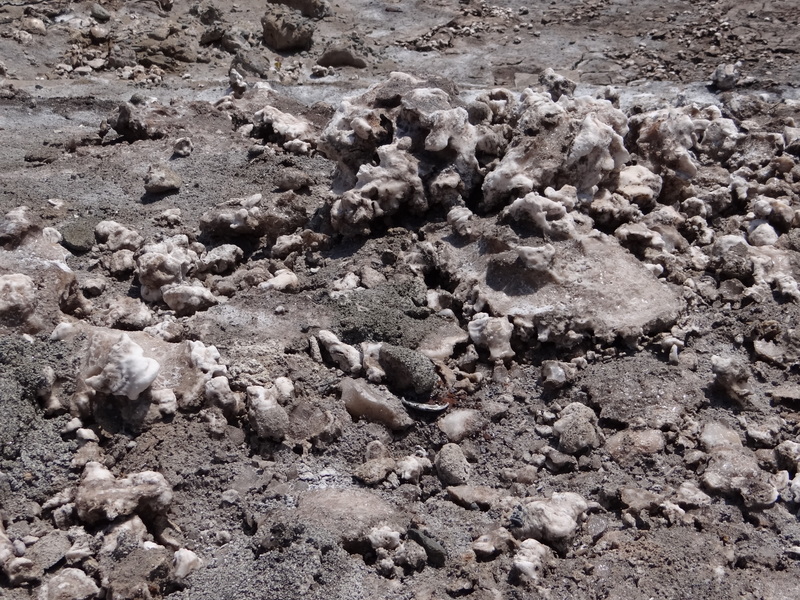


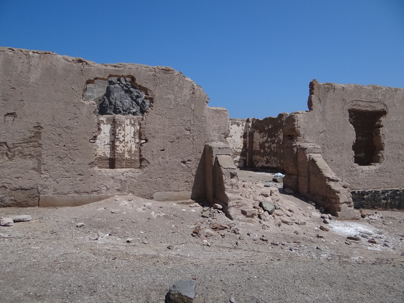


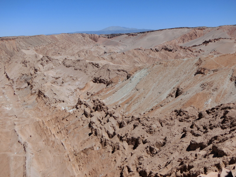


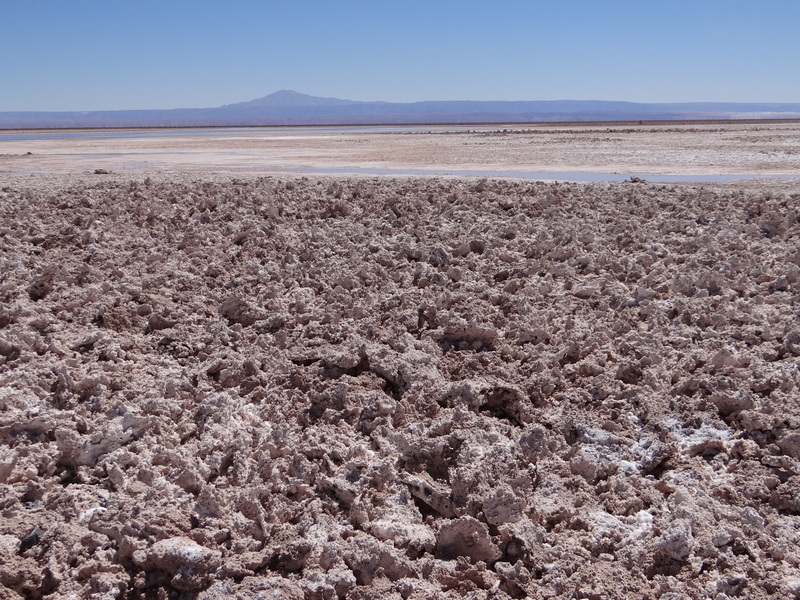

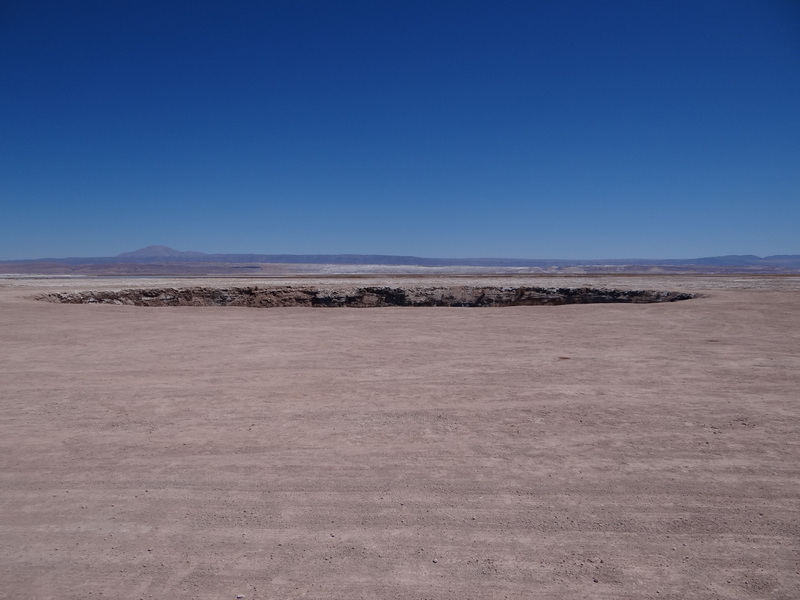


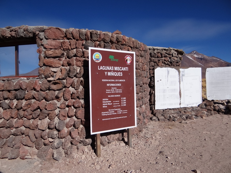


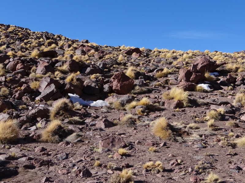


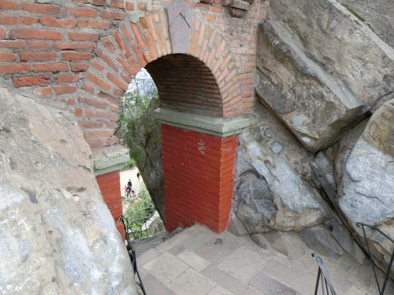


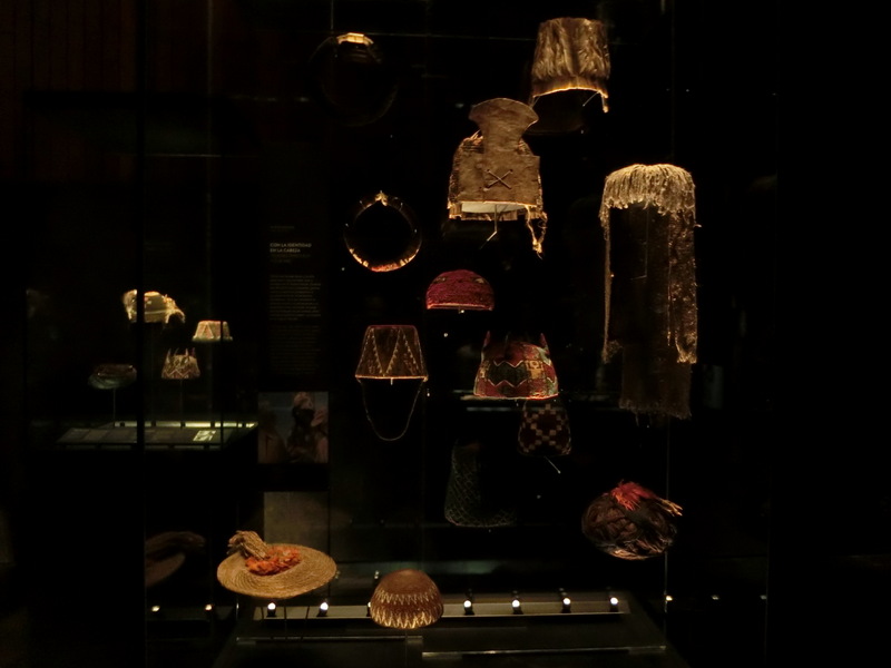


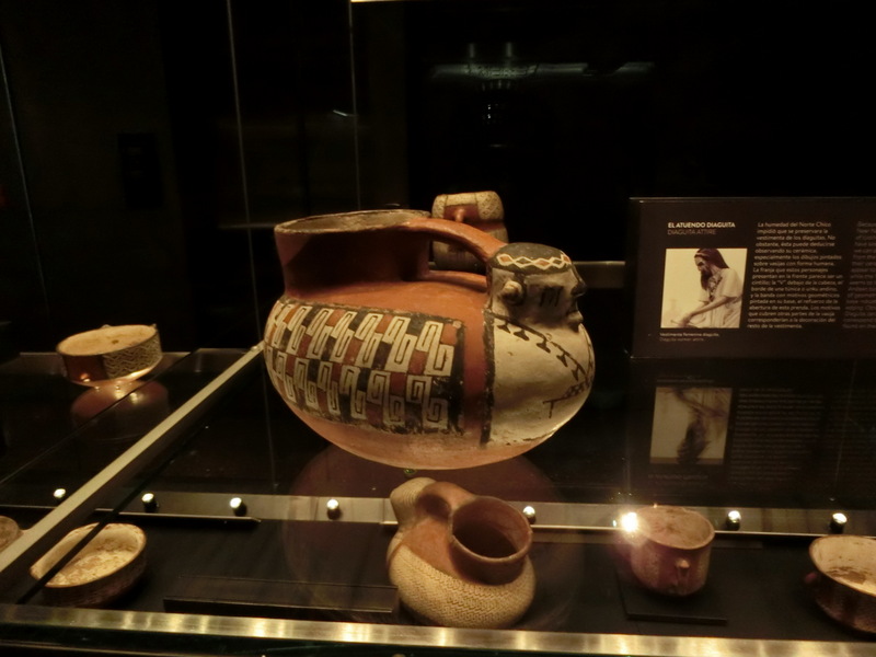


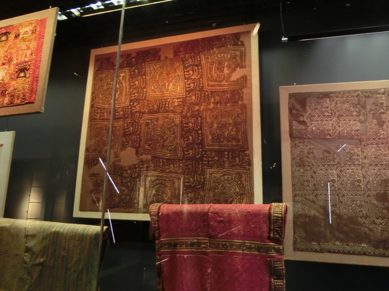


No comments:
Post a Comment